

French Pyrenees
Eine Fahrradroute, die in Canet-en-Roussillon, Languedoc-Roussillon-Midi-Pyrénées, France beginnt.
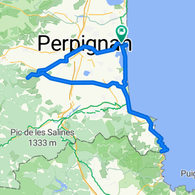
Übersicht
Über diese Route
In May 2015 I biked the Spanish side of the Pyrenees, from Bilbao to Barcelona. And in May 2022 I did a few days biking on the western parts the French side of this mountain range. So, after biking from Kassel to Perpignan I was in October 2022 in good shape and perfect position to take on the french Pyrenees from east.
I knew from before that there was a Route des Cols that passes over a lot of the high passes in the Pyrenees, so I found various lists of passes on the net and mapped them out, then tried to stitch them together. On average I ended up doing about three each day. It was slightly off season, so sometimes finding lodging was difficult, and in one case I was left to the good grace of an English couple running a gite (simple lodging) to cook me some pasta for dinner.
When I started biking the Trans Pyrenees race had already started, a self supported bike race around all of the Pyrenees. A certain Robert Mueller had already finished after 4 days and 6 hours. Twice did I bump into participants with somewhat similar bike bags as me. One guy from Holland had missed the deadline at a pass and was somewhat depressed contemplating his options, while another guy from Germany was hellbent to finish his ride, after the race had officially finished, just to prove to himself that he could do it.
The weather was gorgeous, and the views just got better and better the further west I got. BILDER The toughest day started with 17 km uphill to Col du Tourmalet, the most famous pass in the Pyrenees, having been part of the Tour de France 88 times. The last part of the climb is 10 km of biking at between 8 and 9%. Normally this would be a torturing hard climb for me, but this time I was in great shape and did it in one go, no zigzagging up the road, just short stops to take photographs. Unfortunately the pass is not just the most famous and highest in the Pyrenees at over 2000 meters, but also the ugliest as it is a very exploited skiing resort. You can't point your camera in any direction without also getting a ski lift or concrete hotel complex on the photo. The weather at the summit was rather grim with drizzle and thick clouds.
Later that day I climbed over Cold du Soulor and then got to see the road to Col d'Aubisque hacked into the mountain side. I think it might be one of the 10 most spectacular roads in Europe!
Then downhill to Laruns where I got to re-attach to my abandoned Pyrenees ride in May.
Next up before I had to go back home was an attempt to break my speed record on the western side of Col de Marie Blanque. It is a very steep climb I did in May. In the end the road down from the col was in the shade and damp from rain, not really as straight and wide as I had remembered, plus quite liberally sprinkled with cow dung, so I never dared to bike faster that 64 km/h. After that ride I felt quite satisfied after 23 days of solid biking, and decided to go home.
I am quite sure I will come back to the Pyrenees again, they are just simply gorgeous for biking or tourism in general.
- -:--
- Dauer
- 666,1 km
- Distanz
- 24.200 m
- Aufstieg
- 23.933 m
- Abstieg
- ---
- Ø-Tempo
- 2.117 m
- Ø-Tempo

Fotos von der Route


Routenqualität
Wegtypen und Untergründe entlang der Route
Wegtypen
Vielbefahrene Straße
436,8 km
(66 %)
Straße
146,7 km
(22 %)
Untergründe
Befestigt
492,7 km
(74 %)
Unbefestigt
4,1 km
(<1 %)
Asphalt
492,4 km
(74 %)
Natürlicher Untergrund
3,3 km
(<1 %)
Weiter mit Bikemap
Diese Radroute verwenden, bearbeiten oder herunterladen
Du möchtest French Pyrenees fahren oder sie für deine eigene Reise anpassen? Folgendes kannst du mit dieser Bikemap-Route machen:
Gratis Funktionen
- Speichere diese Route als Favorit oder in einer Sammlung
- Kopiere & plane deine eigene Version dieser Route
- Synchronisiere deine Route mit Garmin oder Wahoo
Premium-Funktionen
Kostenlose Testversion für 3 Tage oder einmalige Zahlung. Mehr über Bikemap Premium.
- Navigiere diese Route auf iOS & Android
- Exportiere eine GPX / KML-Datei dieser Route
- Erstelle deinen individuellen Ausdruck (Jetzt kostenlos ausprobieren)
- Lade diese Route für die Offline-Navigation herunter
Entdecke weitere Premium-Funktionen.
Bikemap Premium aktivierenVon unserer Community
Canet-en-Roussillon: Andere beliebte Routen, die hier beginnen
 CANET - PORT LA NOUVELLE
- Distanz
- 47,3 km
- Aufstieg
- 88 m
- Abstieg
- 91 m
- Standort
- Canet-en-Roussillon, Languedoc-Roussillon-Midi-Pyrénées, Frankreich
 Canet -> saleilles
- Distanz
- 25,5 km
- Aufstieg
- 22 m
- Abstieg
- 21 m
- Standort
- Canet-en-Roussillon, Languedoc-Roussillon-Midi-Pyrénées, Frankreich
 Transpirinaica.0
- Distanz
- 72,8 km
- Aufstieg
- 577 m
- Abstieg
- 33 m
- Standort
- Canet-en-Roussillon, Languedoc-Roussillon-Midi-Pyrénées, Frankreich
 Cote Vermeille - spanische Grenze - plus Hinterland
- Distanz
- 152,4 km
- Aufstieg
- 681 m
- Abstieg
- 683 m
- Standort
- Canet-en-Roussillon, Languedoc-Roussillon-Midi-Pyrénées, Frankreich
 Canet-en-Roussillon-Perpignan
- Distanz
- 13,8 km
- Aufstieg
- 37 m
- Abstieg
- 17 m
- Standort
- Canet-en-Roussillon, Languedoc-Roussillon-Midi-Pyrénées, Frankreich
 Wild Med Way Draft
- Distanz
- 634,8 km
- Aufstieg
- 3.543 m
- Abstieg
- 3.540 m
- Standort
- Canet-en-Roussillon, Languedoc-Roussillon-Midi-Pyrénées, Frankreich
 B-B 9
B-B 9- Distanz
- 33 km
- Aufstieg
- 201 m
- Abstieg
- 199 m
- Standort
- Canet-en-Roussillon, Languedoc-Roussillon-Midi-Pyrénées, Frankreich
 22 Juillet - Canet-en-Roussillon à Banyuls-sur-Mer
- Distanz
- 36,4 km
- Aufstieg
- 250 m
- Abstieg
- 207 m
- Standort
- Canet-en-Roussillon, Languedoc-Roussillon-Midi-Pyrénées, Frankreich
In der App öffnen