

Point Arkwright to The Boatshed, Cotton Tree
Eine Fahrradroute, die in Coolum Beach, Queensland, Australia beginnt.
Übersicht
Über diese Route
- -:--
- Dauer
- 41,4 km
- Distanz
- 112 m
- Aufstieg
- 112 m
- Abstieg
- ---
- Ø-Tempo
- 24 m
- Ø-Tempo

Routenqualität
Wegtypen und Untergründe entlang der Route
Wegtypen
Radweg
36 km
(87 %)
Pfad
1,5 km
(4 %)
Untergründe
Befestigt
32,9 km
(80 %)
Unbefestigt
0,2 km
(<1 %)
Beton
28,9 km
(70 %)
Asphalt
2,7 km
(7 %)
Highlights der Route
POIs entlang der Route

Interessanter Ort nach 0,9 km
The entry point from the Yerranya Row.

Interessanter Ort nach 1,1 km
The Coastal Pathway goes through Birrahl Park and goes onto Yerrany Row (a street) on the other side.

Interessanter Ort nach 2,5 km
At this point you can cross the David Low Way and head up Tanah Street West to Mount Coolum. It takes about 45 minutes to climb up and 30 minutes to come down. Check out this link: https://www.visitsunshinecoast.com/guide/climb-mount-coolum

Interessanter Ort nach 2,5 km
Turn left into Jarnahill Drive to go into the carpark at the base of the mountain.

Interessanter Ort nach 3,5 km
Curly's on the Boardwalk is an awesome cafe, good food and great service.

Interessanter Ort nach 3,5 km
Take this turn off to go onto the boardwalk and head out east to the lookout. Awesome views!

Interessanter Ort nach 16,6 km
This is a sharp left turn to go onto the path which goes across the bridge.

Interessanter Ort nach 25,4 km
Cross over the road here to access the path across the Maroochy River Bridge.

Interessanter Ort nach 32,4 km
It's a nice little path.

Interessanter Ort nach 32,6 km
Cottonwood Road might end here but the path goes through!
Weiter mit Bikemap
Diese Radroute verwenden, bearbeiten oder herunterladen
Du möchtest Point Arkwright to The Boatshed, Cotton Tree fahren oder sie für deine eigene Reise anpassen? Folgendes kannst du mit dieser Bikemap-Route machen:
Gratis Funktionen
- Speichere diese Route als Favorit oder in einer Sammlung
- Kopiere & plane deine eigene Version dieser Route
- Synchronisiere deine Route mit Garmin oder Wahoo
Premium-Funktionen
Kostenlose Testversion für 3 Tage oder einmalige Zahlung. Mehr über Bikemap Premium.
- Navigiere diese Route auf iOS & Android
- Exportiere eine GPX / KML-Datei dieser Route
- Erstelle deinen individuellen Ausdruck (Jetzt kostenlos ausprobieren)
- Lade diese Route für die Offline-Navigation herunter
Entdecke weitere Premium-Funktionen.
Bikemap Premium aktivierenVon unserer Community
Coolum Beach: Andere beliebte Routen, die hier beginnen
 Mount coolum to 101 Wrigley street Maroochydore
- Distanz
- 7,1 km
- Aufstieg
- 16 m
- Abstieg
- 35 m
- Standort
- Coolum Beach, Queensland, Australien
 Easy ride in Coolum Beach
- Distanz
- 12,6 km
- Aufstieg
- 96 m
- Abstieg
- 103 m
- Standort
- Coolum Beach, Queensland, Australien
 Suneshine Coast
- Distanz
- 58,1 km
- Aufstieg
- 67 m
- Abstieg
- 74 m
- Standort
- Coolum Beach, Queensland, Australien
 1838-1840 David Low Way, Coolum Beach to 1838-1840 David Low Way, Coolum Beach
- Distanz
- 23,6 km
- Aufstieg
- 102 m
- Abstieg
- 102 m
- Standort
- Coolum Beach, Queensland, Australien
 Coolum Beach to Maroochy River North Shore
- Distanz
- 27,7 km
- Aufstieg
- 62 m
- Abstieg
- 65 m
- Standort
- Coolum Beach, Queensland, Australien
 Easy ride in Marcoola
- Distanz
- 15,9 km
- Aufstieg
- 6 m
- Abstieg
- 9 m
- Standort
- Coolum Beach, Queensland, Australien
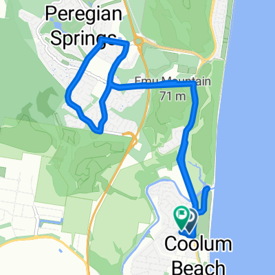 Peregian springs
- Distanz
- 14 km
- Aufstieg
- 81 m
- Abstieg
- 82 m
- Standort
- Coolum Beach, Queensland, Australien
 39 Tradewinds Ave, Coolum Beach to 39 Tradewinds Ave, Coolum Beach
- Distanz
- 7 km
- Aufstieg
- 18 m
- Abstieg
- 17 m
- Standort
- Coolum Beach, Queensland, Australien
In der App öffnen