

B-D 16. Bled to Trenta
Eine Fahrradroute, die in Bled, Občina Bled, Slowenien beginnt.
Übersicht
Über diese Route
Bus stops: Kranjska Gora (1130, 1730, 1830); Šumica; Mihov dom; Koča na Gozdu; Erjavčeva koča; Vršič; Izvir Soče K; Trenta
- -:--
- Dauer
- 63 km
- Distanz
- 1.704 m
- Aufstieg
- 1.556 m
- Abstieg
- ---
- Ø-Tempo
- 1.616 m
- Max. Höhe

Routenqualität
Wegtypen und Untergründe entlang der Route
Wegtypen
Straße
21,4 km
(34 %)
Radweg
11,3 km
(18 %)
Untergründe
Befestigt
60,4 km
(96 %)
Asphalt
51,6 km
(82 %)
Befestigt (undefiniert)
8,8 km
(14 %)
Undefiniert
2,5 km
(4 %)
Highlights der Route
POIs entlang der Route
Unterkunft nach 0 km
Heritage Hotel Starkl
Interessanter Ort nach 1,2 km
viewpoint
Interessanter Ort nach 1,6 km
viewpoint
Unterkunft nach 3,9 km
Hotel Bellini
Interessanter Ort nach 3,9 km
Bled Castle Blejski grad
Unterkunft nach 3,9 km
Gasthof Eberhard - Hof, Wirtshaus & Herberge
Interessanter Ort nach 14,7 km
Radovna Memorial
Interessanter Ort nach 39,3 km
Alpska Vasica
Interessanter Ort nach 40,4 km
New attraction in Kranjska Gora - 30 meters extremely beautiful long suspension bridge, located near Lake Jasna. From the bridge you have a wonderful view of the valley. Easily accessible
Interessanter Ort nach 40,7 km
Jezero Jasna
Interessanter Ort nach 45,4 km
Russian Chapel Ruska kapelica Wooden memorial chapel dedicated to Russian POWs who died building the Russian Road in 1916.
Interessanter Ort nach 50,3 km
Vršič Pass 1611m Slovenia's highest pass
Interessanter Ort nach 52,3 km
Supca viewpoint
Interessanter Ort nach 58,6 km
Julius Kugy was a mountaineer, writer, botanist, humanist, lawyer and officer of Slovenian descent. He wrote mostly in German. He is renowned for his travelogues from opening up the Julian Alps, in which he reflected on the relationship between man, nature, and culture.
Interessanter Ort nach 60,2 km
Juliana Alpine Botanical Garden 0830-1830
Interessanter Ort nach 60,4 km
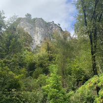
Trentarske Fuzine - iron forges. The first written mention of Trenta was in a note on the Trebiščina alp dating back to 1326. At the beginning of the 16th century, Trenta was still covered with state-owned forests. Who and when first found iron ore in the valley remains unknown but the fact is that in 1576 the iron forges were erected, one opposite the existing church and the other near the entrance to the Zadnjica valley. Soon, the valley was swarming with army deserters, prison fugitives and free-spirited people, most of them from South Tirol, Tridento or Trent, after which the valley was eventually named. Still, the mines were not making much money, and were passed from owner to owner. One of them was Count Herman Attems, who commissioned the construction of a road to Bovec and settled in Trenta. He lived in castle, erected in the place of today’s priest's house. In 1690, he commissioned a church of Our Lady of Loretto. High costs of ore digging and transport made the mine unable to sustain the competition and around 1750 the Attems family sold it. The mine was closed down twenty years later, in 1778. A year after the iron forge near the church had ceased operation, it was studied and recorded by the first explorer of the Julian Alps, Balthasar Hacquet. The workers scattered around the neighbouring villages and towns. Some families stayed in Trenta, exchanging their miner's hammers with shepherd's sticks. In 1715 Trenta was visited by a priest, Venceslav Lucenperger, who stayed in the valley until his death in 1781. Lucenperger had a flock of about 100 sheep and shared the fate of the people of Trenta also after the mines had closed. The people of Trenta have repaid their priest by keeping his memory alive. Even today, the local inhabitants like to refer to him as »the late Trentar«. The thoroughfare to Bovec deteriorated soon after the closure of the mines, its role being taken by a network of paths and trails which connected the pastures and mountains surrounding the Trenta valley. The families of Trenta made their living by raising small cattle, wood harvesting and skidding and hunting. In the second half of the 19th century, people became more interested in the mountains and a number of Trenta inhabitants earned fame as excellent mountain guides. Life in the valley was hard, as the Kaiser Franz Joseph was quick to notice when he was travelling through the area on his way towards Triest in 1882. He offered the people of Trenta some land in Hungary, but the proud Trenta settlers flatly turned down his offer. In 1877 Julius Kugy first came to the valley. On his explorations of the Julian Alps, Kugy was accompanied by local guides, and he was so impressed by their skill and knowledge of mountains that he wrote about them in his books, presenting Trenta and its people to the world. In 1953, the Slovenian Alpine Association commissioned a Slovenian sculptor Jakob Savinšek to construct a monument to Julius Kugy that now stands at Na Turi in the Trenta valley. As a botanist, Kugy made friends with Albert Bois de Chesne, who had the right to hunt in Trenta. De Chesne bought some land in Trenta in 1925 and started working on what is known today as the Juliana Alpine Botanical Garden. Both Bois de Chesne and Kugy helped their guides and the inhabitants of the valley in many ways. The history of the First World War has recorded among the fiercest battles the names of Verdun, the shore of the river Somme, Ypres, Kras (Karst) and Bovec. In October 1917, after three years of battles in the area of the Soča river, combined Austro-Hungarian and German forces surprised the Italians with a counter-attack known as »The Miracle of Kobarid«, in which the winning troops used gas ammunition. Although the major battlefields were in the area of Bovec, only 10 km away from Trenta, the fiercest battles never affected it directly. During the First World War, Trenta received a large number of Russian prisoners who were building a road across the Vršič pass in horrible conditions. The Russian Chapel on the Gorenjsko side of the Vršič pass and the military cemetery in Trenta remain to the present day the only reminders of their suffering and death. During the war, Trenta provided temporary shelter and safe passage to local people from Bovec and its surroundings who were forced to leave their homes by order of Austrian authorities. Closer to the battelfields were Lepena valley and Soča village, where military cemetery could be found. After the Second World War, the image of Trenta changed completely, mainly as a result of depopulation and abandonment of goat and sheep grazing on the mountain slopes. The share of cultivated land fell from 28% to a mere 1% in the period 1900-1994. In 1880 Trenta had 380 inhabitants, but the number has been dropping ever since. In 1948, 281 people lived there; in 1991 there were only 120. Only three people lived in Zgornja Trenta in 1981, and today only the houses in Spodnja Trenta are permanently settled. The 2002 population count recorded 114 permanent inhabitants. Eighty years earlier, in 1921, 873 people lived in the village Soča, and in 2002 there were only 144. For decades on end, Trenta has ranked among demographically endangered areas. In the 1960s, Trenta experienced a tourist boom, and numerous holiday homes, spas and health resorts were built. Unfortunately, the temporary interest in Trenta was not sufficient to contain the drain of people from the valley and promote further development.
Unterkunft nach 63 km
Apartment Natasha
Weiter mit Bikemap
Diese Radroute verwenden, bearbeiten oder herunterladen
Du möchtest B-D 16. Bled to Trenta fahren oder sie für deine eigene Reise anpassen? Folgendes kannst du mit dieser Bikemap-Route machen:
Gratis Funktionen
- Speichere diese Route als Favorit oder in einer Sammlung
- Kopiere & plane deine eigene Version dieser Route
- Synchronisiere deine Route mit Garmin oder Wahoo
Premium-Funktionen
Kostenlose Testversion für 3 Tage oder einmalige Zahlung. Mehr über Bikemap Premium.
- Navigiere diese Route auf iOS & Android
- Exportiere eine GPX / KML-Datei dieser Route
- Erstelle deinen individuellen Ausdruck (Jetzt kostenlos ausprobieren)
- Lade diese Route für die Offline-Navigation herunter
Entdecke weitere Premium-Funktionen.
Bikemap Premium aktivierenVon unserer Community
Bled: Andere beliebte Routen, die hier beginnen
 Arround Mezakla and lake Bled
- Distanz
- 56,4 km
- Aufstieg
- 2.169 m
- Abstieg
- 2.167 m
- Standort
- Bled, Občina Bled, Slowenien
 Route in Bled
- Distanz
- 60 km
- Aufstieg
- 1.949 m
- Abstieg
- 1.948 m
- Standort
- Bled, Občina Bled, Slowenien
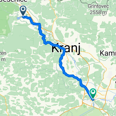
 Savska cesta, Bled až Kolodvorska cesta, Bled
- Distanz
- 5,3 km
- Aufstieg
- 96 m
- Abstieg
- 53 m
- Standort
- Bled, Občina Bled, Slowenien
 Bled - krog
- Distanz
- 19,4 km
- Aufstieg
- 350 m
- Abstieg
- 350 m
- Standort
- Bled, Občina Bled, Slowenien
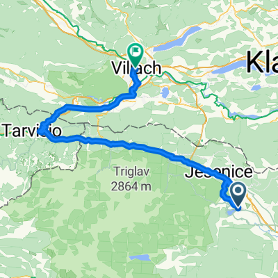
 Bled - Tarvisio
- Distanz
- 63,8 km
- Aufstieg
- 899 m
- Abstieg
- 1.102 m
- Standort
- Bled, Občina Bled, Slowenien
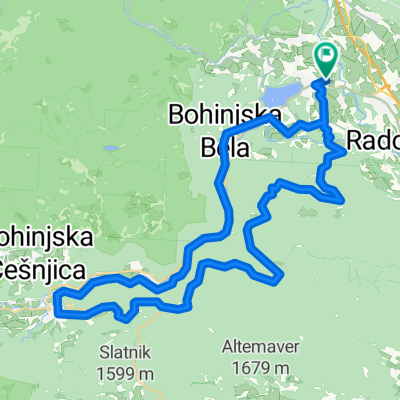
 Route to Bohinjsko jezero
- Distanz
- 29,8 km
- Aufstieg
- 921 m
- Abstieg
- 827 m
- Standort
- Bled, Občina Bled, Slowenien
 Prešernova cesta, Bled to Bahnhofplatz, Villach
- Distanz
- 84,3 km
- Aufstieg
- 1.506 m
- Abstieg
- 1.509 m
- Standort
- Bled, Občina Bled, Slowenien
 Bled Kupljenik
- Distanz
- 21,4 km
- Aufstieg
- 510 m
- Abstieg
- 510 m
- Standort
- Bled, Občina Bled, Slowenien
In der App öffnen