

Cahors - Circle through Goudon and Le Vigan
Eine Fahrradroute, die in Cahors, Occitanie, Frankreich beginnt.
Übersicht
Über diese Route
<p>Dies war eine großartige Fahrt durch die schöne Landschaft und größtenteils großartige Straßen.</p>
<p>Ursprünglich hatten wir beabsichtigt, weiter östlich durch Montfaucon zurückzukehren, damit wir von Osten auf der D653 nach Cahors zurückkehren würden, aber nachdem uns ein Regenschauer nach dem Durchqueren von Le Vigan erwischte, wendeten wir an diesem Punkt nach Süden und kehrten entlang der D820 zurück, was eine viel direktere Route zu unserem Hotel war.</p>
<p>Was die Straßen betrifft, war die D12 eine hervorragende wenig befahrene Straße. Die D811 von Cahors nach Mercuès hatte zu viel Verkehr, war aber nicht allzu schlimm. Die D801 von Goudon nach Le Vigan hatte etwas zu viel Verkehr und null Standstreifen. Schließlich gab es von dort, wo wir auf die D820 nach St-Pierre-Lafeuille aufstiegen, nur einen schmalen Standstreifen, aber der Verkehr war relativ leicht, sodass es kein Problem war. Von St-Pierre-Lafeuille nach Süden nach Cahors gab es einen breiten Standstreifen, aber er war ziemlich rau. Alles in allem stellte sich heraus, dass die D820 eine bessere Straße war, als wir gedacht hatten.
Übersetzt, Original anzeigen (Englisch)- 6 h 28 min
- Dauer
- 88,2 km
- Distanz
- 1.051 m
- Aufstieg
- 1.051 m
- Abstieg
- 13,6 km/h
- Ø-Tempo
- 440 m
- Max. Höhe

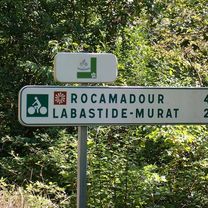
Fotos von der Route


Routenqualität
Wegtypen und Untergründe entlang der Route
Wegtypen
Straße
7,1 km
(8 %)
Ruhige Straße
1,8 km
(2 %)
Untergründe
Befestigt
17,6 km
(20 %)
Asphalt
17,6 km
(20 %)
Undefiniert
70,6 km
(80 %)
Weiter mit Bikemap
Diese Radroute verwenden, bearbeiten oder herunterladen
Du möchtest Cahors - Circle through Goudon and Le Vigan fahren oder sie für deine eigene Reise anpassen? Folgendes kannst du mit dieser Bikemap-Route machen:
Gratis Funktionen
- Speichere diese Route als Favorit oder in einer Sammlung
- Kopiere & plane deine eigene Version dieser Route
- Teile sie in Etappen ein, um eine mehrtägige Tour zu erstellen
- Synchronisiere deine Route mit Garmin oder Wahoo
Premium-Funktionen
Kostenlose Testversion für 3 Tage oder einmalige Zahlung. Mehr über Bikemap Premium.
- Navigiere diese Route auf iOS & Android
- Exportiere eine GPX / KML-Datei dieser Route
- Erstelle deinen individuellen Ausdruck (Jetzt kostenlos ausprobieren)
- Lade diese Route für die Offline-Navigation herunter
Entdecke weitere Premium-Funktionen.
Bikemap Premium aktivierenVon unserer Community
Cahors: Andere beliebte Routen, die hier beginnen
 Deutschland - Portugal (Berlin - Faro) FR 26 Cahors - Montauban
- Distanz
- 68,8 km
- Aufstieg
- 901 m
- Abstieg
- 941 m
- Standort
- Cahors, Occitanie, Frankreich
 Cahors to La Forge (Souillac)
- Distanz
- 71,6 km
- Aufstieg
- 835 m
- Abstieg
- 840 m
- Standort
- Cahors, Occitanie, Frankreich
 Cahors - Ride to St-Pierre-Lafeuille and Return
- Distanz
- 15,9 km
- Aufstieg
- 287 m
- Abstieg
- 290 m
- Standort
- Cahors, Occitanie, Frankreich
 Cargolate été 2021 étape 7
- Distanz
- 39,9 km
- Aufstieg
- 485 m
- Abstieg
- 321 m
- Standort
- Cahors, Occitanie, Frankreich
 Cahors to Rocamadour - V87 Route
- Distanz
- 66,4 km
- Aufstieg
- 995 m
- Abstieg
- 1.016 m
- Standort
- Cahors, Occitanie, Frankreich
 Gramat anders
- Distanz
- 92,2 km
- Aufstieg
- 2.089 m
- Abstieg
- 2.145 m
- Standort
- Cahors, Occitanie, Frankreich
 Cahors - St. Gaudens
- Distanz
- 200,5 km
- Aufstieg
- 869 m
- Abstieg
- 596 m
- Standort
- Cahors, Occitanie, Frankreich
 Cahors Circle to St-Cirq-Lapopie
- Distanz
- 80,1 km
- Aufstieg
- 1.247 m
- Abstieg
- 1.247 m
- Standort
- Cahors, Occitanie, Frankreich
In der App öffnen