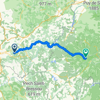
Albussac (Les Quatre Routes) - Circle to Brive-la-Gaillarde (Malemort)
Eine Fahrradroute, die in Beynat, Nouvelle-Aquitaine, Frankreich beginnt.
Übersicht
Über diese Route
Das wurde eine verdammt aufregende Fahrt. Ein paar Kilometer nach dem Verlassen von Brive auf der D141E3 begannen Donner, Blitz und richtig starker Regen. Für etwa eine halbe Stunde suchten wir Schutz unter einem überdachten Eingang eines Gebäudes in St-Hilaire-Peyroux. Danach nahmen wir bei Regen eine falsche Abzweigung und mussten dann auf der D1089 fahren, was bei dem Regen alles andere als angenehm war. Diese Straße hatte auch einige Tunnel; zum Glück hatten wir Rücklichter an den Fahrrädern, da es durch die starke Bewölkung und den Regen relativ dunkel war. Schließlich erreichten wir Cornil, wo wir auf die D1 Richtung Osten nach Ste-Fortunade und dann auf die D940 abbiegen konnten, um wieder südlich zurück zu unserem Hotel zu fahren. Unser ursprüngliches Ziel war Tulle, wo wir Lebensmittel einkaufen und einige McDonalds-Artikel fürs Abendessen mitnehmen wollten. Wegen Donner, Blitz und Regen sind wir an Tulle vorbeigefahren... vielleicht morgen.
- 4 h 31 min
- Dauer
- 75,3 km
- Distanz
- 1.422 m
- Aufstieg
- 1.422 m
- Abstieg
- 16,7 km/h
- Ø-Tempo
- 570 m
- Max. Höhe
Fotos von der Route
Routenqualität
Wegtypen und Untergründe entlang der Route
Wegtypen
Straße
15,8 km
(21 %)
Ruhige Straße
4,5 km
(6 %)
Untergründe
Befestigt
30,9 km
(41 %)
Asphalt
30,9 km
(41 %)
Undefiniert
44,4 km
(59 %)
Weiter mit Bikemap
Diese Radroute verwenden, bearbeiten oder herunterladen
Du möchtest Albussac (Les Quatre Routes) - Circle to Brive-la-Gaillarde (Malemort) fahren oder sie für deine eigene Reise anpassen? Folgendes kannst du mit dieser Bikemap-Route machen:
Gratis Funktionen
- Speichere diese Route als Favorit oder in einer Sammlung
- Kopiere & plane deine eigene Version dieser Route
- Synchronisiere deine Route mit Garmin oder Wahoo
Premium-Funktionen
Kostenlose Testversion für 3 Tage oder einmalige Zahlung. Mehr über Bikemap Premium.
- Navigiere diese Route auf iOS & Android
- Exportiere eine GPX / KML-Datei dieser Route
- Erstelle deinen individuellen Ausdruck (Jetzt kostenlos ausprobieren)
- Lade diese Route für die Offline-Navigation herunter
Entdecke weitere Premium-Funktionen.
Bikemap Premium aktivierenVon unserer Community
Beynat: Andere beliebte Routen, die hier beginnen
 Albussac (Les Quatre Routes) to Égletons
- Distanz
- 53,5 km
- Aufstieg
- 978 m
- Abstieg
- 889 m
- Standort
- Beynat, Nouvelle-Aquitaine, Frankreich
 Albussac (Les Quatre Routes) - Circle through Neuville
- Distanz
- 37,8 km
- Aufstieg
- 686 m
- Abstieg
- 686 m
- Standort
- Beynat, Nouvelle-Aquitaine, Frankreich
 Montée Lanteuil-Brousse
- Distanz
- 7,7 km
- Aufstieg
- 354 m
- Abstieg
- 95 m
- Standort
- Beynat, Nouvelle-Aquitaine, Frankreich
 Palazinges - Barrage aigle
- Distanz
- 66,7 km
- Aufstieg
- 508 m
- Abstieg
- 764 m
- Standort
- Beynat, Nouvelle-Aquitaine, Frankreich
 puy mary 2
- Distanz
- 116,8 km
- Aufstieg
- 1.874 m
- Abstieg
- 824 m
- Standort
- Beynat, Nouvelle-Aquitaine, Frankreich
 espagnagol
- Distanz
- 7,1 km
- Aufstieg
- 135 m
- Abstieg
- 135 m
- Standort
- Beynat, Nouvelle-Aquitaine, Frankreich
 Circuit championat
- Distanz
- 9,7 km
- Aufstieg
- 156 m
- Abstieg
- 156 m
- Standort
- Beynat, Nouvelle-Aquitaine, Frankreich
 Albussac (Les Quatre Routes) - Circle to Brive-la-Gaillarde (Malemort)
- Distanz
- 75,3 km
- Aufstieg
- 1.422 m
- Abstieg
- 1.422 m
- Standort
- Beynat, Nouvelle-Aquitaine, Frankreich
In der App öffnen


