Radroute in Carcassonne, Languedoc-Roussillon-Midi-Pyrénées, Frankreich
Ride Day 20—1 Oct 2005—11000 Carcassonne -- Circle
0

Route in der Bikemap App öffnen

Diese Route in Bikemap Web öffnen
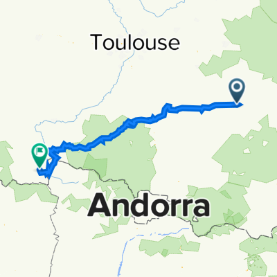
105
km
Distanz
Distanz
1517
m
Aufstieg
Aufstieg
1518
m
Abstieg
Abstieg
-:--
h
Dauer
Dauer
--
km/h
ø-Tempo
ø-Tempo
---
m
Max. Höhe
Max. Höhe