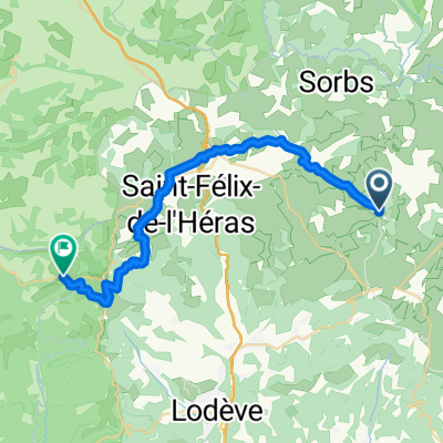
Lodève - La Tour-sur-Orb
- 47,3 km
- 542 m
- 428 m
- Lodève, Occitanie, Frankreich
Eine Fahrradroute, die in Lodève, Occitanie, Frankreich beginnt.
Übersicht
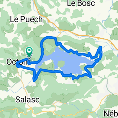
Nach so vielen Tagen kaltem, nassem Wetter war der heutige Tag strahlend sonnig mit wunderschönem blauen Himmel und angenehmen Temperaturen. Nach einem anfänglichen Anstieg von Lodève nach St Pierre-de-la-Fage befanden wir uns mehrere Meilen auf einem Plateau, bis wir einen unerwarteten Abstieg von mehreren hundert Metern an der Seite der Gorges de la Vis hatten. Wunderschön und spektakulär. Von unten in Madières folgten wir dem Vis-Fluss flussabwärts nach Ganges. Sehr angenehmes Fahren. In Ganges nahmen wir die D999, die zwar kein schlechtes Fahren war, aber zu viel Verkehr hatte. Glücklicherweise hielt das nicht lange. Die D907 für die paar Meilen nach St Jean-du-Gard hatte ebenfalls zu viel Verkehr und wäre gut zu vermeiden, wo immer möglich. Entlang der D25 und D999 umrissen wir die Departementsgrenze zwischen den Departements Hérault und Gard und überquerten die Grenze mehrere Male, um schließlich im Departement Le Gard zu landen. Insgesamt eine sehr angenehme und zufriedenstellende Fahrt, besonders als wir in St Jean-du-Gard etwa eine Stunde oder mehr früher ankamen, als wir erwartet hatten. Das passiert uns nicht oft. Hintergrund: Meine Frau und ich machen seit 1993 selbstgeführte Touren in Westeuropa (vor allem in Frankreich). Diese Reihe von Fahrten umfasst unsere Route von zwei Monaten im Jahr 2005 durch Teile Frankreichs. Unser Anfangs- und Endpunkt liegt in der Nähe von Chaduri (südlich von Angoulême), wo unsere Freunde eine Farm mit Gîtes und Chambres d'Hôtes haben. Wir fuhren mit unseren Dawes-Trekkingfahrrädern, die wir 1993 gekauft hatten, stark beladen mit 700Cx32-Reifen. Alle unsere Fahrten fanden auf asphaltierten Straßen statt, meist mit sehr wenig Verkehr. Wenn Sie Fragen haben, können Sie mir gerne eine E-Mail an jeffkadet@netdiving.com schicken. Jeff
Erstellt vor 14 Jahren
Routenqualität
Forst- / Feldweg
7,3 km
(8 %)
Straße
5,4 km
(6 %)
Befestigt
40,9 km
(45 %)
Unbefestigt
1,8 km
(2 %)
Asphalt
40,9 km
(45 %)
Schotter
1,8 km
(2 %)
Undefiniert
48,1 km
(53 %)
Weiter mit Bikemap
Du möchtest Ride Day 24—5 Oct 2005—34700 Lodève to 30270 St Jean-du-Gard fahren oder sie für deine eigene Reise anpassen? Folgendes kannst du mit dieser Bikemap-Route machen:
Kostenlose Testversion für 3 Tage oder einmalige Zahlung. Mehr über Bikemap Premium.
Entdecke weitere Premium-Funktionen.
Bikemap Premium aktivierenVon unserer Community
In der App öffnen