

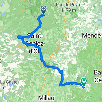
Ride Day 32—13 Oct 2005—48260 Recoules D'Aubrac (Nasbinals) to 15300 Murat
Eine Fahrradroute, die in Laguiole, Occitanie, Frankreich beginnt.
Übersicht
Über diese Route
<span style="font-size: 12pt; font-family: Arial;">Into every life, a little rain must fall.<span> </span>Shortly after starting out in the chilly morning, we donned our rain pants and booties due to a light rain.<span> </span>While it never got seriously heavy, it was more than light and continued steadily for several hours.<span> </span>The most difficult part of this was the descent from about 1050 M along D13 and D989 into Chaudes-Aigues at about 750 M.<span> </span>Happily, while we were climbing back to the 1000+ M level north of Chaudes-Aigues, the rain lightened…and we even could see our shadows by the time we were on D16.<span> </span>We hadn’t expected such a nice end to the day.</span>
<span style="font-size: 12pt; font-family: Arial;">As a final point, we left the Lozère Department and entered the Cantal Department</span><span style="font-size: 12pt; font-family: Arial;"> just before entering St Urcize</span><span style="font-size: 12pt; font-family: Arial;">.<span> </span>This also meant that we passed from the Languedoc-Roussillon Region to the Auvergne Region</span>
<span style="font-size: 12pt; font-family: Arial;">Great low traffic roads.</span>
Background:<br /><br /><br />My wife and I have been doing self-supported tours in Western Europe (a majority in France) since 1993. This series of rides covers our 2005 2 month route through parts of France. Our beginning and ending point is near Chaduri (south of Angoulême) where our friends have a farm with Gites and Chambres d'Hotes.<br /><br /><br />We rode our Dawes touring bicycles purchased in 1993 heavily loaded with 700Cx32 tires. All of our riding was on paved roads, mostly with very little traffic.<br /><br /><br />If any questions, feel free to email me at jeffkadet@netdiving.com<br /><br /><br />Jeff
- -:--
- Dauer
- 67,6 km
- Distanz
- 587 m
- Aufstieg
- 757 m
- Abstieg
- ---
- Ø-Tempo
- ---
- Max. Höhe

Weiter mit Bikemap
Diese Radroute verwenden, bearbeiten oder herunterladen
Du möchtest Ride Day 32—13 Oct 2005—48260 Recoules D'Aubrac (Nasbinals) to 15300 Murat fahren oder sie für deine eigene Reise anpassen? Folgendes kannst du mit dieser Bikemap-Route machen:
Gratis Funktionen
- Speichere diese Route als Favorit oder in einer Sammlung
- Kopiere & plane deine eigene Version dieser Route
- Synchronisiere deine Route mit Garmin oder Wahoo
Premium-Funktionen
Kostenlose Testversion für 3 Tage oder einmalige Zahlung. Mehr über Bikemap Premium.
- Navigiere diese Route auf iOS & Android
- Exportiere eine GPX / KML-Datei dieser Route
- Erstelle deinen individuellen Ausdruck (Jetzt kostenlos ausprobieren)
- Lade diese Route für die Offline-Navigation herunter
Entdecke weitere Premium-Funktionen.
Bikemap Premium aktivierenVon unserer Community
Laguiole: Andere beliebte Routen, die hier beginnen
 JATIENZA2
- Distanz
- 44,1 km
- Aufstieg
- 860 m
- Abstieg
- 858 m
- Standort
- Laguiole, Occitanie, Frankreich
 Nasbidaniel1
- Distanz
- 53,4 km
- Aufstieg
- 964 m
- Abstieg
- 964 m
- Standort
- Laguiole, Occitanie, Frankreich
 Laguiole - Viaduc de Garabit Etape 3
- Distanz
- 67,3 km
- Aufstieg
- 1.282 m
- Abstieg
- 1.505 m
- Standort
- Laguiole, Occitanie, Frankreich
 7.etapa St Chely d Aubrac - Le Malzieu-Ville
- Distanz
- 80,6 km
- Aufstieg
- 934 m
- Abstieg
- 877 m
- Standort
- Laguiole, Occitanie, Frankreich
 Ride Day 32—13 Oct 2005—48260 Recoules D'Aubrac (Nasbinals) to 15300 Murat
- Distanz
- 67,6 km
- Aufstieg
- 587 m
- Abstieg
- 757 m
- Standort
- Laguiole, Occitanie, Frankreich
 Aveyron-Tag1--4-0719 Runde angepasst 2
- Distanz
- 138,5 km
- Aufstieg
- 1.438 m
- Abstieg
- 1.922 m
- Standort
- Laguiole, Occitanie, Frankreich
 2014 Ride Day 99 - St-Chély-d'Aubrac to Marvejols
- Distanz
- 44,7 km
- Aufstieg
- 673 m
- Abstieg
- 856 m
- Standort
- Laguiole, Occitanie, Frankreich
 09-MassifCentral
- Distanz
- 60,8 km
- Aufstieg
- 509 m
- Abstieg
- 1.057 m
- Standort
- Laguiole, Occitanie, Frankreich
In der App öffnen