

Recovered Route
Eine Fahrradroute, die in Boothbay Harbor, Maine, Vereinigte Staaten beginnt.
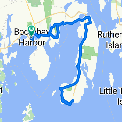
Übersicht
Über diese Route
- 18 min
- Dauer
- 5,7 km
- Distanz
- 65 m
- Aufstieg
- 73 m
- Abstieg
- 19,3 km/h
- Ø-Tempo
- 39 m
- Max. Höhe

Routenqualität
Wegtypen und Untergründe entlang der Route
Wegtypen
Ruhige Straße
1,6 km
(29 %)
Fußgängerzone
0,1 km
(1 %)
Undefiniert
4 km
(70 %)
Untergründe
Befestigt
4 km
(70 %)
Asphalt
4 km
(70 %)
Undefiniert
1,7 km
(30 %)
Weiter mit Bikemap
Diese Radroute verwenden, bearbeiten oder herunterladen
Du möchtest Recovered Route fahren oder sie für deine eigene Reise anpassen? Folgendes kannst du mit dieser Bikemap-Route machen:
Gratis Funktionen
- Speichere diese Route als Favorit oder in einer Sammlung
- Kopiere & plane deine eigene Version dieser Route
- Synchronisiere deine Route mit Garmin oder Wahoo
Premium-Funktionen
Kostenlose Testversion für 3 Tage oder einmalige Zahlung. Mehr über Bikemap Premium.
- Navigiere diese Route auf iOS & Android
- Exportiere eine GPX / KML-Datei dieser Route
- Erstelle deinen individuellen Ausdruck (Jetzt kostenlos ausprobieren)
- Lade diese Route für die Offline-Navigation herunter
Entdecke weitere Premium-Funktionen.
Bikemap Premium aktivierenVon unserer Community
Boothbay Harbor: Andere beliebte Routen, die hier beginnen
 23 Atlantic Ave, Boothbay Harbor to 24 Atlantic Ave, Boothbay Harbor
- Distanz
- 14,1 km
- Aufstieg
- 206 m
- Abstieg
- 205 m
- Standort
- Boothbay Harbor, Maine, Vereinigte Staaten
 1–99 High St, Boothbay Harbor to 24 Atlantic Ave, Boothbay Harbor
- Distanz
- 15,3 km
- Aufstieg
- 185 m
- Abstieg
- 189 m
- Standort
- Boothbay Harbor, Maine, Vereinigte Staaten
 ocean bike with noah
- Distanz
- 27,1 km
- Aufstieg
- 432 m
- Abstieg
- 432 m
- Standort
- Boothbay Harbor, Maine, Vereinigte Staaten
 185 Townsend Ave, Boothbay Harbor to 185 Townsend Ave, Boothbay Harbor
- Distanz
- 15 km
- Aufstieg
- 221 m
- Abstieg
- 224 m
- Standort
- Boothbay Harbor, Maine, Vereinigte Staaten
 Recovered Route
- Distanz
- 4,3 km
- Aufstieg
- 48 m
- Abstieg
- 53 m
- Standort
- Boothbay Harbor, Maine, Vereinigte Staaten
 tour of maine stage 1
- Distanz
- 124,9 km
- Aufstieg
- 368 m
- Abstieg
- 353 m
- Standort
- Boothbay Harbor, Maine, Vereinigte Staaten
 Recorded on Jun 11, 2023 at 12:55 PM
- Distanz
- 2,8 km
- Aufstieg
- 58 m
- Abstieg
- 54 m
- Standort
- Boothbay Harbor, Maine, Vereinigte Staaten
 104 Commercial St, Boothbay Harbor to 35 School St, East Boothbay
- Distanz
- 5,9 km
- Aufstieg
- 83 m
- Abstieg
- 82 m
- Standort
- Boothbay Harbor, Maine, Vereinigte Staaten
In der App öffnen