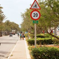
Mallorca - Palma Beach
Palma – Puig Mayor and Sa Calobra (tough ride)
Fahrradroute
Übersicht
Über diese Route
This route includes the two toughest climbs in Mallorca: Puig Mayor and Sa Calobra. You can skip the latter if you are not up to it.
The first 20 km of the route is warm up to the first ascent over the mountain towards Soller. This is a beautiful climb and equally beautiful descent towards Soller, where you can buy provisions before embarking on the ascent towards the highest mountain in Mallorca: Puig Mayor.
Prearrange to meet up after approximately 14 km where you reach a photo spot just before the tunnel. From here the route continues along the mountain ridge before the descent towards Sa Calobra where you can familiarize yourself with the road curves before the uphill climb. Buy provisions (water/energy bars) in Sa Calobra before the tough ascent which resembles Alpe d’Huez in climb and character.
After the ascent to the top of the mountain ridge you continue towards Lluch and begin the descent after the petrol station situated just after you meet the road leading to Pollenca (you do not take this road).
Provisions:
There is a petrol station at Bunyola before the climb, shops in Soller (slightly inconvenient, but may be necessary), a restaurant/kiosk in Sa Calobra and a petrol station with cafeteria just before you go downhill towards Selva.
Enjoy the ride!
- -:--
- Dauer
- 141,7 km
- Distanz
- 2.124 m
- Aufstieg
- 2.121 m
- Abstieg
- ---
- Ø-Tempo
- ---
- Max. Höhe
Erstellt vor 14 Jahren
Teil von

5 Etappen
Highlights der Route
POIs entlang der Route
Interessanter Ort nach 97,4 km
Petrol station - you can buy water/food
Weiter mit Bikemap
Diese Radroute verwenden, bearbeiten oder herunterladen
Du möchtest Palma – Puig Mayor and Sa Calobra (tough ride) fahren oder sie für deine eigene Reise anpassen? Folgendes kannst du mit dieser Bikemap-Route machen:
Gratis Funktionen
- Speichere diese Route als Favorit oder in einer Sammlung
- Kopiere & plane deine eigene Version dieser Route
- Teile sie in Etappen ein, um eine mehrtägige Tour zu erstellen
- Synchronisiere deine Route mit Garmin oder Wahoo
Premium-Funktionen
Kostenlose Testversion für 3 Tage oder einmalige Zahlung. Mehr über Bikemap Premium.
- Navigiere diese Route auf iOS & Android
- Exportiere eine GPX / KML-Datei dieser Route
- Erstelle deinen individuellen Ausdruck (Jetzt kostenlos ausprobieren)
- Lade diese Route für die Offline-Navigation herunter
Entdecke weitere Premium-Funktionen.
Bikemap Premium aktivierenIn der App öffnen


