Piriné Epic Trail Extrem
Eine Fahrradroute, die in Bonansa, Aragon, Spain beginnt.
Übersicht
Über diese Route
<span style="color: #000000; font-family: verdana, arial, sans-serif; font-size: 14px; line-height: 21px; background-color: #f3f3f3;">Inolvidable recorrido circular por las comarcas oscenses de Ribagorça y Sobrarbe. Se trata de las mas abruptas del Pirineo aragonés lo que la conviertes en lugar idóneo para las actividades al aire libre. </span><br style="color: #000000; font-family: verdana, arial, sans-serif; font-size: 14px; line-height: 21px; text-align: justify; background-color: #f3f3f3; padding: 0px; margin: 0px;" /><span style="color: #000000; font-family: verdana, arial, sans-serif; font-size: 14px; line-height: 21px; text-align: justify; background-color: #f3f3f3;">Nuestro periplo se desarrolla por las inmediaciones del Parque Natural(desde 1964) de Poçets-Maladeta en el que se encuentran el mayor numero de picos de mas de 3000 mts. de altura,13 glaciares y la estación de esquí mas alta de los Pirineos; Cerler. </span><br style="color: #000000; font-family: verdana, arial, sans-serif; font-size: 14px; line-height: 21px; text-align: justify; background-color: #f3f3f3; padding: 0px; margin: 0px;" /><span style="color: #000000; font-family: verdana, arial, sans-serif; font-size: 14px; line-height: 21px; text-align: justify; background-color: #f3f3f3;">La exuberante Naturaleza y la pureza de sus ríos serán nuestros compañeros de viaje. Caprichosas formas geológicas nos dejarán agradablemente sorprendidos. Saltos de agua,ríos, ibones, embalses y fuentes por doquier con que el numeroso ganado, que pasta apaciblemente en las laderas, calma su sed. </span><br style="color: #000000; font-family: verdana, arial, sans-serif; font-size: 14px; line-height: 21px; text-align: justify; background-color: #f3f3f3; padding: 0px; margin: 0px;" /><span style="color: #000000; font-family: verdana, arial, sans-serif; font-size: 14px; line-height: 21px; text-align: justify; background-color: #f3f3f3;">Valles de cuento de adas como los de Chistau, Benasque o Ventimillo. Congostos de difícil acceso en los que el hombre se ha superado para ganarle la batalla a la Naturaleza como es el Congosto de La Inclusa en el río Cinqueta. El de Ventimillo en el Ésera. O el de Las Devotas en el Cinca. Senderos para todos los gustos y niveles con los que esta ruta no seria igual. Llama la atención la arquitectura civil popular con muros recios de piedra para combatir las bajas temperaturas. Una distribución interior adaptada a la agricultura, el pastoreo y en los últimos tiempos al turismo de invierno. </span><br style="color: #000000; font-family: verdana, arial, sans-serif; font-size: 14px; line-height: 21px; text-align: justify; background-color: #f3f3f3; padding: 0px; margin: 0px;" /><span style="color: #000000; font-family: verdana, arial, sans-serif; font-size: 14px; line-height: 21px; text-align: justify; background-color: #f3f3f3;">En cuanto a la gastronomía se podría hablar largo y tendido pero lo mejor sera que la pruebes. </span><br style="color: #000000; font-family: verdana, arial, sans-serif; font-size: 14px; line-height: 21px; text-align: justify; background-color: #f3f3f3; padding: 0px; margin: 0px;" /><span style="color: #000000; font-family: verdana, arial, sans-serif; font-size: 14px; line-height: 21px; text-align: justify; background-color: #f3f3f3;">Viajaremos por los cauces de varios de los ríos mas importantes de la Comarca del Sobrarbe y Ribagorça como son el propio Ribera Ribagorçana, Cinca, Cinqueta, Ésera, Irués o Chistau. </span><br style="color: #000000; font-family: verdana, arial, sans-serif; font-size: 14px; line-height: 21px; text-align: justify; background-color: #f3f3f3; padding: 0px; margin: 0px;" /><span style="color: #000000; font-family: verdana, arial, sans-serif; font-size: 14px; line-height: 21px; text-align: justify; background-color: #f3f3f3;">Gentes de trato amable y dispuestas a ayudar en cuanto lo necesitas son las que veras en los núcleos urbanos. </span><br style="color: #000000; font-family: verdana, arial, sans-serif; font-size: 14px; line-height: 21px; text-align: justify; background-color: #f3f3f3; padding: 0px; margin: 0px;" /><br style="color: #000000; font-family: verdana, arial, sans-serif; font-size: 14px; line-height: 21px; text-align: justify; background-color: #f3f3f3; padding: 0px; margin: 0px;" /><span style="color: #000000; font-family: verdana, arial, sans-serif; font-size: 14px; line-height: 21px; text-align: justify; background-color: #f3f3f3;">El reto deportivo con que los casi 8000 mts de desnivel y 230 Kms. te recordarán que, como humanos, tenemos limitaciones físicas que hay que superar. Solo 81 Bikers han completado la ruta que te propongo aquí, entre los que me cuento. Existe una alternativa mas popular(970 participantes) en la que se recortan 35 kms de senderos técnicos para sustituirlos por tramos de pistas o caminos. Ello supone terminar antes las etapas. Aunque hablamos de parecido desnivel y distancia. Esta alternativa es la llamada Pirené Epic Trail. </span><br style="color: #000000; font-family: verdana, arial, sans-serif; font-size: 14px; line-height: 21px; text-align: justify; background-color: #f3f3f3; padding: 0px; margin: 0px;" /><br style="color: #000000; font-family: verdana, arial, sans-serif; font-size: 14px; line-height: 21px; text-align: justify; background-color: #f3f3f3; padding: 0px; margin: 0px;" /><span style="color: #000000; font-family: verdana, arial, sans-serif; font-size: 14px; line-height: 21px; text-align: justify; background-color: #f3f3f3;">En cuanto a la que aquí te presento la Pirené Epic Trail Extrem estos son los datos recogidos por mi GPS: </span><br style="color: #000000; font-family: verdana, arial, sans-serif; font-size: 14px; line-height: 21px; text-align: justify; background-color: #f3f3f3; padding: 0px; margin: 0px;" /><br style="color: #000000; font-family: verdana, arial, sans-serif; font-size: 14px; line-height: 21px; text-align: justify; background-color: #f3f3f3; padding: 0px; margin: 0px;" /><span style="color: #000000; font-family: verdana, arial, sans-serif; font-size: 14px; line-height: 21px; text-align: justify; background-color: #f3f3f3;">Etapa 1--->Pont de Suer-Senz(1)--->64 kms.---> 2064 mts desnivel+--->I BP 150 </span><br style="color: #000000; font-family: verdana, arial, sans-serif; font-size: 14px; line-height: 21px; text-align: justify; background-color: #f3f3f3; padding: 0px; margin: 0px;" /><br style="color: #000000; font-family: verdana, arial, sans-serif; font-size: 14px; line-height: 21px; text-align: justify; background-color: #f3f3f3; padding: 0px; margin: 0px;" /><span style="color: #000000; font-family: verdana, arial, sans-serif; font-size: 14px; line-height: 21px; text-align: justify; background-color: #f3f3f3;">Etapa 2-------> Senz-Plan (2) ---> 45Kms ---> 1430 Mts desnivel+---> IBP 110 </span><br style="color: #000000; font-family: verdana, arial, sans-serif; font-size: 14px; line-height: 21px; text-align: justify; background-color: #f3f3f3; padding: 0px; margin: 0px;" /><br style="color: #000000; font-family: verdana, arial, sans-serif; font-size: 14px; line-height: 21px; text-align: justify; background-color: #f3f3f3; padding: 0px; margin: 0px;" /><span style="color: #000000; font-family: verdana, arial, sans-serif; font-size: 14px; line-height: 21px; text-align: justify; background-color: #f3f3f3;">Etapa3--->Plan-Castejón de Sos---> 61Kms.---> 2032 mts. Desnivel+---> IBP 147 </span><br style="color: #000000; font-family: verdana, arial, sans-serif; font-size: 14px; line-height: 21px; text-align: justify; background-color: #f3f3f3; padding: 0px; margin: 0px;" /><br style="color: #000000; font-family: verdana, arial, sans-serif; font-size: 14px; line-height: 21px; text-align: justify; background-color: #f3f3f3; padding: 0px; margin: 0px;" /><span style="color: #000000; font-family: verdana, arial, sans-serif; font-size: 14px; line-height: 21px; text-align: justify; background-color: #f3f3f3;">Etapa 4--->Castejón-Pont de Suer--->58 Kms.--->2223 mts. Desnivel+---> IBP 179 </span><br style="color: #000000; font-family: verdana, arial, sans-serif; font-size: 14px; line-height: 21px; text-align: justify; background-color: #f3f3f3; padding: 0px; margin: 0px;" /><br style="color: #000000; font-family: verdana, arial, sans-serif; font-size: 14px; line-height: 21px; text-align: justify; background-color: #f3f3f3; padding: 0px; margin: 0px;" /><br style="color: #000000; font-family: verdana, arial, sans-serif; font-size: 14px; line-height: 21px; text-align: justify; background-color: #f3f3f3; padding: 0px; margin: 0px;" /><span style="color: #000000; font-family: verdana, arial, sans-serif; font-size: 14px; line-height: 21px; text-align: justify; background-color: #f3f3f3;">Saludos y a disfrutarla. </span>
- -:--
- Dauer
- 214,1 km
- Distanz
- 4.738 m
- Aufstieg
- 4.736 m
- Abstieg
- ---
- Ø-Tempo
- ---
- Ø-Tempo
Routenqualität
Wegtypen und Untergründe entlang der Route
Wegtypen
Undefiniert
214,1 km
(100 %)
Untergründe
Undefiniert
214,1 km
(100 %)
Weiter mit Bikemap
Diese Radroute verwenden, bearbeiten oder herunterladen
Du möchtest Piriné Epic Trail Extrem fahren oder sie für deine eigene Reise anpassen? Folgendes kannst du mit dieser Bikemap-Route machen:
Gratis Funktionen
- Speichere diese Route als Favorit oder in einer Sammlung
- Kopiere & plane deine eigene Version dieser Route
- Synchronisiere deine Route mit Garmin oder Wahoo
Premium-Funktionen
Kostenlose Testversion für 3 Tage oder einmalige Zahlung. Mehr über Bikemap Premium.
- Navigiere diese Route auf iOS & Android
- Exportiere eine GPX / KML-Datei dieser Route
- Erstelle deinen individuellen Ausdruck (Jetzt kostenlos ausprobieren)
- Lade diese Route für die Offline-Navigation herunter
Entdecke weitere Premium-Funktionen.
Bikemap Premium aktivierenVon unserer Community
Bonansa: Andere beliebte Routen, die hier beginnen
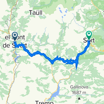
- Transpirenaica.Etapa9.Sentis-Senz
- Distanz
- 58 km
- Aufstieg
- 1.635 m
- Abstieg
- 1.568 m
- Standort
- Bonansa, Aragonien, Spanien
- Las Herrerías de Calvera-Monzón. Junio 2017
- Distanz
- 85,1 km
- Aufstieg
- 224 m
- Abstieg
- 924 m
- Standort
- Bonansa, Aragonien, Spanien
- circular btt-monasterio de obarra
- Distanz
- 51,3 km
- Aufstieg
- 1.116 m
- Abstieg
- 1.106 m
- Standort
- Bonansa, Aragonien, Spanien
- B to B VIII etapp
- Distanz
- 52,7 km
- Aufstieg
- 1.957 m
- Abstieg
- 1.521 m
- Standort
- Bonansa, Aragonien, Spanien
- El Pont de Suert - Pic del Maià
- Distanz
- 183,7 km
- Aufstieg
- 4.283 m
- Abstieg
- 2.606 m
- Standort
- Bonansa, Aragonien, Spanien
- ETAPA 1
- Distanz
- 154,5 km
- Aufstieg
- 2.277 m
- Abstieg
- 2.410 m
- Standort
- Bonansa, Aragonien, Spanien
- El Pont de Suert - Jaca
- Distanz
- 181,9 km
- Aufstieg
- 1.999 m
- Abstieg
- 2.031 m
- Standort
- Bonansa, Aragonien, Spanien
- Piriné Epic Trail Extrem
- Distanz
- 214,1 km
- Aufstieg
- 4.738 m
- Abstieg
- 4.736 m
- Standort
- Bonansa, Aragonien, Spanien