

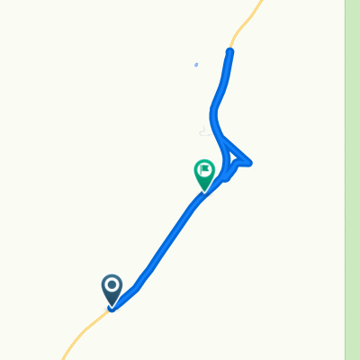
Airport to Harshaw Road loop and back to airport
Eine Fahrradroute, die in Nogales, Arizona, USA beginnt.
Übersicht
Über diese Route
There are a couple of places to place a vehicle on this route to avoid having to ride the pavement back to the airport. This is a great ride, rugged in a few places andsome great climbs and downhills and well as some scenic detours. Bring plenty of water and snacks...it's a long ride.
- -:--
- Dauer
- 28,4 km
- Distanz
- 427 m
- Aufstieg
- 430 m
- Abstieg
- ---
- Ø-Tempo
- ---
- Max. Höhe
Highlights der Route
POIs entlang der Route
Interessanter Ort nach 2,7 km
Paloma Canyon Turnoff
Interessanter Ort nach 2,9 km
Interessanter Ort nach 2,9 km
Gate...Please close the gate...
Interessanter Ort nach 3,1 km
Junction..Right goes to old corrals and water tank and dead ends there...nice diversion..
Interessanter Ort nach 4,7 km
Gate..Please close the gate..
Interessanter Ort nach 4,7 km
This road just goes up the hill to a cattle tank and dead ends...it's still a good ride and a rugged climb
Interessanter Ort nach 7,7 km
Old Corral...this is a good turnaround spot if you want to go back the way you came..from here the round trip is 9.5 miles....or continue..
Interessanter Ort nach 8,7 km
great road...comes out just south of the runway...the gate is probably locked however
Interessanter Ort nach 9 km
Great climb and beautiful view from top but is a dead end..although the view is worth the ride
Interessanter Ort nach 12,8 km
Gate..Please close the gate
Interessanter Ort nach 14,9 km
This is a great place to leave a vehicle if you want to end your ride here..otherwise it's on out to the Patagonia Hwy
Interessanter Ort nach 15,9 km
Back entrance to Kino Springs via The Village
Interessanter Ort nach 23,1 km
this also a good place to leave a vehicle if you want to end the ride here...otherwise..back to the airport
Weiter mit Bikemap
Diese Radroute verwenden, bearbeiten oder herunterladen
Du möchtest Airport to Harshaw Road loop and back to airport fahren oder sie für deine eigene Reise anpassen? Folgendes kannst du mit dieser Bikemap-Route machen:
Gratis Funktionen
- Speichere diese Route als Favorit oder in einer Sammlung
- Kopiere & plane deine eigene Version dieser Route
- Synchronisiere deine Route mit Garmin oder Wahoo
Premium-Funktionen
Kostenlose Testversion für 3 Tage oder einmalige Zahlung. Mehr über Bikemap Premium.
- Navigiere diese Route auf iOS & Android
- Exportiere eine GPX / KML-Datei dieser Route
- Erstelle deinen individuellen Ausdruck (Jetzt kostenlos ausprobieren)
- Lade diese Route für die Offline-Navigation herunter
Entdecke weitere Premium-Funktionen.
Bikemap Premium aktivierenVon unserer Community
Nogales: Andere beliebte Routen, die hier beginnen
 trecho yankee
- Distanz
- 3.675,7 km
- Aufstieg
- 9.362 m
- Abstieg
- 10.532 m
- Standort
- Nogales, Arizona, USA
 744–748 E Patagonia Hwy, Nogales to 900–958 E Patagonia Hwy, Nogales
- Distanz
- 7,9 km
- Aufstieg
- 1.279 m
- Abstieg
- 1.234 m
- Standort
- Nogales, Arizona, USA
 san2tume
- Distanz
- 828,7 km
- Aufstieg
- 2.759 m
- Abstieg
- 1.583 m
- Standort
- Nogales, Arizona, USA
 paloma canyon
- Distanz
- 14,9 km
- Aufstieg
- 333 m
- Abstieg
- 287 m
- Standort
- Nogales, Arizona, USA
 Airport to Harshaw Road loop and back to airport
- Distanz
- 28,4 km
- Aufstieg
- 427 m
- Abstieg
- 430 m
- Standort
- Nogales, Arizona, USA
In der App öffnen