

Loire by bike - Sully-sur-Loire to Angers
Eine Fahrradroute, die in Sully-sur-Loire, Centre-Val de Loire, Frankreich beginnt.
Übersicht
Über diese Route
More about Loire by bike:
https://www.cyclingthread.com/cycling-loire-valley-loire-velo-castles-and-wine
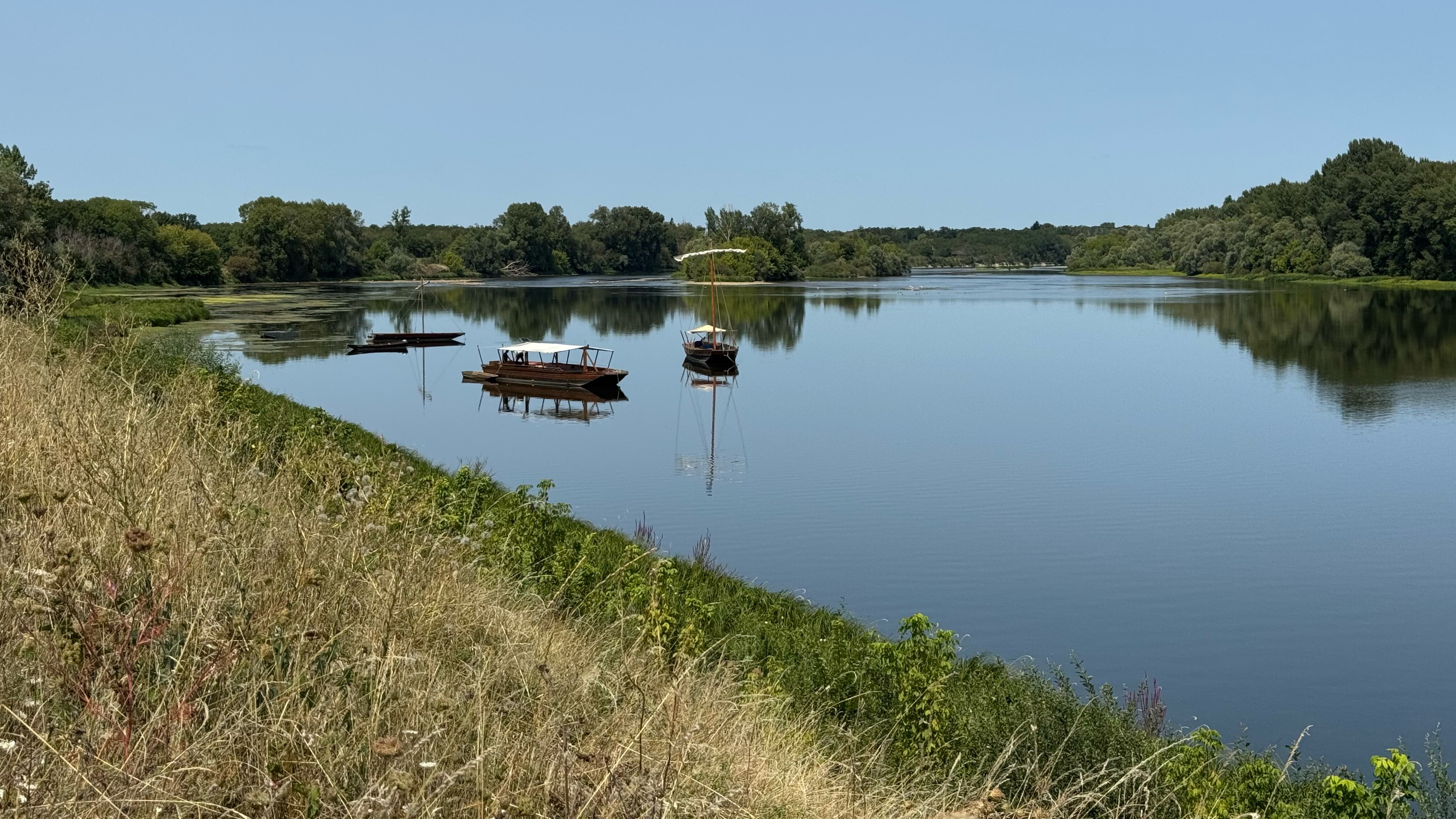
The Loire à Vélo route in the Loire Valley is mostly on gravel paths instead of smooth asphalt, which makes the cycling different than many imagine. The river views are calm and modest, but the many castles and palaces quickly become the main attraction. The route passes through a region full of history, culture and architecture that give the ride extra depth. Riders see famous châteaux with different styles and stories, surrounded by the gentle scenery of the Loire. The area is well prepared for cycling tourism with clear signs, cyclist friendly services and even trains adapted for bikes. Along the way there are historic towns, gardens and vineyards that add variety to the journey. It is a route that combines cycling with an immersive experience of the Loire Valley’s heritage.
- -:--
- Dauer
- 382,1 km
- Distanz
- 1.990 m
- Aufstieg
- 2.064 m
- Abstieg
- ---
- Ø-Tempo
- 122 m
- Max. Höhe

Fotos von der Route


Routenqualität
Wegtypen und Untergründe entlang der Route
Wegtypen
Ruhige Straße
153,1 km
(40 %)
Radweg
60,1 km
(16 %)
Untergründe
Befestigt
214 km
(56 %)
Unbefestigt
36,6 km
(10 %)
Asphalt
188,9 km
(49 %)
Schotter
28,7 km
(8 %)
Weiter mit Bikemap
Diese Radroute verwenden, bearbeiten oder herunterladen
Du möchtest Loire by bike - Sully-sur-Loire to Angers fahren oder sie für deine eigene Reise anpassen? Folgendes kannst du mit dieser Bikemap-Route machen:
Gratis Funktionen
- Speichere diese Route als Favorit oder in einer Sammlung
- Kopiere & plane deine eigene Version dieser Route
- Teile sie in Etappen ein, um eine mehrtägige Tour zu erstellen
- Synchronisiere deine Route mit Garmin oder Wahoo
Premium-Funktionen
Kostenlose Testversion für 3 Tage oder einmalige Zahlung. Mehr über Bikemap Premium.
- Navigiere diese Route auf iOS & Android
- Exportiere eine GPX / KML-Datei dieser Route
- Erstelle deinen individuellen Ausdruck (Jetzt kostenlos ausprobieren)
- Lade diese Route für die Offline-Navigation herunter
Entdecke weitere Premium-Funktionen.
Bikemap Premium aktivierenVon unserer Community
Sully-sur-Loire: Andere beliebte Routen, die hier beginnen
 Camino 2015 18 Sully sur Loire nach Orléans
- Distanz
- 51,3 km
- Aufstieg
- 86 m
- Abstieg
- 90 m
- Standort
- Sully-sur-Loire, Centre-Val de Loire, Frankreich
 Loire 6 Schlössertour
- Distanz
- 397,1 km
- Aufstieg
- 296 m
- Abstieg
- 297 m
- Standort
- Sully-sur-Loire, Centre-Val de Loire, Frankreich
 Sully - Chateneuf
- Distanz
- 10,7 km
- Aufstieg
- 21 m
- Abstieg
- 26 m
- Standort
- Sully-sur-Loire, Centre-Val de Loire, Frankreich
 Boulevard du Champ de Foire 3, Sully-sur-Loire nach Orléans
- Distanz
- 52,1 km
- Aufstieg
- 142 m
- Abstieg
- 147 m
- Standort
- Sully-sur-Loire, Centre-Val de Loire, Frankreich
 04 - Sully sur Loire - Orléans
- Distanz
- 53 km
- Aufstieg
- 82 m
- Abstieg
- 88 m
- Standort
- Sully-sur-Loire, Centre-Val de Loire, Frankreich
 LV15 Sully to Orleans.kml - LV15 Sully to Orleans.kml_LV15 Sully to Orleans
- Distanz
- 50,9 km
- Aufstieg
- 121 m
- Abstieg
- 144 m
- Standort
- Sully-sur-Loire, Centre-Val de Loire, Frankreich
 Sully_Decize
- Distanz
- 196,3 km
- Aufstieg
- 594 m
- Abstieg
- 521 m
- Standort
- Sully-sur-Loire, Centre-Val de Loire, Frankreich
 Chemin de la Salle Verte, Sully-sur-Loire à Saint-Jean-le-Blanc
- Distanz
- 47 km
- Aufstieg
- 19 m
- Abstieg
- 36 m
- Standort
- Sully-sur-Loire, Centre-Val de Loire, Frankreich
In der App öffnen