Jozankei railway from Makomanai station to Jozankei
Eine Fahrradroute, die in Sapporo, Hokkaido, Japan beginnt.
Übersicht
Über diese Route
a route trying to follow Jozankei railway
- -:--
- Dauer
- 20,2 km
- Distanz
- 370 m
- Aufstieg
- 166 m
- Abstieg
- ---
- Ø-Tempo
- 309 m
- Max. Höhe
Highlights der Route
POIs entlang der Route

Interessanter Ort nach 0,2 km
The location of Midorigaoka stop 1961 - 1969, currently serves as a shelter
Interessanter Ort nach 3,1 km
Ishikiriyama station, formerly Ananosawa station at the Jozankei line 1918 - 1969, the only remaining station building on the line

Interessanter Ort nach 5,9 km
the location of Fujinosawa station, formerly Marujugo station 1918 - 1969. The park was established after the railway's suspension

Interessanter Ort nach 6,5 km
Jugoshima Koen (Jugoshima Park) a picturesque park with a suspension brigde over the river

Interessanter Ort nach 6,8 km
The location of Jugoshima Koen (Jugoshima Park) Station 1959 - 1969

Interessanter Ort nach 7,9 km
The location of Shimo Fujino (Lower Fujino) station 1948 - 1969

Interessanter Ort nach 9,4 km
The location of Higashimisumai (East Misumai) stop 1951 - 1969, currently a bus stop

Interessanter Ort nach 9,6 km
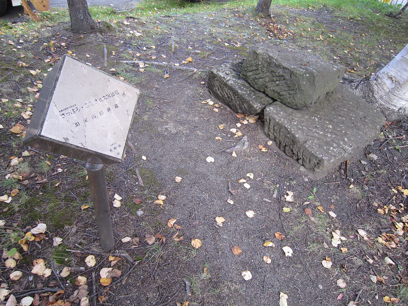
historical monument of the railway in Misumai area

Interessanter Ort nach 9,6 km
Misumai local museum with information about the Jozankei railway and Koganji road

Interessanter Ort nach 10,2 km
The location of Misumai Station 1918 - 1969

Interessanter Ort nach 12,5 km
The location of Toyotaki station 1948 - 1969 The nearby power utility station has some information about the area

Interessanter Ort nach 13,8 km
The location of Takinosawa station 1924 - 1969

Interessanter Ort nach 14,9 km
The location of Koganeyu stop for Koganeyu Onsen 1936 - 1969. Also, very close to the Sapporo Ainu Culture Promotion Center
Interessanter Ort nach 14,9 km
The Sapporo Ainu Culture Promotion Center

Interessanter Ort nach 15,9 km
the location of Ichinosawa station 1924 - 1969

Interessanter Ort nach 19,5 km
Shiraito no Taki (Shiraito Falls) Stop 1933 - 1969

Interessanter Ort nach 20,2 km
The location of Jozankei station terminal 1918 - 1969
Weiter mit Bikemap
Diese Radroute verwenden, bearbeiten oder herunterladen
Du möchtest Jozankei railway from Makomanai station to Jozankei fahren oder sie für deine eigene Reise anpassen? Folgendes kannst du mit dieser Bikemap-Route machen:
Gratis Funktionen
- Speichere diese Route als Favorit oder in einer Sammlung
- Kopiere & plane deine eigene Version dieser Route
- Synchronisiere deine Route mit Garmin oder Wahoo
Premium-Funktionen
Kostenlose Testversion für 3 Tage oder einmalige Zahlung. Mehr über Bikemap Premium.
- Navigiere diese Route auf iOS & Android
- Exportiere eine GPX / KML-Datei dieser Route
- Erstelle deinen individuellen Ausdruck (Jetzt kostenlos ausprobieren)
- Lade diese Route für die Offline-Navigation herunter
Entdecke weitere Premium-Funktionen.
Bikemap Premium aktivierenVon unserer Community
Sapporo: Andere beliebte Routen, die hier beginnen
 Sapporo around the island
- Distanz
- 1.561,5 km
- Aufstieg
- 11.216 m
- Abstieg
- 11.216 m
- Standort
- Sapporo, Hokkaido, Japan
 Hokkido trip
- Distanz
- 529,9 km
- Aufstieg
- 2.618 m
- Abstieg
- 2.617 m
- Standort
- Sapporo, Hokkaido, Japan
 1-32, Kita23Johigashi 23-Chōme, Higashi, Sapporo to 1-32, Kita23Johigashi 23-Chōme, Higashi, Sapporo
- Distanz
- 16,2 km
- Aufstieg
- 13 m
- Abstieg
- 13 m
- Standort
- Sapporo, Hokkaido, Japan
 toyohira towards the sea
- Distanz
- 29,7 km
- Aufstieg
- 43 m
- Abstieg
- 57 m
- Standort
- Sapporo, Hokkaido, Japan
 ripple
- Distanz
- 86,7 km
- Aufstieg
- 240 m
- Abstieg
- 246 m
- Standort
- Sapporo, Hokkaido, Japan
 Alt. route Sapporo - Lake Shikotsu
- Distanz
- 51,3 km
- Aufstieg
- 861 m
- Abstieg
- 632 m
- Standort
- Sapporo, Hokkaido, Japan
 札幌市立大ライド
- Distanz
- 37,1 km
- Aufstieg
- 413 m
- Abstieg
- 416 m
- Standort
- Sapporo, Hokkaido, Japan
 Sapporo to Abashiri
- Distanz
- 696,2 km
- Aufstieg
- 1.066 m
- Abstieg
- 1.091 m
- Standort
- Sapporo, Hokkaido, Japan
In der App öffnen


