

Seattle to Marysville
Eine Fahrradroute, die in Seattle, Washington, USA beginnt.
Übersicht
Über diese Route
Until near the end of the ride, we rode almost continually along the Interurban Trail. For the most part, this was an excellent mostly urban route with the vast bulk of it being either dedicated cycling trails or streets with good bike lanes. While having the GPS for our route was critical a number of times to keep from getting irretrievably lost, there was a lot of good signage for the most part. Despite all the good trails and bike lanes, going through Everett was no great pleasure. And between Everett and Marysville, we got onto State Route 204 for just a few hundred meters…and that was absolutely terrible. Actually, this highway is a bicycle trail itself with an excellent bicycle lane, but we had to quickly get across two lanes of traffic to get into a left turn lane in order to turn on to Sunnyside Blvd SE. As it was during afternoon rush hour and there’s a freeway exit than empties onto this road, the cars were not only continuous, they were driving at highway speeds. It probably took us ten minutes before we were able to get across to the left turn lane. What a pleasure to be off that road.
- 4 h 20 min
- Dauer
- 76,1 km
- Distanz
- 650 m
- Aufstieg
- 687 m
- Abstieg
- 17,6 km/h
- Ø-Tempo
- 171 m
- Max. Höhe

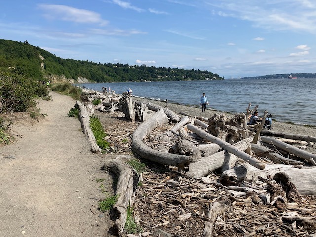
Fotos von der Route


Routenqualität
Wegtypen und Untergründe entlang der Route
Wegtypen
Radweg
32,5 km
(43 %)
Straße
30,3 km
(40 %)
Untergründe
Befestigt
40 km
(53 %)
Unbefestigt
0,6 km
(<1 %)
Asphalt
35,5 km
(47 %)
Beton
3,7 km
(5 %)
Weiter mit Bikemap
Diese Radroute verwenden, bearbeiten oder herunterladen
Du möchtest Seattle to Marysville fahren oder sie für deine eigene Reise anpassen? Folgendes kannst du mit dieser Bikemap-Route machen:
Gratis Funktionen
- Speichere diese Route als Favorit oder in einer Sammlung
- Kopiere & plane deine eigene Version dieser Route
- Synchronisiere deine Route mit Garmin oder Wahoo
Premium-Funktionen
Kostenlose Testversion für 3 Tage oder einmalige Zahlung. Mehr über Bikemap Premium.
- Navigiere diese Route auf iOS & Android
- Exportiere eine GPX / KML-Datei dieser Route
- Erstelle deinen individuellen Ausdruck (Jetzt kostenlos ausprobieren)
- Lade diese Route für die Offline-Navigation herunter
Entdecke weitere Premium-Funktionen.
Bikemap Premium aktivierenVon unserer Community
Seattle: Andere beliebte Routen, die hier beginnen
 Magnolia/Discovery Park Hidden Areas and Great Climbs
- Distanz
- 34,9 km
- Aufstieg
- 530 m
- Abstieg
- 530 m
- Standort
- Seattle, Washington, USA
 Bridge2Bridge
- Distanz
- 34,3 km
- Aufstieg
- 448 m
- Abstieg
- 449 m
- Standort
- Seattle, Washington, USA
 1/2 of Lake Washington Loop
- Distanz
- 54 km
- Aufstieg
- 358 m
- Abstieg
- 358 m
- Standort
- Seattle, Washington, USA
 Southern Lake Washington Loop
- Distanz
- 58,2 km
- Aufstieg
- 357 m
- Abstieg
- 358 m
- Standort
- Seattle, Washington, USA
 Anderson Classic
- Distanz
- 95,9 km
- Aufstieg
- 1.022 m
- Abstieg
- 1.030 m
- Standort
- Seattle, Washington, USA
 Cedar River Trail to Snoqualmie to Home
- Distanz
- 124,9 km
- Aufstieg
- 824 m
- Abstieg
- 839 m
- Standort
- Seattle, Washington, USA
 Fremont - Kenmore - Kirkland - 520 - Fremont Loop
- Distanz
- 49,1 km
- Aufstieg
- 568 m
- Abstieg
- 568 m
- Standort
- Seattle, Washington, USA
 university loop
- Distanz
- 16,9 km
- Aufstieg
- 125 m
- Abstieg
- 124 m
- Standort
- Seattle, Washington, USA
In der App öffnen