

Burlington to Bellingham
Eine Fahrradroute, die in Burlington, Washington, Vereinigte Staaten beginnt.
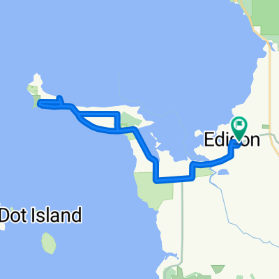
Übersicht
Über diese Route
The first half to two-thirds of the ride was pretty much flat through nice agricultural areas.
After the flat portion of the ride, we got onto Chuckanut Drive, which is really a beautiful road along the coast south of Bellingham that rises and falls a number of times. The only downsides are a little too much traffic, though not uncomfortably so for us, and the lack of road shoulder. There are a few lookout points, though with the trees below the lookout points growing up, the view of Puget Sound was nice, but not as panoramic as it would otherwise be.
Overall, great ride with good road conditions and nice countryside and views.
- 4 h 27 min
- Dauer
- 52,8 km
- Distanz
- 635 m
- Aufstieg
- 590 m
- Abstieg
- 11,9 km/h
- Ø-Tempo
- 98 m
- Max. Höhe

Fotos von der Route


Routenqualität
Wegtypen und Untergründe entlang der Route
Wegtypen
Vielbefahrene Straße
31,7 km
(60 %)
Straße
10,9 km
(21 %)
Untergründe
Befestigt
32,7 km
(62 %)
Unbefestigt
0,2 km
(<1 %)
Asphalt
29,4 km
(56 %)
Beton
3,3 km
(6 %)
Weiter mit Bikemap
Diese Radroute verwenden, bearbeiten oder herunterladen
Du möchtest Burlington to Bellingham fahren oder sie für deine eigene Reise anpassen? Folgendes kannst du mit dieser Bikemap-Route machen:
Gratis Funktionen
- Speichere diese Route als Favorit oder in einer Sammlung
- Kopiere & plane deine eigene Version dieser Route
- Synchronisiere deine Route mit Garmin oder Wahoo
Premium-Funktionen
Kostenlose Testversion für 3 Tage oder einmalige Zahlung. Mehr über Bikemap Premium.
- Navigiere diese Route auf iOS & Android
- Exportiere eine GPX / KML-Datei dieser Route
- Erstelle deinen individuellen Ausdruck (Jetzt kostenlos ausprobieren)
- Lade diese Route für die Offline-Navigation herunter
Entdecke weitere Premium-Funktionen.
Bikemap Premium aktivierenVon unserer Community
Burlington: Andere beliebte Routen, die hier beginnen
 Recording from September 18, 4:29 PM
- Distanz
- 12,1 km
- Aufstieg
- 0 m
- Abstieg
- 0 m
- Standort
- Burlington, Washington, Vereinigte Staaten
 Recording from September 18, 9:53 PM
- Distanz
- 7,8 km
- Aufstieg
- 8 m
- Abstieg
- 8 m
- Standort
- Burlington, Washington, Vereinigte Staaten
 EdisonSchool-SamishIsland
- Distanz
- 20,5 km
- Aufstieg
- 62 m
- Abstieg
- 63 m
- Standort
- Burlington, Washington, Vereinigte Staaten
 Mt. Constitution
- Distanz
- 265 km
- Aufstieg
- 682 m
- Abstieg
- 550 m
- Standort
- Burlington, Washington, Vereinigte Staaten
 2012 Skagit Spring Classic 45-Mile Route
- Distanz
- 75,9 km
- Aufstieg
- 254 m
- Abstieg
- 254 m
- Standort
- Burlington, Washington, Vereinigte Staaten
 5530 Chuckanut Dr, Bow to 14969 W Bow Hill Rd, Bow
- Distanz
- 47,1 km
- Aufstieg
- 761 m
- Abstieg
- 758 m
- Standort
- Burlington, Washington, Vereinigte Staaten
 Recording from October 25, 12:35 AM
- Distanz
- 7,3 km
- Aufstieg
- 10 m
- Abstieg
- 8 m
- Standort
- Burlington, Washington, Vereinigte Staaten
 Edison-SamishIsland20200728
- Distanz
- 25 km
- Aufstieg
- 119 m
- Abstieg
- 119 m
- Standort
- Burlington, Washington, Vereinigte Staaten
In der App öffnen