Central Lonsdale - Circle to Stanley Park
Eine Fahrradroute, die in North Vancouver, British Columbia, Kanada beginnt.
Übersicht
Über diese Route
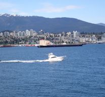
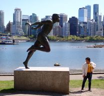
Today’s riding through parts of North Vancouver and over the Lions Gate Bridge into Stanley Park again emphasized what a wonderful job the locality has done in creating great bicycle infrastructure. We’ve now been across three bridges, each with excellent paths for pedestrians and cyclists. Stanley Park had excellent cycling road and paths for those who want to push it and for those who just able along. With the wonderful weather today, there were plenty of people out, which made us stay primarily on the park roads rather than the cycling paths.
- 4 h 14 min
- Dauer
- 31,1 km
- Distanz
- 627 m
- Aufstieg
- 622 m
- Abstieg
- 7,3 km/h
- Ø-Tempo
- 128 m
- Max. Höhe
Fotos von der Route
Weiter mit Bikemap
Diese Radroute verwenden, bearbeiten oder herunterladen
Du möchtest Central Lonsdale - Circle to Stanley Park fahren oder sie für deine eigene Reise anpassen? Folgendes kannst du mit dieser Bikemap-Route machen:
Gratis Funktionen
- Speichere diese Route als Favorit oder in einer Sammlung
- Kopiere & plane deine eigene Version dieser Route
- Synchronisiere deine Route mit Garmin oder Wahoo
Premium-Funktionen
Kostenlose Testversion für 3 Tage oder einmalige Zahlung. Mehr über Bikemap Premium.
- Navigiere diese Route auf iOS & Android
- Exportiere eine GPX / KML-Datei dieser Route
- Erstelle deinen individuellen Ausdruck (Jetzt kostenlos ausprobieren)
- Lade diese Route für die Offline-Navigation herunter
Entdecke weitere Premium-Funktionen.
Bikemap Premium aktivierenVon unserer Community
North Vancouver: Andere beliebte Routen, die hier beginnen
 Proposed Acrtoss Canada Trails - Paved Route Burnaby to Hope
- Distanz
- 141,9 km
- Aufstieg
- 963 m
- Abstieg
- 967 m
- Standort
- North Vancouver, British Columbia, Kanada
 Bowen Island Bounder
- Distanz
- 52,6 km
- Aufstieg
- 412 m
- Abstieg
- 412 m
- Standort
- North Vancouver, British Columbia, Kanada
 Lonsdale --> Demo Forest
- Distanz
- 41 km
- Aufstieg
- 645 m
- Abstieg
- 646 m
- Standort
- North Vancouver, British Columbia, Kanada
 Mosquito Creek to Silva Bay, Gabriola Is., BC
- Distanz
- 49,4 km
- Aufstieg
- 0 m
- Abstieg
- 0 m
- Standort
- North Vancouver, British Columbia, Kanada
 Seymour Valley Loop
- Distanz
- 46,9 km
- Aufstieg
- 614 m
- Abstieg
- 613 m
- Standort
- North Vancouver, British Columbia, Kanada
 Studio to Buntzen Lake
- Distanz
- 89,3 km
- Aufstieg
- 877 m
- Abstieg
- 879 m
- Standort
- North Vancouver, British Columbia, Kanada
 North Vancouver to Mission
- Distanz
- 79,9 km
- Aufstieg
- 1.057 m
- Abstieg
- 1.071 m
- Standort
- North Vancouver, British Columbia, Kanada
 221 Lloyd Ave, North Vancouver to 221 Lloyd Ave, North Vancouver
- Distanz
- 13,5 km
- Aufstieg
- 0 m
- Abstieg
- 6 m
- Standort
- North Vancouver, British Columbia, Kanada
In der App öffnen


