

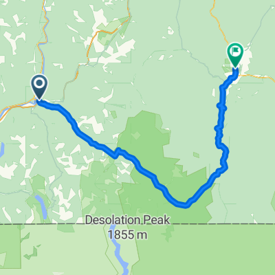
Hope to Sunshine Valley
Eine Fahrradroute, die in Hope, British Columbia, Kanada beginnt.
Übersicht
Über diese Route
Das war eine sehr langsame Fahrt, da es abgesehen von den letzten ein oder zwei Kilometern ziemlich steil bergauf und im Regen ging. Der Ausstieg aus Hope war ein Anstieg auf einer sehr belebten Autobahn, die sowohl BC Highways 5 als auch 3 (und vielleicht auch National Highway 1) verbindet. Schließlich, nach ein paar Kilometern, verließen wir die Hauptstraße und fuhren auf die Highway 3, und waren überglücklich über das viel geringere Verkehrsaufkommen. (Es gab immer noch mehr Verkehr und Lärm, als uns lieb gewesen wäre, aber im Vergleich war es viel, viel besser.) Während der gesamten Fahrt heute war der Seitenstreifen gut, obwohl er manchmal im späteren Teil des Anstiegs etwas breiter hätte sein können. Aufgrund der tiefhängenden Wolken konnten wir nicht viel von der Landschaft sehen, aber was wir sehen konnten, war wunderbar.
- 3 h 39 min
- Dauer
- 23,5 km
- Distanz
- 944 m
- Aufstieg
- 307 m
- Abstieg
- 6,4 km/h
- Ø-Tempo
- 731 m
- Max. Höhe

Fotos von der Route


Weiter mit Bikemap
Diese Radroute verwenden, bearbeiten oder herunterladen
Du möchtest Hope to Sunshine Valley fahren oder sie für deine eigene Reise anpassen? Folgendes kannst du mit dieser Bikemap-Route machen:
Gratis Funktionen
- Speichere diese Route als Favorit oder in einer Sammlung
- Kopiere & plane deine eigene Version dieser Route
- Synchronisiere deine Route mit Garmin oder Wahoo
Premium-Funktionen
Kostenlose Testversion für 3 Tage oder einmalige Zahlung. Mehr über Bikemap Premium.
- Navigiere diese Route auf iOS & Android
- Exportiere eine GPX / KML-Datei dieser Route
- Erstelle deinen individuellen Ausdruck (Jetzt kostenlos ausprobieren)
- Lade diese Route für die Offline-Navigation herunter
Entdecke weitere Premium-Funktionen.
Bikemap Premium aktivierenVon unserer Community
Hope: Andere beliebte Routen, die hier beginnen
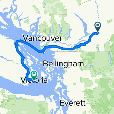
 TBC day 11. Hope to Vancouver
- Distanz
- 162,7 km
- Aufstieg
- 732 m
- Abstieg
- 726 m
- Standort
- Hope, British Columbia, Kanada
 Hope Manning
- Distanz
- 147,5 km
- Aufstieg
- 1.942 m
- Abstieg
- 1.284 m
- Standort
- Hope, British Columbia, Kanada
 Hope to Manning Park
- Distanz
- 66,5 km
- Aufstieg
- 1.546 m
- Abstieg
- 376 m
- Standort
- Hope, British Columbia, Kanada
 End of Cross Canada Ride
- Distanz
- 373,8 km
- Aufstieg
- 2.781 m
- Abstieg
- 2.806 m
- Standort
- Hope, British Columbia, Kanada
 Home to Othello Tunnels
- Distanz
- 18,2 km
- Aufstieg
- 226 m
- Abstieg
- 226 m
- Standort
- Hope, British Columbia, Kanada
 Hope to Kamloops
- Distanz
- 192 km
- Aufstieg
- 3.262 m
- Abstieg
- 2.584 m
- Standort
- Hope, British Columbia, Kanada
 62210 Flood Hope Rd, Hope à 67354–67498 Tunnels Rd, Fraser Valley H
- Distanz
- 13,1 km
- Aufstieg
- 395 m
- Abstieg
- 256 m
- Standort
- Hope, British Columbia, Kanada
 Canada by Bike: Hope - Princeton
- Distanz
- 132,8 km
- Aufstieg
- 1.774 m
- Abstieg
- 1.196 m
- Standort
- Hope, British Columbia, Kanada
In der App öffnen