

Arlington to Seattle
Eine Fahrradroute, die in Smokey Point, Washington, Vereinigte Staaten beginnt.
Übersicht
Über diese Route
Ein hoher Anteil dieser Strecke verlief auf asphaltierten Radwegen. Der Centennial Trail von Arlington bis nach Snohomish war wunderbar und erlaubte schnelles Fahren. Der North Creek Trail hingegen schlängelte sich und wäre großartig für alle, die es nicht eilig haben. Und natürlich ist der Burke-Gilman Trail ebenfalls wunderbar und schnell.
Die ersten Straßen südwestlich von Snohomish hatten zu viele Autos und keinen Seitenstreifen, bis wir gut auf der Seattle Hill Road waren. Von dem Zeitpunkt, als der Radweg begann, bis wir auf den Bothell-Everett Highway abbog, war die Seattle Hill Road ausgezeichnet. Um jedoch zur Seattle Hill Road zu gelangen, gab es nicht nur mehrere Meilen ohne Seitenstreifen, sondern auch einen kurzen, aber sehr steilen Anstieg, der ebenfalls ohne Seitenstreifen war. Wir hielten den Verkehr auf, während wir uns mühselig hinaufarbeiteten. Wenn wir wieder durch Snohomish fahren, müssen wir sehen, welcher bessere Weg es geben könnte, um diese verkehrsreichen Straßen ohne Seitenstreifen und den steilen Anstieg ohne Seitenstreifen zu vermeiden.
Der Bothell-Everett Highway war schnell mit einem ziemlich guten Radweg, aber er war sehr beschäftigt und laut.
- 6 h 56 min
- Dauer
- 97,6 km
- Distanz
- 1.514 m
- Aufstieg
- 1.459 m
- Abstieg
- 14,1 km/h
- Ø-Tempo
- 145 m
- Max. Höhe

Fotos von der Route


Weiter mit Bikemap
Diese Radroute verwenden, bearbeiten oder herunterladen
Du möchtest Arlington to Seattle fahren oder sie für deine eigene Reise anpassen? Folgendes kannst du mit dieser Bikemap-Route machen:
Gratis Funktionen
- Speichere diese Route als Favorit oder in einer Sammlung
- Kopiere & plane deine eigene Version dieser Route
- Teile sie in Etappen ein, um eine mehrtägige Tour zu erstellen
- Synchronisiere deine Route mit Garmin oder Wahoo
Premium-Funktionen
Kostenlose Testversion für 3 Tage oder einmalige Zahlung. Mehr über Bikemap Premium.
- Navigiere diese Route auf iOS & Android
- Exportiere eine GPX / KML-Datei dieser Route
- Erstelle deinen individuellen Ausdruck (Jetzt kostenlos ausprobieren)
- Lade diese Route für die Offline-Navigation herunter
Entdecke weitere Premium-Funktionen.
Bikemap Premium aktivierenVon unserer Community
Smokey Point: Andere beliebte Routen, die hier beginnen
 Arlington to Seattle
- Distanz
- 97,6 km
- Aufstieg
- 1.514 m
- Abstieg
- 1.459 m
- Standort
- Smokey Point, Washington, Vereinigte Staaten
 hdjdj
hdjdj- Distanz
- 29,1 km
- Aufstieg
- 653 m
- Abstieg
- 634 m
- Standort
- Smokey Point, Washington, Vereinigte Staaten
 15291–15359 67th Ave NE, Arlington to 15405 67th Ave NE, Arlington
- Distanz
- 5,2 km
- Aufstieg
- 23 m
- Abstieg
- 23 m
- Standort
- Smokey Point, Washington, Vereinigte Staaten
 15405 67th Ave NE, Arlington to 15405 67th Ave NE, Arlington
- Distanz
- 11,1 km
- Aufstieg
- 65 m
- Abstieg
- 66 m
- Standort
- Smokey Point, Washington, Vereinigte Staaten
 Easy ride in Arlington
- Distanz
- 40,9 km
- Aufstieg
- 196 m
- Abstieg
- 195 m
- Standort
- Smokey Point, Washington, Vereinigte Staaten
 15405 67th Ave NE, Arlington to 15405 67th Ave NE, Arlington
- Distanz
- 10,9 km
- Aufstieg
- 69 m
- Abstieg
- 70 m
- Standort
- Smokey Point, Washington, Vereinigte Staaten
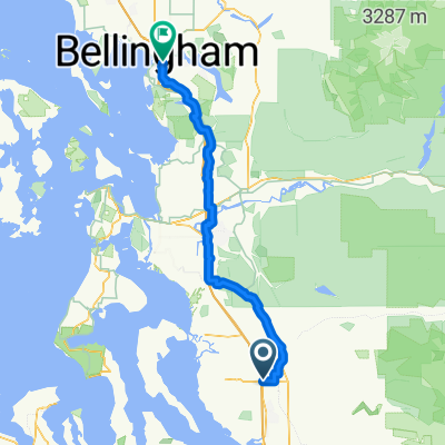 172nd St NE, Arlington to Lakeway Dr, Bellingham
- Distanz
- 93,7 km
- Aufstieg
- 604 m
- Abstieg
- 593 m
- Standort
- Smokey Point, Washington, Vereinigte Staaten
 15405 67th Ave NE, Arlington to 15405 67th Ave NE, Arlington
- Distanz
- 13 km
- Aufstieg
- 118 m
- Abstieg
- 116 m
- Standort
- Smokey Point, Washington, Vereinigte Staaten
In der App öffnen