

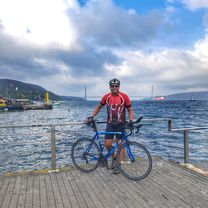
Rumeli Kavağı - Rumeli Feneri (Dogus CICEK)
Eine Fahrradroute, die in Arıköy, Istanbul, Türkei beginnt.
Übersicht
Über diese Route
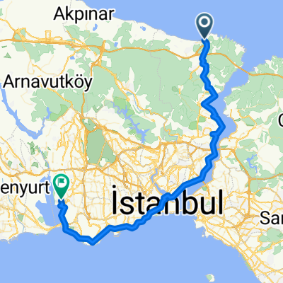
Rumeli Kavagi - Rumeli Feneri - optional Garipce (von Dogus CICEK)
Nachdem sie Rumeli Kavagi verlassen haben, führt eine asphaltierte Waldstraße die Fahrer zu dem Punkt, an dem der Bosporus und das Schwarze Meer zusammentreffen. In Rumeli Feneri gibt es einen Ort (Café/Restaurant), um zu essen/trinken und Vorräte aufzufüllen. Der Fener ist ein historischer Leuchtturm, der eine kleine Ausstellung über seine Vergangenheit hat, und der Blick von der Küste ist wunderschön. Die Fahrer können auch nach Westen vom Rumeli Feneri fahren, um ein Strandhotel namens Golden Beach zu erreichen, das aus mehreren Bungalows mittlerer bis hoher Luxusklasse besteht (aber Vorsicht: die Preise sind hoch). Die Fahrer können „Garipce“ auf dem Rückweg oder vor Rumeli Feneri besuchen, das sich mehrere Meilen südlich von Rumeli Feneri befindet. Vorsicht: Die Straße, die von der Waldstraße, auf der ihr gefahren seid, nach Garipce führt, könnte Schotter oder unbefestigt sein, also sollten Radfahrer Vorsicht walten lassen. Garipce ist ein Fischerdorf mit einem Restaurant. Und natürlich ist der beste Ort, den man in Garipce besuchen kann, die Ruinen einer alten Burg und eines Redoubts, die sich direkt nördlich des Dorfes befinden. (Ihr müsst einen Stockwerk unter die Erde gehen, um im Redoubt zu laufen - seid gewarnt, dass der Redoubt nicht beleuchtet ist, also besser tagsüber hineingehen.) Es wird gesagt, dass Garipce in den kommenden Jahren dem Erdboden gleichgemacht werden soll, weil Pläne zum Bau einer dritten Brücke über den Bosporus bestehen, also ist es eine großartige Zeit, diesen Ort zu sehen, bevor er zerstört wird.
- -:--
- Dauer
- 11,7 km
- Distanz
- 235 m
- Aufstieg
- 227 m
- Abstieg
- ---
- Ø-Tempo
- ---
- Max. Höhe
Weiter mit Bikemap
Diese Radroute verwenden, bearbeiten oder herunterladen
Du möchtest Rumeli Kavağı - Rumeli Feneri (Dogus CICEK) fahren oder sie für deine eigene Reise anpassen? Folgendes kannst du mit dieser Bikemap-Route machen:
Gratis Funktionen
- Speichere diese Route als Favorit oder in einer Sammlung
- Kopiere & plane deine eigene Version dieser Route
- Synchronisiere deine Route mit Garmin oder Wahoo
Premium-Funktionen
Kostenlose Testversion für 3 Tage oder einmalige Zahlung. Mehr über Bikemap Premium.
- Navigiere diese Route auf iOS & Android
- Exportiere eine GPX / KML-Datei dieser Route
- Erstelle deinen individuellen Ausdruck (Jetzt kostenlos ausprobieren)
- Lade diese Route für die Offline-Navigation herunter
Entdecke weitere Premium-Funktionen.
Bikemap Premium aktivierenVon unserer Community
Arıköy: Andere beliebte Routen, die hier beginnen
- ayvat bahcekoy
- 35,9 km
- 456 m
- 455 m
- Arıköy, Istanbul, Türkei
- bentler parkuru
- 4,6 km
- 538 m
- 551 m
- Arıköy, Istanbul, Türkei
- Koc University - Golden Beach - Demirci
- 27 km
- 413 m
- 414 m
- Arıköy, Istanbul, Türkei
- Moderate route in Sariyer
- 15,1 km
- 460 m
- 451 m
- Arıköy, Istanbul, Türkei
- Sinpas - Rumeli Feneri loop
- 18,2 km
- 325 m
- 325 m
- Arıköy, Istanbul, Türkei
- Etape 25
- 68,5 km
- 365 m
- 374 m
- Arıköy, Istanbul, Türkei


In der App öffnen