

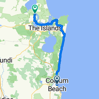
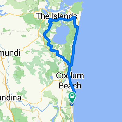
Coolum Beach to Maroochy Wetlands Sanctuary
Eine Fahrradroute, die in Coolum Beach, State of Queensland, Australien beginnt.
Übersicht
Über diese Route
Explore the breathtaking coastline and lush landscapes from Coolum to Maroochy Wetlands Sanctuary with our detailed e-bike route map. This map guides you through a scenic journey, highlighting the best bicycle pathways and key points of interest along the way. Note: There is a 2km section of roadside bicycle lane between Pacific Paradise and Bli Bli, providing a direct route. For a more scenic alternative, consider the route across Maroochy Bridge on cycle pathways, which extends the trip by an additional 6km, offering enhanced views and a more leisurely ride.
- 1 h 21 min
- Dauer
- 22,5 km
- Distanz
- 105 m
- Aufstieg
- 101 m
- Abstieg
- 16,7 km/h
- Ø-Tempo
- 52 m
- Max. Höhe

Routenqualität
Wegtypen und Untergründe entlang der Route
Wegtypen
Radweg
18,7 km
(83 %)
Ruhige Straße
1,6 km
(7 %)
Untergründe
Befestigt
16,5 km
(73 %)
Unbefestigt
0,2 km
(1 %)
Beton
12,6 km
(56 %)
Asphalt
2,9 km
(13 %)
Weiter mit Bikemap
Diese Radroute verwenden, bearbeiten oder herunterladen
Du möchtest Coolum Beach to Maroochy Wetlands Sanctuary fahren oder sie für deine eigene Reise anpassen? Folgendes kannst du mit dieser Bikemap-Route machen:
Gratis Funktionen
- Speichere diese Route als Favorit oder in einer Sammlung
- Kopiere & plane deine eigene Version dieser Route
- Synchronisiere deine Route mit Garmin oder Wahoo
Premium-Funktionen
Kostenlose Testversion für 3 Tage oder einmalige Zahlung. Mehr über Bikemap Premium.
- Navigiere diese Route auf iOS & Android
- Exportiere eine GPX / KML-Datei dieser Route
- Erstelle deinen individuellen Ausdruck (Jetzt kostenlos ausprobieren)
- Lade diese Route für die Offline-Navigation herunter
Entdecke weitere Premium-Funktionen.
Bikemap Premium aktivierenVon unserer Community
Coolum Beach: Andere beliebte Routen, die hier beginnen
 Coolum Beach - Tewantin
- Distanz
- 27,8 km
- Aufstieg
- 194 m
- Abstieg
- 198 m
- Standort
- Coolum Beach, State of Queensland, Australien
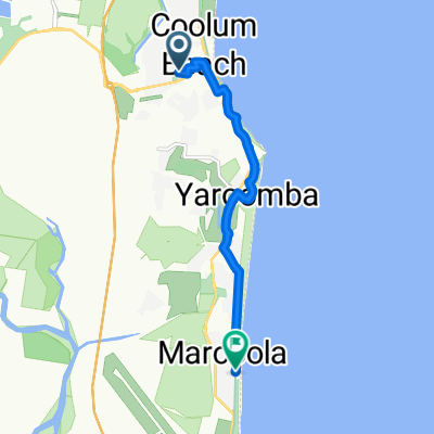
 Merchants Parade 18, Marcoola to Merchants Parade 18, Marcoola
- Distanz
- 22,9 km
- Aufstieg
- 88 m
- Abstieg
- 131 m
- Standort
- Coolum Beach, State of Queensland, Australien
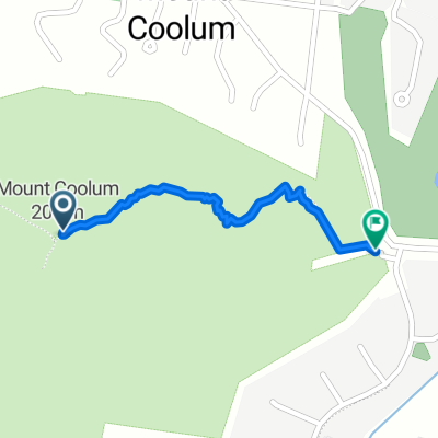 Mount Coolum Track, Mount Coolum to Mount Coolum Track, Mount Coolum
- Distanz
- 1 km
- Aufstieg
- 0 m
- Abstieg
- 187 m
- Standort
- Coolum Beach, State of Queensland, Australien
 Lake Weiba loop
- Distanz
- 53 km
- Aufstieg
- 415 m
- Abstieg
- 413 m
- Standort
- Coolum Beach, State of Queensland, Australien
 State Route to Petrie Ave at Marcoola
- Distanz
- 8,1 km
- Aufstieg
- 86 m
- Abstieg
- 94 m
- Standort
- Coolum Beach, State of Queensland, Australien
 Marcoola to Noosa
- Distanz
- 20,9 km
- Aufstieg
- 199 m
- Abstieg
- 166 m
- Standort
- Coolum Beach, State of Queensland, Australien
 David Low Way, Coolum Beach to 82 Shorehaven Dr, Noosaville
- Distanz
- 19,3 km
- Aufstieg
- 142 m
- Abstieg
- 145 m
- Standort
- Coolum Beach, State of Queensland, Australien
 David Low Way at Warran Road, Yaroomba to Lorraine Avenue 1, Marcoola
- Distanz
- 24,9 km
- Aufstieg
- 181 m
- Abstieg
- 185 m
- Standort
- Coolum Beach, State of Queensland, Australien
In der App öffnen