

Lodève to La Loubière, Combret
Eine Fahrradroute, die in Lodève, Occitanie, Frankreich beginnt.
Übersicht
Über diese Route
Es war eine herausfordernde Fahrt mit viel Bergauffahren auf größtenteils wenig befahrenen und verkehrsarmen Straßen. Es war Ende Oktober 2024 und wir hatten Nebel und etwas Regen, besonders beim Abstieg nach dem Col du Perthus. Ein bisschen kühl.
Der erste große Anstieg war während der gesamten Fahrt relativ konstant. Den zweiten Anstieg fand ich ähnlich, obwohl ich mich da nicht ganz sicher erinnere. Der letzte große Anstieg von Combret nach La Loubière fühlte sich absolut endlos an. Und mit unseren schweren Packtaschen am Ende eines langen Tages war es in der Tat langsam. Außerdem ging es, als wir der Dämmerung näherkamen und die Straße manchmal nach Westen und manchmal nach Süden führte, die Sonne viel zu oft direkt in unsere Augen. Ein harter Anstieg, um unseren Tag zu beenden.
Wir empfehlen diese Straßen wärmstens.
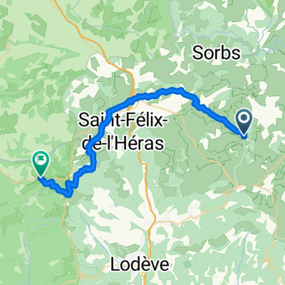
Wie deutlich wird, sind wir spät in der Fahrt geradeaus gefahren, als wir abbiegen sollten. Das fügte der Fahrt mehrere Kilometer hinzu.
- 10 h 11 min
- Dauer
- 89,4 km
- Distanz
- 1.799 m
- Aufstieg
- 1.408 m
- Abstieg
- 8,8 km/h
- Ø-Tempo
- 830 m
- Max. Höhe

Fotos von der Route


Routenqualität
Wegtypen und Untergründe entlang der Route
Wegtypen
Straße
29,5 km
(33 %)
Ruhige Straße
11,6 km
(13 %)
Untergründe
Befestigt
35,8 km
(40 %)
Asphalt
35,8 km
(40 %)
Undefiniert
53,6 km
(60 %)
Weiter mit Bikemap
Diese Radroute verwenden, bearbeiten oder herunterladen
Du möchtest Lodève to La Loubière, Combret fahren oder sie für deine eigene Reise anpassen? Folgendes kannst du mit dieser Bikemap-Route machen:
Gratis Funktionen
- Speichere diese Route als Favorit oder in einer Sammlung
- Kopiere & plane deine eigene Version dieser Route
- Teile sie in Etappen ein, um eine mehrtägige Tour zu erstellen
- Synchronisiere deine Route mit Garmin oder Wahoo
Premium-Funktionen
Kostenlose Testversion für 3 Tage oder einmalige Zahlung. Mehr über Bikemap Premium.
- Navigiere diese Route auf iOS & Android
- Exportiere eine GPX / KML-Datei dieser Route
- Erstelle deinen individuellen Ausdruck (Jetzt kostenlos ausprobieren)
- Lade diese Route für die Offline-Navigation herunter
Entdecke weitere Premium-Funktionen.
Bikemap Premium aktivierenVon unserer Community
Lodève: Andere beliebte Routen, die hier beginnen
 2016 Ride Day 60 - Lodève to Sauve
- Distanz
- 103,5 km
- Aufstieg
- 903 m
- Abstieg
- 982 m
- Standort
- Lodève, Occitanie, Frankreich
 Lodève to La Loubière, Combret
- Distanz
- 89,4 km
- Aufstieg
- 1.799 m
- Abstieg
- 1.408 m
- Standort
- Lodève, Occitanie, Frankreich
 Etape 08 – De La Vernède à Roqueredonde
- Distanz
- 30 km
- Aufstieg
- 510 m
- Abstieg
- 521 m
- Standort
- Lodève, Occitanie, Frankreich
 Etape 09 – De Roqueredonde au Col de Roube
- Distanz
- 21,2 km
- Aufstieg
- 534 m
- Abstieg
- 783 m
- Standort
- Lodève, Occitanie, Frankreich
 2021 D 493 um La Bastide du Font
- Distanz
- 12,4 km
- Aufstieg
- 177 m
- Abstieg
- 176 m
- Standort
- Lodève, Occitanie, Frankreich
 Hérault 2010 - 05
- Distanz
- 51,1 km
- Aufstieg
- 910 m
- Abstieg
- 906 m
- Standort
- Lodève, Occitanie, Frankreich
 TdfC 31k Lac Salagou
- Distanz
- 30,9 km
- Aufstieg
- 466 m
- Abstieg
- 467 m
- Standort
- Lodève, Occitanie, Frankreich
 Etape 10 – Du Col de Roube à Dio-et-Valquières
- Distanz
- 13,3 km
- Aufstieg
- 337 m
- Abstieg
- 384 m
- Standort
- Lodève, Occitanie, Frankreich
In der App öffnen