

Combret (La Loubière) to Castres
Eine Fahrradroute, die in Belmont-sur-Rance, Occitanie, Frankreich beginnt.
Übersicht
Über diese Route
Das war eine wundervolle Fahrt ausschließlich auf Straßen mit sehr geringem und ohne Verkehr. Es gab eine herausragende Landschaft und eine Vielzahl von Höhen und Tiefen.
Der Grund für das seltsame Ende in Castres ist, dass wir an unserem reservierten Hotel (einem ibis Styles) angekommen sind, nur um ein Schild zu finden, das besagte, dass das Hotel geschlossen war. Bitte gehen Sie zum nahegelegenen Mecure Hotel für Ihre Unterkunft. Im Mecure erfuhren wir, dass wegen der geringen Anzahl von Reservierungen für heute (ein Sonntagabend Ende Oktober) das Hotel geschlossen wurde und alle Gäste ins nahegelegene Mecure verlegt wurden. Glücklicherweise für uns nur eine kleine Unannehmlichkeit.
- 5 h 47 min
- Dauer
- 75,3 km
- Distanz
- 827 m
- Aufstieg
- 1.217 m
- Abstieg
- 13 km/h
- Ø-Tempo
- 878 m
- Max. Höhe

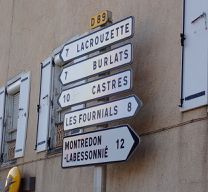
Fotos von der Route
 to Castres\"")
 to Castres\"")
 to Castres\"")
 to Castres\"")
 to Castres\"")
 to Castres\"")
 to Castres\"")
 to Castres\"")
Routenqualität
Wegtypen und Untergründe entlang der Route
Wegtypen
Straße
19,6 km
(26 %)
Ruhige Straße
2,3 km
(3 %)
Untergründe
Befestigt
3,8 km
(5 %)
Asphalt
3,8 km
(5 %)
Undefiniert
71,6 km
(95 %)
Weiter mit Bikemap
Diese Radroute verwenden, bearbeiten oder herunterladen
Du möchtest Combret (La Loubière) to Castres fahren oder sie für deine eigene Reise anpassen? Folgendes kannst du mit dieser Bikemap-Route machen:
Gratis Funktionen
- Speichere diese Route als Favorit oder in einer Sammlung
- Kopiere & plane deine eigene Version dieser Route
- Synchronisiere deine Route mit Garmin oder Wahoo
Premium-Funktionen
Kostenlose Testversion für 3 Tage oder einmalige Zahlung. Mehr über Bikemap Premium.
- Navigiere diese Route auf iOS & Android
- Exportiere eine GPX / KML-Datei dieser Route
- Erstelle deinen individuellen Ausdruck (Jetzt kostenlos ausprobieren)
- Lade diese Route für die Offline-Navigation herunter
Entdecke weitere Premium-Funktionen.
Bikemap Premium aktivierenVon unserer Community
Belmont-sur-Rance: Andere beliebte Routen, die hier beginnen
 Tour de France 2011 - Etappe 10 - Belmont-sur-Rance - Nimes
- Distanz
- 178,8 km
- Aufstieg
- 1.053 m
- Abstieg
- 1.490 m
- Standort
- Belmont-sur-Rance, Occitanie, Frankreich
 Saint-Sernin-sur-Rance - Circle through Pousthomy
- Distanz
- 20,8 km
- Aufstieg
- 519 m
- Abstieg
- 514 m
- Standort
- Belmont-sur-Rance, Occitanie, Frankreich
 etape 3
- Distanz
- 88,4 km
- Aufstieg
- ---
- Abstieg
- ---
- Standort
- Belmont-sur-Rance, Occitanie, Frankreich
 Combret (La Loubière) to Castres
- Distanz
- 75,3 km
- Aufstieg
- 827 m
- Abstieg
- 1.217 m
- Standort
- Belmont-sur-Rance, Occitanie, Frankreich
 La Loubière-Combret - Circle to Lacaune
- Distanz
- 42,2 km
- Aufstieg
- 905 m
- Abstieg
- 906 m
- Standort
- Belmont-sur-Rance, Occitanie, Frankreich
 Tappa 8 Belmont sur Rance - Carcassonne
- Distanz
- 100,9 km
- Aufstieg
- 1.705 m
- Abstieg
- 2.037 m
- Standort
- Belmont-sur-Rance, Occitanie, Frankreich
 Saint-Sernin/Rance à Bédarieux
- Distanz
- 100,6 km
- Aufstieg
- 1.164 m
- Abstieg
- 1.298 m
- Standort
- Belmont-sur-Rance, Occitanie, Frankreich
 Belmont-sur-Rance - La Salvetat-sur-Agout
- Distanz
- 46,8 km
- Aufstieg
- 910 m
- Abstieg
- 639 m
- Standort
- Belmont-sur-Rance, Occitanie, Frankreich
In der App öffnen