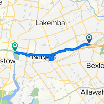
(Map 3D) M5 Linear Park to Bexley Pool
Eine Fahrradroute, die in Bexley North, New South Wales, Australien beginnt.
Übersicht
Über diese Route
This map is for planning purposes and does not currently exist.
This route relates to suggested upgrades to (Map 3) which it is requested that Bayside Council and the NSW Government deliver.
Features include:
- A new tunnel or bridge to link the M5 Linear Park with Kookaburra Lane.
- An ATL along Bardwell Creek through vacant land.
- Utilisation of Preddys Lane and Council land to connect with Highgate St.
- 11 min
- Dauer
- 2,7 km
- Distanz
- 32 m
- Aufstieg
- 16 m
- Abstieg
- 15 km/h
- Ø-Tempo
- 44 m
- Max. Höhe
Weiter mit Bikemap
Diese Radroute verwenden, bearbeiten oder herunterladen
Du möchtest (Map 3D) M5 Linear Park to Bexley Pool fahren oder sie für deine eigene Reise anpassen? Folgendes kannst du mit dieser Bikemap-Route machen:
Gratis Funktionen
- Speichere diese Route als Favorit oder in einer Sammlung
- Kopiere & plane deine eigene Version dieser Route
- Synchronisiere deine Route mit Garmin oder Wahoo
Premium-Funktionen
Kostenlose Testversion für 3 Tage oder einmalige Zahlung. Mehr über Bikemap Premium.
- Navigiere diese Route auf iOS & Android
- Exportiere eine GPX / KML-Datei dieser Route
- Erstelle deinen individuellen Ausdruck (Jetzt kostenlos ausprobieren)
- Lade diese Route für die Offline-Navigation herunter
Entdecke weitere Premium-Funktionen.
Bikemap Premium aktivierenVon unserer Community
Bexley North: Andere beliebte Routen, die hier beginnen
- Clemton Park to Lakemba
- Distanz
- 3,4 km
- Aufstieg
- 44 m
- Abstieg
- 29 m
- Standort
- Bexley North, New South Wales, Australien
- Kingsland road to Struthers st
- Distanz
- 19 km
- Aufstieg
- 98 m
- Abstieg
- 129 m
- Standort
- Bexley North, New South Wales, Australien
- Bexley North - Home
- Distanz
- 4,9 km
- Aufstieg
- 57 m
- Abstieg
- 28 m
- Standort
- Bexley North, New South Wales, Australien
- Miller Avenue 16, Bexley North to Golden Vale Road, Sutton Forest
- Distanz
- 132 km
- Aufstieg
- 2.182 m
- Abstieg
- 1.566 m
- Standort
- Bexley North, New South Wales, Australien
- Bexley North to Cooks River
- Distanz
- 3,7 km
- Aufstieg
- 32 m
- Abstieg
- 45 m
- Standort
- Bexley North, New South Wales, Australien
- cooks River home loop
- Distanz
- 10,2 km
- Aufstieg
- 146 m
- Abstieg
- 139 m
- Standort
- Bexley North, New South Wales, Australien
- 9 Calbina Road, Earlwood to 13 Calbina Road, Earlwood
- Distanz
- 22,6 km
- Aufstieg
- 34 m
- Abstieg
- 57 m
- Standort
- Bexley North, New South Wales, Australien
- Bexley Rd, Kingsgrove to 3 The Crescent, Kingsgrove
- Distanz
- 4,7 km
- Aufstieg
- 30 m
- Abstieg
- 18 m
- Standort
- Bexley North, New South Wales, Australien
In der App öffnen