
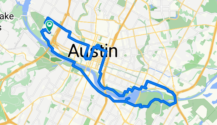
Austin - Circle Exploring Capitol and River
Eine Fahrradroute, die in Rollingwood, Texas, Vereinigte Staaten beginnt.
Übersicht
Über diese Route
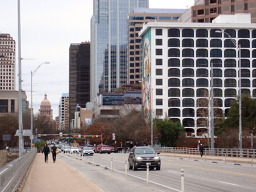
Neu in Austin habe ich eine kurze Radtour gemacht, um ein wenig um den See zu erkunden. Zuerst bin ich jedoch bei Rosen's Bagels vorbeigefahren, um ein paar zu kaufen, um zu sehen, ob sie meiner Frau gefallen. Dann bin ich, da ich die Kuppel des Staatskapitols beim Fahren zum Bagel-Laden gesehen hatte, dorthin gefahren, um es aus der Nähe zu sehen. Schönes, gut erhaltenes Gebäude.
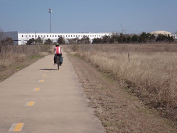
Vom Kapitol fuhr ich hinunter zum Colorado River (offenbar auch Lady Bird Lake genannt) und bog nach Osten ab, um über eine Radwegbrücke zu fahren, um einen Kreis auf der Westseite des Flusses zu machen. An einigen Stellen benutzte ich den hartgepackten Erdweg, während ich an anderen Asphaltstraßen und Radwegen parallel zum Flussufer folgte. Der Abschnitt des unbefestigten Pfades gleich nach der Radlerbrücke am östlichen Ende war ein paar Meilen lang weniger hart gepackt. Befahrbar, aber viele Straßenfahrer würden sich über diesen Teil nicht gerade freuen.
größtenteils war dies eine schöne Fahrt entlang und in der Nähe des Flusses, obwohl ich für einen guten Teil der Fahrt auf der Südseite auf der East und West Riverside Dr war, die auf der Karte als Radroute markiert war, es aber offensichtlich nicht hätte sein sollen. Es hatte viel Verkehr und keinen Standstreifen. Ich empfehle, andere Straßen oder den Radweg entlang dieses Abschnitts zu benutzen. Ich vermute, dass der Radweg hart gepackt wäre, aber ich bin ihn noch nicht gefahren, um es zu sehen.
Zurück zur Fußgänger-/Radfahrerbrücke in der Nähe des Stadtzentrums überquerte ich und nutzte den hartgepackten Weg, um in die Nähe des HEB am westlichen Ende meines Kreises zum Einkaufen zu kommen.
- 3 h
- Dauer
- 31,2 km
- Distanz
- 207 m
- Aufstieg
- 207 m
- Abstieg
- 10,4 km/h
- Ø-Tempo
- 174 m
- Max. Höhe

Fotos von der Route


Routenqualität
Wegtypen und Untergründe entlang der Route
Wegtypen
Radweg
6,5 km
(21 %)
Ruhige Straße
5,9 km
(19 %)
Untergründe
Befestigt
20,3 km
(65 %)
Unbefestigt
4,4 km
(14 %)
Asphalt
15,6 km
(50 %)
Loser Schotter
3,1 km
(10 %)
Weiter mit Bikemap
Diese Radroute verwenden, bearbeiten oder herunterladen
Du möchtest Austin - Circle Exploring Capitol and River fahren oder sie für deine eigene Reise anpassen? Folgendes kannst du mit dieser Bikemap-Route machen:
Gratis Funktionen
- Speichere diese Route als Favorit oder in einer Sammlung
- Kopiere & plane deine eigene Version dieser Route
- Synchronisiere deine Route mit Garmin oder Wahoo
Premium-Funktionen
Kostenlose Testversion für 3 Tage oder einmalige Zahlung. Mehr über Bikemap Premium.
- Navigiere diese Route auf iOS & Android
- Exportiere eine GPX / KML-Datei dieser Route
- Erstelle deinen individuellen Ausdruck (Jetzt kostenlos ausprobieren)
- Lade diese Route für die Offline-Navigation herunter
Entdecke weitere Premium-Funktionen.
Bikemap Premium aktivierenVon unserer Community
Rollingwood: Andere beliebte Routen, die hier beginnen
 Austin - Circle to McKinney Falls State Park
- Distanz
- 40,3 km
- Aufstieg
- 360 m
- Abstieg
- 355 m
- Standort
- Rollingwood, Texas, Vereinigte Staaten
 Austin to Giddings
- Distanz
- 113,7 km
- Aufstieg
- 492 m
- Abstieg
- 529 m
- Standort
- Rollingwood, Texas, Vereinigte Staaten
 Austin - Circle thru Lost Creek Blvd to Barton Creek and Costco
- Distanz
- 41,4 km
- Aufstieg
- 572 m
- Abstieg
- 572 m
- Standort
- Rollingwood, Texas, Vereinigte Staaten
 Austin - Circle to MT Supermarket and Walnut Creek
- Distanz
- 49,2 km
- Aufstieg
- 414 m
- Abstieg
- 413 m
- Standort
- Rollingwood, Texas, Vereinigte Staaten
 Buda loop - 37 mi
- Distanz
- 60,2 km
- Aufstieg
- 212 m
- Abstieg
- 213 m
- Standort
- Rollingwood, Texas, Vereinigte Staaten
 Austin - Random Riding in Neighborhood North of MUNY Golf Course
- Distanz
- 18,7 km
- Aufstieg
- 290 m
- Abstieg
- 290 m
- Standort
- Rollingwood, Texas, Vereinigte Staaten
 Austin - Circle to Bee Cave
- Distanz
- 44,6 km
- Aufstieg
- 562 m
- Abstieg
- 564 m
- Standort
- Rollingwood, Texas, Vereinigte Staaten
 Austin - Circle to Steiner Ranch
- Distanz
- 56,1 km
- Aufstieg
- 757 m
- Abstieg
- 758 m
- Standort
- Rollingwood, Texas, Vereinigte Staaten
In der App öffnen