

Austin - Circle Southeast to Richard Moya Park
Eine Fahrradroute, die in Rollingwood, Texas, Vereinigte Staaten beginnt.
Übersicht
Über diese Route
This ride is on either neighborhood roads or roads with cycling lanes. Except for the initial portion of the ride which was through interesting neighborhoods, the bulk of the ride was on busy and noisy highways.
I took this route since I wanted to see what it was like since we'll be leaving Austin in a few days and this is one of the possible routes out of town.
- 2 h 57 min
- Dauer
- 47,2 km
- Distanz
- 288 m
- Aufstieg
- 288 m
- Abstieg
- 16 km/h
- Ø-Tempo
- 205 m
- Max. Höhe

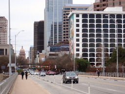
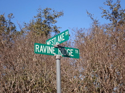
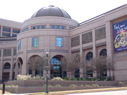
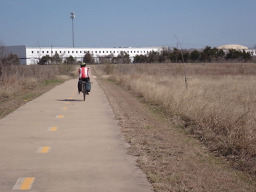
Fotos von der Route


Routenqualität
Wegtypen und Untergründe entlang der Route
Wegtypen
Radweg
13,6 km
(29 %)
Straße
9,8 km
(21 %)
Untergründe
Befestigt
38,3 km
(81 %)
Asphalt
23 km
(49 %)
Beton
9,9 km
(21 %)
Weiter mit Bikemap
Diese Radroute verwenden, bearbeiten oder herunterladen
Du möchtest Austin - Circle Southeast to Richard Moya Park fahren oder sie für deine eigene Reise anpassen? Folgendes kannst du mit dieser Bikemap-Route machen:
Gratis Funktionen
- Speichere diese Route als Favorit oder in einer Sammlung
- Kopiere & plane deine eigene Version dieser Route
- Synchronisiere deine Route mit Garmin oder Wahoo
Premium-Funktionen
Kostenlose Testversion für 3 Tage oder einmalige Zahlung. Mehr über Bikemap Premium.
- Navigiere diese Route auf iOS & Android
- Exportiere eine GPX / KML-Datei dieser Route
- Erstelle deinen individuellen Ausdruck (Jetzt kostenlos ausprobieren)
- Lade diese Route für die Offline-Navigation herunter
Entdecke weitere Premium-Funktionen.
Bikemap Premium aktivierenVon unserer Community
Rollingwood: Andere beliebte Routen, die hier beginnen
 Austin - Circle to McKinney Falls State Park
- Distanz
- 40,3 km
- Aufstieg
- 360 m
- Abstieg
- 355 m
- Standort
- Rollingwood, Texas, Vereinigte Staaten
 Austin - Circle to Steiner Ranch
- Distanz
- 56,1 km
- Aufstieg
- 757 m
- Abstieg
- 758 m
- Standort
- Rollingwood, Texas, Vereinigte Staaten
- Austin - Circle Southeast to Richard Moya Park
- Distanz
- 47,2 km
- Aufstieg
- 288 m
- Abstieg
- 288 m
- Standort
- Rollingwood, Texas, Vereinigte Staaten
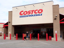 Austin - Circle to MT Supermarket and Costco
- Distanz
- 50,5 km
- Aufstieg
- 428 m
- Abstieg
- 428 m
- Standort
- Rollingwood, Texas, Vereinigte Staaten
 Buda loop - 37 mi
- Distanz
- 60,2 km
- Aufstieg
- 212 m
- Abstieg
- 213 m
- Standort
- Rollingwood, Texas, Vereinigte Staaten
 Austin - Circle to Northeast
- Distanz
- 36,4 km
- Aufstieg
- 270 m
- Abstieg
- 276 m
- Standort
- Rollingwood, Texas, Vereinigte Staaten
 Austin - Circle to Bee Cave
- Distanz
- 44,6 km
- Aufstieg
- 562 m
- Abstieg
- 564 m
- Standort
- Rollingwood, Texas, Vereinigte Staaten
 Austin to Giddings
- Distanz
- 113,7 km
- Aufstieg
- 492 m
- Abstieg
- 529 m
- Standort
- Rollingwood, Texas, Vereinigte Staaten
In der App öffnen