

Via Transilvanica, Section 5: Terra Dacica (official)
Eine Fahrradroute, die in Micăsasa, Sibiu, Rumänien beginnt.
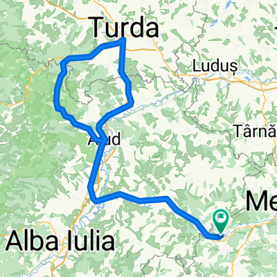
Übersicht
Über diese Route
This section of the trail is rich in history, both old and recent, under whose weight important cities stretch lazily, preserving their royal and Dacian fortresses. Here, too, are the highest altitudes of Via Transilvanica (VT), reaching approximately 1,300 meters. One of the cities that Terra Dacica passes through is Alba Iulia, a place where major events such as the Great Union took place - a city that stands as a symbol of unity and national identity for Romanians. Vast vineyards, steppe-like habitats offering visitors fascinating insights into flora, fauna, paleontology, and mineralogy, small hobbit-like villages with rounded stone fences, discoveries of dwarf dinosaur fossils, traces of the Dacian ancestors, and welcoming people who always have a kind word to say - Terra Dacica is an experience like no other. More information: https://www.viatransilvanica.com/en/
- -:--
- Dauer
- 293,6 km
- Distanz
- 8.599 m
- Aufstieg
- 8.233 m
- Abstieg
- ---
- Ø-Tempo
- 1.220 m
- Max. Höhe

Fotos von der Route
\"")
\"")
\"")
\"")
\"")
Weiter mit Bikemap
Diese Radroute verwenden, bearbeiten oder herunterladen
Du möchtest Via Transilvanica, Section 5: Terra Dacica (official) fahren oder sie für deine eigene Reise anpassen? Folgendes kannst du mit dieser Bikemap-Route machen:
Gratis Funktionen
- Speichere diese Route als Favorit oder in einer Sammlung
- Kopiere & plane deine eigene Version dieser Route
- Teile sie in Etappen ein, um eine mehrtägige Tour zu erstellen
- Synchronisiere deine Route mit Garmin oder Wahoo
Premium-Funktionen
Kostenlose Testversion für 3 Tage oder einmalige Zahlung. Mehr über Bikemap Premium.
- Navigiere diese Route auf iOS & Android
- Exportiere eine GPX / KML-Datei dieser Route
- Erstelle deinen individuellen Ausdruck (Jetzt kostenlos ausprobieren)
- Lade diese Route für die Offline-Navigation herunter
Entdecke weitere Premium-Funktionen.
Bikemap Premium aktivierenVon unserer Community
Micăsasa: Andere beliebte Routen, die hier beginnen
 Spring Classic Challenge
- Distanz
- 143,8 km
- Aufstieg
- 694 m
- Abstieg
- 696 m
- Standort
- Micăsasa, Sibiu, Rumänien
 Micasasa - Craciunelul de Sus
- Distanz
- 15,9 km
- Aufstieg
- 193 m
- Abstieg
- 133 m
- Standort
- Micăsasa, Sibiu, Rumänien
 Spring Classic Challenge
- Distanz
- 140,4 km
- Aufstieg
- 759 m
- Abstieg
- 757 m
- Standort
- Micăsasa, Sibiu, Rumänien
 Via Transilvanica judetul Alba
- Distanz
- 133,7 km
- Aufstieg
- 0 m
- Abstieg
- 0 m
- Standort
- Micăsasa, Sibiu, Rumänien
- Via Transilvanica, Section 5: Terra Dacica (official)
- Distanz
- 293,6 km
- Aufstieg
- 8.599 m
- Abstieg
- 8.233 m
- Standort
- Micăsasa, Sibiu, Rumänien
 No 30 Micasasa - Rimetia
- Distanz
- 194,3 km
- Aufstieg
- 606 m
- Abstieg
- 607 m
- Standort
- Micăsasa, Sibiu, Rumänien
 Via Transilvanica - Terra Dacica
- Distanz
- 292,1 km
- Aufstieg
- ---
- Abstieg
- ---
- Standort
- Micăsasa, Sibiu, Rumänien
 No 02 Micasasa - Cluj Napoca
- Distanz
- 291 km
- Aufstieg
- 1.109 m
- Abstieg
- 1.108 m
- Standort
- Micăsasa, Sibiu, Rumänien
In der App öffnen