

Noel Shore Loop
Eine Fahrradroute, die in Windsor, Neuschottland, Kanada beginnt.
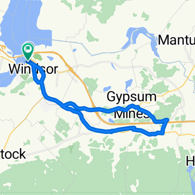
Übersicht
Über diese Route
This is a nice two day excursion. Starts and finishes at Smiley's Provincial campground and takes in some really pretty scenery. The shore along the Bay of Funday is very quiet, with abandoned villages, but great views. Nice campground in East Walton, to break up the journey.
Be prepared for short steep climbs and short steep decents.
Interesting lighthouse and small museum at Burnt Coat.
Convenience stores in Centre Burlington, Cheverie, Walton, Noel, Kennetcook.
- 7 h 44 min
- Dauer
- 127,2 km
- Distanz
- 481 m
- Aufstieg
- 481 m
- Abstieg
- 16,4 km/h
- Ø-Tempo
- 85 m
- Max. Höhe

Routenqualität
Wegtypen und Untergründe entlang der Route
Wegtypen
Straße
15,1 km
(12 %)
Ruhige Straße
6,6 km
(5 %)
Untergründe
Befestigt
124,3 km
(98 %)
Unbefestigt
2,9 km
(2 %)
Asphalt
104,1 km
(82 %)
Befestigt (undefiniert)
20,2 km
(16 %)
Weiter mit Bikemap
Diese Radroute verwenden, bearbeiten oder herunterladen
Du möchtest Noel Shore Loop fahren oder sie für deine eigene Reise anpassen? Folgendes kannst du mit dieser Bikemap-Route machen:
Gratis Funktionen
- Speichere diese Route als Favorit oder in einer Sammlung
- Kopiere & plane deine eigene Version dieser Route
- Teile sie in Etappen ein, um eine mehrtägige Tour zu erstellen
- Synchronisiere deine Route mit Garmin oder Wahoo
Premium-Funktionen
Kostenlose Testversion für 3 Tage oder einmalige Zahlung. Mehr über Bikemap Premium.
- Navigiere diese Route auf iOS & Android
- Exportiere eine GPX / KML-Datei dieser Route
- Erstelle deinen individuellen Ausdruck (Jetzt kostenlos ausprobieren)
- Lade diese Route für die Offline-Navigation herunter
Entdecke weitere Premium-Funktionen.
Bikemap Premium aktivierenVon unserer Community
Windsor: Andere beliebte Routen, die hier beginnen
 Box factory loop
- Distanz
- 18,3 km
- Aufstieg
- 140 m
- Abstieg
- 142 m
- Standort
- Windsor, Neuschottland, Kanada
 Wednesday Night Ride
- Distanz
- 33,8 km
- Aufstieg
- 196 m
- Abstieg
- 197 m
- Standort
- Windsor, Neuschottland, Kanada
 Noel Shore Loop
- Distanz
- 127,2 km
- Aufstieg
- 481 m
- Abstieg
- 481 m
- Standort
- Windsor, Neuschottland, Kanada
 The Dyke Rd Dash
- Distanz
- 20,6 km
- Aufstieg
- 143 m
- Abstieg
- 145 m
- Standort
- Windsor, Neuschottland, Kanada
 ride before the storm
- Distanz
- 24,7 km
- Aufstieg
- 132 m
- Abstieg
- 132 m
- Standort
- Windsor, Neuschottland, Kanada
 smile cuz you bike it !
- Distanz
- 32,7 km
- Aufstieg
- 224 m
- Abstieg
- 224 m
- Standort
- Windsor, Neuschottland, Kanada
 Windsor to Hantsport Loop
- Distanz
- 23,3 km
- Aufstieg
- 200 m
- Abstieg
- 201 m
- Standort
- Windsor, Neuschottland, Kanada
 racing the light
- Distanz
- 31,4 km
- Aufstieg
- 170 m
- Abstieg
- 173 m
- Standort
- Windsor, Neuschottland, Kanada
In der App öffnen