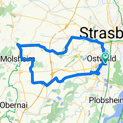
Illkirch-Graffenstaden - Wörth am Rhein
- 91,2 km
- 200 m
- 240 m
- Illkirch-Graffenstaden, Grand Est, Frankreich
Eine Fahrradroute, die in Illkirch-Graffenstaden, Grand Est, Frankreich beginnt.
Übersicht
Obwohl alles flach ist, eine schöne Fahrt durch eine reizvolle Landschaft und Dörfer entlang von Straßen, die normalerweise wenig Verkehr haben oder entlang von Radwegen, die an den Kanälen am Rhein verlaufen. Da wir nicht viele Brücken über den Rhein fanden, waren wir uns nicht sicher, wie wir hinüberkommen würden, also hielten wir glücklich an, als wir ein Fähre sahen, und warteten ein wenig auf sie. Wir fanden wirklich schöne Radwege und Straßen ohne Verkehr entlang des Rheins. Einfach schön. Früh am Tag folgten wir dem Canal du Rhône au Rhin nach Straßburg und fuhren an der Kathedrale vorbei. Einfach prächtig. Nördlich von Straßburg versuchten wir erneut, einen Kanalisierungspfad zu nehmen... und wir landeten westlich statt nördlich. Wahrscheinlich fügten wir unserer Reise fünf oder sechs zusätzliche Meilen hinzu. Außerdem kamen wir während dieses Abschnitts auf einen unbefestigten Weg, der eine kleine Herausforderung war, egal ob beim Gehen oder Fahren. Route: N83 nach Norden vom Hotel zur D222 und einer unnummerierten Straße Südosten durch Eschau nach Canal du Rhône au Rhin nach Norden in Straßburg. Verschiedene Straßen nach Norden durch das Zentrum und bei der Kathedrale nach D468 Nordosten nach La Wantzenau. Kanalweg nach Westen nach Vendenheim. D226/D64/D301 nach Osten zurück nach La Wantzenau. D468 Nordosten nach Seltz. D28 nach Osten zum Rhein. Wege und lokale Straßen am Westufer des Rheins nordöstlich zur Fähre etwas südlich von Karlsruhe in der Nähe der französischen Stadt Mothern oder Lauterbourg und vielleicht D89. Fähre über den Rhein von Frankreich nach Deutschland. Verschiedene Straßen und Wege südlich von Karlsruhe mit hilfreichen Wegweisern nach Osten nach Ettlingen und dann nordwestlich zum Hotel in der Nähe der Kreuzung von A5 und A8. Hintergrund: Meine Frau und ich machen seit 1993 selbstgeführte Touren in Westeuropa (überwiegend in Frankreich). Diese Reihe von Fahrten umfasst unsere 4,5-monatige Route von 2009 durch Teile von Frankreich, Deutschland, Österreich, die Schweiz und dann zurück nach Frankreich. Unser Anfangs- und Endpunkt liegt in der Nähe von Chadurie (südlich von Angoulême), wo unsere Freunde einen Bauernhof mit Gîtes und Chambres d'Hôtes haben. Wir fuhren mit unseren Dawes-Reise-Fahrrädern, die wir 1993 gekauft hatten, stark beladen mit 700Cx32 Reifen. Alle unsere Fahrten fanden auf asphaltierten Straßen statt, meist mit sehr wenig Verkehr. Fast die einzigen unbefestigten Abschnitte waren einige Radwege in Deutschland und Österreich. Leider war das nicht so toll, da Helen mehrmals auf den unbefestigten Wegen gefallen ist. Glücklicherweise jedoch gab es keine ernsthaften Verletzungen. Bei Fragen können Sie mir gerne eine E-Mail an jeffkadet@netdiving.com senden. Jeff
Erstellt vor 13 Jahren
Routenqualität
Forst- / Feldweg
14,8 km
(12 %)
Radweg
14,8 km
(12 %)
Befestigt
96,3 km
(78 %)
Unbefestigt
1,2 km
(1 %)
Asphalt
92,6 km
(75 %)
Befestigt (undefiniert)
3,7 km
(3 %)
Weiter mit Bikemap
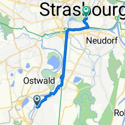
Du möchtest 2009 Euro Tour -- Ride Day 36 — 4 August 2009 — 67118 Geispolsheim (Strasbourg) to 76227 Karlsruhe fahren oder sie für deine eigene Reise anpassen? Folgendes kannst du mit dieser Bikemap-Route machen:
Kostenlose Testversion für 3 Tage oder einmalige Zahlung. Mehr über Bikemap Premium.
Entdecke weitere Premium-Funktionen.
Bikemap Premium aktivierenVon unserer Community
In der App öffnen