
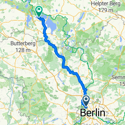
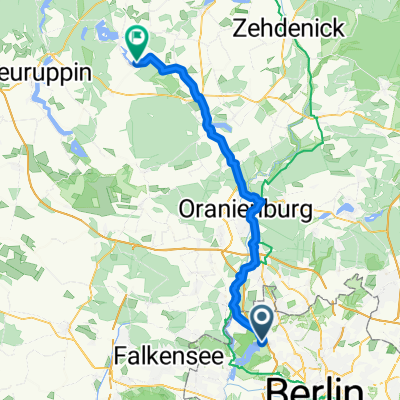
Schubartstraße, Berlin nach Weingartnerallee, Falkensee
Eine Fahrradroute, die in Berlin-Tegel, Land Berlin, Deutschland beginnt.
Übersicht
Über diese Route
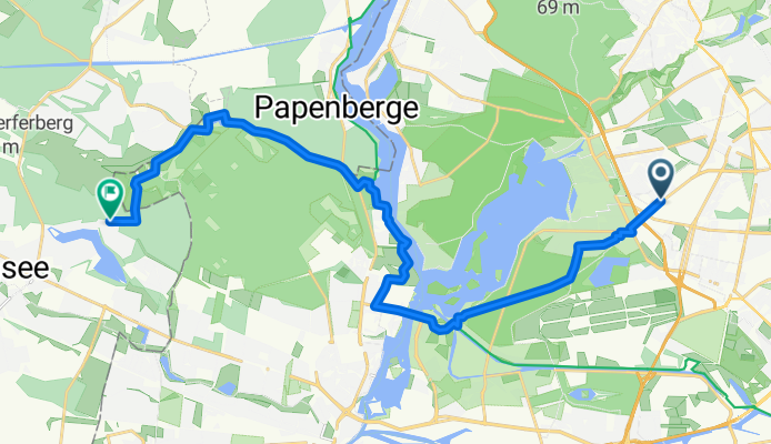
Start your cycling adventure at Schubartstraße 22 in Berlin and pedal along the serene Eiskellerweg 6–8. This route offers a delightful mix of smooth asphalt paths and charming forest trails, perfect for an enjoyable ride.
You'll ascend gently, reaching a maximum elevation of just 48 meters, before descending back to a comfortable pace. The journey covers a total distance of 20.3 km, with an elevation gain of 62 meters and a descent of 65 meters.
Experience the diverse surfaces, including asphalt for the majority of the route, with some unpaved sections adding an extra layer of adventure. Enjoy the transition through various terrain types, from quiet city streets to lush forest paths, and immerse yourself in the beauty of the surroundings.
This route is ideal for both leisurely rides and those seeking a bit of challenge, making it a perfect choice for cyclists of all levels. So gear up and set off on this scenic journey through Berlin and Falkensee!
KI-generiert
- 1 h 24 min
- Dauer
- 20,3 km
- Distanz
- 63 m
- Aufstieg
- 65 m
- Abstieg
- 14,5 km/h
- Ø-Tempo
- 48 m
- Max. Höhe

Routenqualität
Wegtypen und Untergründe entlang der Route
Wegtypen
Ruhige Straße
7,5 km
(37 %)
Pfad
4,7 km
(23 %)
Untergründe
Befestigt
16 km
(79 %)
Unbefestigt
2,4 km
(12 %)
Asphalt
14,4 km
(71 %)
Beton
1,4 km
(7 %)
Weiter mit Bikemap
Diese Radroute verwenden, bearbeiten oder herunterladen
Du möchtest Schubartstraße, Berlin nach Weingartnerallee, Falkensee fahren oder sie für deine eigene Reise anpassen? Folgendes kannst du mit dieser Bikemap-Route machen:
Gratis Funktionen
- Speichere diese Route als Favorit oder in einer Sammlung
- Kopiere & plane deine eigene Version dieser Route
- Synchronisiere deine Route mit Garmin oder Wahoo
Premium-Funktionen
Kostenlose Testversion für 3 Tage oder einmalige Zahlung. Mehr über Bikemap Premium.
- Navigiere diese Route auf iOS & Android
- Exportiere eine GPX / KML-Datei dieser Route
- Erstelle deinen individuellen Ausdruck (Jetzt kostenlos ausprobieren)
- Lade diese Route für die Offline-Navigation herunter
Entdecke weitere Premium-Funktionen.
Bikemap Premium aktivierenVon unserer Community
Berlin-Tegel: Andere beliebte Routen, die hier beginnen
 Berlin - Mecklenburger Seenplatte
- Distanz
- 211,7 km
- Aufstieg
- 651 m
- Abstieg
- 649 m
- Standort
- Berlin-Tegel, Land Berlin, Deutschland
 MTB Tour: Tegel > Eberswalde modified Tegel>Werbellinsee
- Distanz
- 97,2 km
- Aufstieg
- 201 m
- Abstieg
- 199 m
- Standort
- Berlin-Tegel, Land Berlin, Deutschland
 Von Berlin bis Göhren-Lebbin
- Distanz
- 152,6 km
- Aufstieg
- 728 m
- Abstieg
- 690 m
- Standort
- Berlin-Tegel, Land Berlin, Deutschland
 2009 Sonntagstour Tegel ->Nordwärts Landstrasse
- Distanz
- 74,9 km
- Aufstieg
- 148 m
- Abstieg
- 153 m
- Standort
- Berlin-Tegel, Land Berlin, Deutschland
 NordTour_Rundfahrt
- Distanz
- 36,4 km
- Aufstieg
- 103 m
- Abstieg
- 97 m
- Standort
- Berlin-Tegel, Land Berlin, Deutschland
 Kurze Radrunde durch Berlin
- Distanz
- 2,1 km
- Aufstieg
- 24 m
- Abstieg
- 19 m
- Standort
- Berlin-Tegel, Land Berlin, Deutschland
 Freienhagen
- Distanz
- 89,2 km
- Aufstieg
- 128 m
- Abstieg
- 128 m
- Standort
- Berlin-Tegel, Land Berlin, Deutschland
 Berlin-Tegel - Schönermark
- Distanz
- 59,7 km
- Aufstieg
- 200 m
- Abstieg
- 192 m
- Standort
- Berlin-Tegel, Land Berlin, Deutschland
In der App öffnen