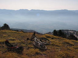
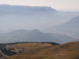
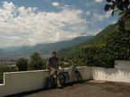
Wanna be at the white house on the top ;)
Eine Fahrradroute, die in Saint-Martin-d’Hères, Auvergne-Rhône-Alpes, Frankreich beginnt.
Übersicht
Über diese Route
Ich sah ein weißes Skihütte auf dem Gipfel eines Berges, nahe der Stadt. Ich lebe in Ungarn, wo der höchste Punkt etwa 1000 m hoch ist, also war es eine Herausforderung hinaufzufahren. Es wurde mit einem 2005 Banshee Chaparral + 2003 Junior-T - ca. 20,5 kg gemacht. Ich empfehle ein leichteres Fahrrad zum Hochfahren... ;) Aber die Aussicht ist das Leiden wert! NIMM VIEL WASSER MIT! Ich habe keine Quelle zwischen Uriage und Chamrousse gefunden!
- -:--
- Dauer
- 27,2 km
- Distanz
- 2.013 m
- Aufstieg
- 22 m
- Abstieg
- ---
- Ø-Tempo
- ---
- Max. Höhe
Highlights der Route
POIs entlang der Route

Interessanter Ort nach 9,6 km

Interessanter Ort nach 10,8 km

Interessanter Ort nach 10,8 km

Interessanter Ort nach 11,4 km

Interessanter Ort nach 13,1 km

Interessanter Ort nach 14,4 km
Good place to eat :)

Interessanter Ort nach 16,7 km

Interessanter Ort nach 16,9 km

Interessanter Ort nach 16,9 km

Interessanter Ort nach 17 km

Interessanter Ort nach 17,7 km

Interessanter Ort nach 17,7 km

Interessanter Ort nach 17,7 km

Interessanter Ort nach 19,2 km
Was a good feeling to know that it goes up 370 m on 2,6 Km

Interessanter Ort nach 19,2 km
A guy didn't drift it with an MX-5.... BAAAAAD :D

Interessanter Ort nach 20,2 km

Interessanter Ort nach 20,2 km

Interessanter Ort nach 20,7 km

Interessanter Ort nach 20,7 km

Interessanter Ort nach 21,2 km

Interessanter Ort nach 21,2 km

Interessanter Ort nach 21,6 km

Interessanter Ort nach 23,7 km
First source since Uriage :)

Interessanter Ort nach 24,3 km
There's no much no.... NOT

Interessanter Ort nach 25,4 km

Interessanter Ort nach 25,8 km

Interessanter Ort nach 26,4 km

Interessanter Ort nach 26,5 km

Interessanter Ort nach 26,6 km

Interessanter Ort nach 26,8 km

Interessanter Ort nach 27,1 km
The lift closes, sheeps come :D

Interessanter Ort nach 27,1 km

Interessanter Ort nach 27,1 km
Weiter mit Bikemap
Diese Radroute verwenden, bearbeiten oder herunterladen
Du möchtest Wanna be at the white house on the top ;) fahren oder sie für deine eigene Reise anpassen? Folgendes kannst du mit dieser Bikemap-Route machen:
Gratis Funktionen
- Speichere diese Route als Favorit oder in einer Sammlung
- Kopiere & plane deine eigene Version dieser Route
- Synchronisiere deine Route mit Garmin oder Wahoo
Premium-Funktionen
Kostenlose Testversion für 3 Tage oder einmalige Zahlung. Mehr über Bikemap Premium.
- Navigiere diese Route auf iOS & Android
- Exportiere eine GPX / KML-Datei dieser Route
- Erstelle deinen individuellen Ausdruck (Jetzt kostenlos ausprobieren)
- Lade diese Route für die Offline-Navigation herunter
Entdecke weitere Premium-Funktionen.
Bikemap Premium aktivierenVon unserer Community
Saint-Martin-d’Hères: Andere beliebte Routen, die hier beginnen
 Challange of St. Eynard
- Distanz
- 33,3 km
- Aufstieg
- 1.185 m
- Abstieg
- 1.186 m
- Standort
- Saint-Martin-d’Hères, Auvergne-Rhône-Alpes, Frankreich
 Grand tour Chartreuse depuis Grenoble
- Distanz
- 71,8 km
- Aufstieg
- 1.318 m
- Abstieg
- 1.318 m
- Standort
- Saint-Martin-d’Hères, Auvergne-Rhône-Alpes, Frankreich
 De 106 Avenue Marcel Cachin, Saint-Martin-d'Hères à Avenue Marcel Cachin, Saint-Martin-d'Hères
- Distanz
- 23,8 km
- Aufstieg
- 293 m
- Abstieg
- 292 m
- Standort
- Saint-Martin-d’Hères, Auvergne-Rhône-Alpes, Frankreich
 Montée Chamrousse depuis Grenoble
- Distanz
- 67,1 km
- Aufstieg
- 1.571 m
- Abstieg
- 1.571 m
- Standort
- Saint-Martin-d’Hères, Auvergne-Rhône-Alpes, Frankreich
 Clémencière + Palaquit
- Distanz
- 36,8 km
- Aufstieg
- 1.045 m
- Abstieg
- 1.045 m
- Standort
- Saint-Martin-d’Hères, Auvergne-Rhône-Alpes, Frankreich
 Tavernolles - Arkéma
- Distanz
- 31,1 km
- Aufstieg
- 377 m
- Abstieg
- 377 m
- Standort
- Saint-Martin-d’Hères, Auvergne-Rhône-Alpes, Frankreich
 Grenoble - Val Pelouse
- Distanz
- 155,4 km
- Aufstieg
- 5.934 m
- Abstieg
- 4.465 m
- Standort
- Saint-Martin-d’Hères, Auvergne-Rhône-Alpes, Frankreich
 Tour Belledonne par Villard-Bonnot
- Distanz
- 52,1 km
- Aufstieg
- 880 m
- Abstieg
- 878 m
- Standort
- Saint-Martin-d’Hères, Auvergne-Rhône-Alpes, Frankreich
In der App öffnen


