

Bush Beeline Loop
Eine Fahrradroute, die in Mesa, Arizona, Vereinigte Staaten beginnt.
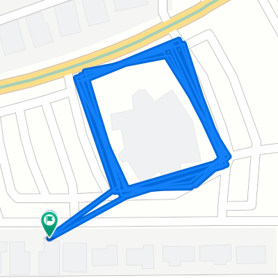
Übersicht
Über diese Route
Ride out to Saguaro Lake via Bush Highway, following Salt River; return on Beeline Highway. While there are large shoulders on highways at nearly all parts, be aware that Bush Highway is used heavily by boaters, and the Beeline is a 4-lane mostly-divided highway with very heavy traffic at times. Alternatives: Ride McKellips to Ellsworth and take the Usery Pass road, Take McDowell instead of McKellips, Use Gilbert Rd as a shortcut (places not rider friendly). Note that most of the route is through park/forest/reservation, so services (restrooms, water stops, etc) are limited. On the Beeline, a good stopping point is at the Fort McDowell Rd junction, or at Shea Blvd turn to Fountain Hills.
- -:--
- Dauer
- 81,4 km
- Distanz
- 2.229 m
- Aufstieg
- 2.229 m
- Abstieg
- ---
- Ø-Tempo
- ---
- Max. Höhe
Weiter mit Bikemap
Diese Radroute verwenden, bearbeiten oder herunterladen
Du möchtest Bush Beeline Loop fahren oder sie für deine eigene Reise anpassen? Folgendes kannst du mit dieser Bikemap-Route machen:
Gratis Funktionen
- Speichere diese Route als Favorit oder in einer Sammlung
- Kopiere & plane deine eigene Version dieser Route
- Teile sie in Etappen ein, um eine mehrtägige Tour zu erstellen
- Synchronisiere deine Route mit Garmin oder Wahoo
Premium-Funktionen
Kostenlose Testversion für 3 Tage oder einmalige Zahlung. Mehr über Bikemap Premium.
- Navigiere diese Route auf iOS & Android
- Exportiere eine GPX / KML-Datei dieser Route
- Erstelle deinen individuellen Ausdruck (Jetzt kostenlos ausprobieren)
- Lade diese Route für die Offline-Navigation herunter
Entdecke weitere Premium-Funktionen.
Bikemap Premium aktivierenVon unserer Community
Mesa: Andere beliebte Routen, die hier beginnen
 Paragon to Rio Verde
- Distanz
- 90,8 km
- Aufstieg
- 370 m
- Abstieg
- 370 m
- Standort
- Mesa, Arizona, Vereinigte Staaten
 Spook Mtn 20
- Distanz
- 32 km
- Aufstieg
- 191 m
- Abstieg
- 189 m
- Standort
- Mesa, Arizona, Vereinigte Staaten
 24km morning ride
- Distanz
- 24 km
- Aufstieg
- 29 m
- Abstieg
- 27 m
- Standort
- Mesa, Arizona, Vereinigte Staaten
 60km Mesa
- Distanz
- 60,5 km
- Aufstieg
- 47 m
- Abstieg
- 47 m
- Standort
- Mesa, Arizona, Vereinigte Staaten
 canal-pecans-Lindsey-brown-power-Alma school
- Distanz
- 70,2 km
- Aufstieg
- 90 m
- Abstieg
- 89 m
- Standort
- Mesa, Arizona, Vereinigte Staaten
 Relaxed route in Mesa
- Distanz
- 39 km
- Aufstieg
- 810 m
- Abstieg
- 812 m
- Standort
- Mesa, Arizona, Vereinigte Staaten
 Peter
Peter- Distanz
- 2 km
- Aufstieg
- 0 m
- Abstieg
- 0 m
- Standort
- Mesa, Arizona, Vereinigte Staaten
 Steady ride in Tempe
- Distanz
- 15,9 km
- Aufstieg
- 38 m
- Abstieg
- 64 m
- Standort
- Mesa, Arizona, Vereinigte Staaten
In der App öffnen