

Bisbee via Palominas
Eine Fahrradroute, die in Sierra Vista, Arizona, Vereinigte Staaten beginnt.
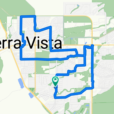
Übersicht
Über diese Route
Der Anstieg durch Palominas nach Bisbee ist nicht so drastisch wie der Tunnel auf der HWY 80. Es ist eine schöne ruhige Fahrt mit viel Seitenstreifen. In Palominas gibt es eine Tankstelle, die ein netter Ort ist, um sich bei Bedarf Wasser zu holen. Ich genieße es, in einem der lokalen Restaurants für die Rückfahrt etwas zu essen. Seien Sie vorsichtig beim Durchfahren des Tunnels, da die Fahrer dort durchrauschen und es keinen Seitenstreifen gibt. Viel Spaß!
- -:--
- Dauer
- 110,5 km
- Distanz
- 897 m
- Aufstieg
- 897 m
- Abstieg
- ---
- Ø-Tempo
- ---
- Max. Höhe
Weiter mit Bikemap
Diese Radroute verwenden, bearbeiten oder herunterladen
Du möchtest Bisbee via Palominas fahren oder sie für deine eigene Reise anpassen? Folgendes kannst du mit dieser Bikemap-Route machen:
Gratis Funktionen
- Speichere diese Route als Favorit oder in einer Sammlung
- Kopiere & plane deine eigene Version dieser Route
- Teile sie in Etappen ein, um eine mehrtägige Tour zu erstellen
- Synchronisiere deine Route mit Garmin oder Wahoo
Premium-Funktionen
Kostenlose Testversion für 3 Tage oder einmalige Zahlung. Mehr über Bikemap Premium.
- Navigiere diese Route auf iOS & Android
- Exportiere eine GPX / KML-Datei dieser Route
- Erstelle deinen individuellen Ausdruck (Jetzt kostenlos ausprobieren)
- Lade diese Route für die Offline-Navigation herunter
Entdecke weitere Premium-Funktionen.
Bikemap Premium aktivierenVon unserer Community
Sierra Vista: Andere beliebte Routen, die hier beginnen
 Loop around Sierra Vista
- Distanz
- 21,7 km
- Aufstieg
- 101 m
- Abstieg
- 101 m
- Standort
- Sierra Vista, Arizona, Vereinigte Staaten
 El Mercado Loop 2200, Sierra Vista to El Mercado Loop 2200, Sierra Vista
- Distanz
- 15 km
- Aufstieg
- 73 m
- Abstieg
- 74 m
- Standort
- Sierra Vista, Arizona, Vereinigte Staaten
 Copper Sky Drive 2533, Sierra Vista to Lexington Drive 1901, Sierra Vista
- Distanz
- 33,9 km
- Aufstieg
- 915 m
- Abstieg
- 872 m
- Standort
- Sierra Vista, Arizona, Vereinigte Staaten
 St. Andrews path
- Distanz
- 12,6 km
- Aufstieg
- 92 m
- Abstieg
- 69 m
- Standort
- Sierra Vista, Arizona, Vereinigte Staaten
 Lexington Drive 1901, Sierra Vista to Lexington Drive 1901, Sierra Vista
- Distanz
- 23,5 km
- Aufstieg
- 1.034 m
- Abstieg
- 1.035 m
- Standort
- Sierra Vista, Arizona, Vereinigte Staaten
 Lexington Drive 1901, Sierra Vista to Lexington Drive 1901, Sierra Vista
- Distanz
- 23,3 km
- Aufstieg
- 512 m
- Abstieg
- 512 m
- Standort
- Sierra Vista, Arizona, Vereinigte Staaten
 Lexington Drive 1901, Sierra Vista to Lexington Drive 1901, Sierra Vista
- Distanz
- 24,2 km
- Aufstieg
- 415 m
- Abstieg
- 418 m
- Standort
- Sierra Vista, Arizona, Vereinigte Staaten
 Morning Ride
- Distanz
- 17,1 km
- Aufstieg
- 99 m
- Abstieg
- 99 m
- Standort
- Sierra Vista, Arizona, Vereinigte Staaten
In der App öffnen