

Recreational Trails Map - Gateway Country - Route 5
Eine Fahrradroute, die in Prince Edward, Ontario, Kanada beginnt.
Übersicht
Über diese Route
I just traced the route as outlined to get a reading on the distance because it was not included on the Recreational Trails Map (a large oversite in my opinion). The description given:<br />Picton - Sand Banks Loop - This is the beach tour, so be prpared for traffic on the weekends. Head west out of Picton on Hwy 33 to CR10 and follow south to Cherry Valley. Hug the shore of East Lake. At Salmon Point, turn right and pass through The Outlet and over to Sandbanks PP, or West Lake, as you chosse. Head back up West Lake Rd to the pretty village of Bloomfield, featuring a vibrant main street. Return to Picton along Hwy33. Generally flat, a few rolling hills on the last stretch.<br /><br /><br />If we bike it, I will add details.
- -:--
- Dauer
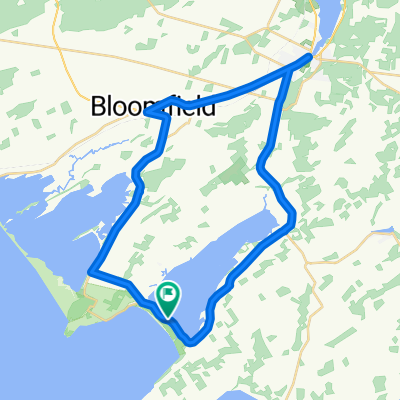
- 40,4 km
- Distanz
- 107 m
- Aufstieg
- 109 m
- Abstieg
- ---
- Ø-Tempo
- ---
- Max. Höhe
Weiter mit Bikemap
Diese Radroute verwenden, bearbeiten oder herunterladen
Du möchtest Recreational Trails Map - Gateway Country - Route 5 fahren oder sie für deine eigene Reise anpassen? Folgendes kannst du mit dieser Bikemap-Route machen:
Gratis Funktionen
- Speichere diese Route als Favorit oder in einer Sammlung
- Kopiere & plane deine eigene Version dieser Route
- Synchronisiere deine Route mit Garmin oder Wahoo
Premium-Funktionen
Kostenlose Testversion für 3 Tage oder einmalige Zahlung. Mehr über Bikemap Premium.
- Navigiere diese Route auf iOS & Android
- Exportiere eine GPX / KML-Datei dieser Route
- Erstelle deinen individuellen Ausdruck (Jetzt kostenlos ausprobieren)
- Lade diese Route für die Offline-Navigation herunter
Entdecke weitere Premium-Funktionen.
Bikemap Premium aktivierenVon unserer Community
Prince Edward: Andere beliebte Routen, die hier beginnen
 Recreational Trails Map - Gateway Country - Route 5
- Distanz
- 40,4 km
- Aufstieg
- 107 m
- Abstieg
- 109 m
- Standort
- Prince Edward, Ontario, Kanada
 Wellington Brighton Wellington
- Distanz
- 90,9 km
- Aufstieg
- 204 m
- Abstieg
- 205 m
- Standort
- Prince Edward, Ontario, Kanada
 Bloomfield to County Cider Factory and back
- Distanz
- 65,7 km
- Aufstieg
- 261 m
- Abstieg
- 261 m
- Standort
- Prince Edward, Ontario, Kanada
 randonnée de vacance
- Distanz
- 60,7 km
- Aufstieg
- 241 m
- Abstieg
- 238 m
- Standort
- Prince Edward, Ontario, Kanada
 BloomfieldSandbanksloop
- Distanz
- 51,9 km
- Aufstieg
- 127 m
- Abstieg
- 134 m
- Standort
- Prince Edward, Ontario, Kanada
 Boo Hoo. Dad told me to take out the trash
- Distanz
- 1 km
- Aufstieg
- 0 m
- Abstieg
- 0 m
- Standort
- Prince Edward, Ontario, Kanada
 May 17, 2015, 3:28 PM
- Distanz
- 38,3 km
- Aufstieg
- 110 m
- Abstieg
- 109 m
- Standort
- Prince Edward, Ontario, Kanada
 Bloomfield to County Cider Factory and back
- Distanz
- 66,5 km
- Aufstieg
- 248 m
- Abstieg
- 245 m
- Standort
- Prince Edward, Ontario, Kanada
In der App öffnen