

St Columba's Way- Perth to St Andrews
Eine Fahrradroute, die in Perth, Schottland, Vereinigtes Königreich beginnt.
Übersicht
Über diese Route
Überqueren Sie die Brücke in Perth auf der Fahrradroute 77 und folgen Sie dann ruhigen Straßen, Flusswegen und Hauptwegen. Am Anfang etwas hügelig, bis zu 145 Meter außerhalb von Perth, dann flach bis zum Ziel mit schönen Ausblicken über den Fluss Tay nach Dundee und die berühmte Eisenbahnbrücke. In Dundee gibt es viele Unterkünfte, Pubs usw.
- -:--
- Dauer
- 73,2 km
- Distanz
- 266 m
- Aufstieg
- 249 m
- Abstieg
- ---
- Ø-Tempo
- ---
- Max. Höhe

Routenqualität
Wegtypen und Untergründe entlang der Route
Wegtypen
Straße
17,6 km
(24 %)
Radweg
16,1 km
(22 %)
Untergründe
Befestigt
22 km
(30 %)
Unbefestigt
9,5 km
(13 %)
Asphalt
22 km
(30 %)
Schotter
8,1 km
(11 %)
Highlights der Route
POIs entlang der Route
Interessanter Ort nach 0,1 km
Scone camping and caravan site
Interessanter Ort nach 8,6 km
BIKE ROUTE 77. Signposted from Perth to Dundee
Interessanter Ort nach 40,7 km
DUNDEE. Hotels, hostels, shops, pubs etc
Interessanter Ort nach 65,3 km
Guardbridge. The village derives its name from this 15th-century six-arched bridge over the Eden and is the site of the last hostel – or “gare” from the French word for station - where many pilgrims stayed before setting off on the final three miles (5 km) to St Andrews and the great cathedral holding the relics of St Andrew.
Weiter mit Bikemap
Diese Radroute verwenden, bearbeiten oder herunterladen
Du möchtest St Columba's Way- Perth to St Andrews fahren oder sie für deine eigene Reise anpassen? Folgendes kannst du mit dieser Bikemap-Route machen:
Gratis Funktionen
- Speichere diese Route als Favorit oder in einer Sammlung
- Kopiere & plane deine eigene Version dieser Route
- Synchronisiere deine Route mit Garmin oder Wahoo
Premium-Funktionen
Kostenlose Testversion für 3 Tage oder einmalige Zahlung. Mehr über Bikemap Premium.
- Navigiere diese Route auf iOS & Android
- Exportiere eine GPX / KML-Datei dieser Route
- Erstelle deinen individuellen Ausdruck (Jetzt kostenlos ausprobieren)
- Lade diese Route für die Offline-Navigation herunter
Entdecke weitere Premium-Funktionen.
Bikemap Premium aktivierenVon unserer Community
Perth: Andere beliebte Routen, die hier beginnen
 Day 25 Perth to Pitlochry
- Distanz
- 47,7 km
- Aufstieg
- 587 m
- Abstieg
- 502 m
- Standort
- Perth, Schottland, Vereinigtes Königreich
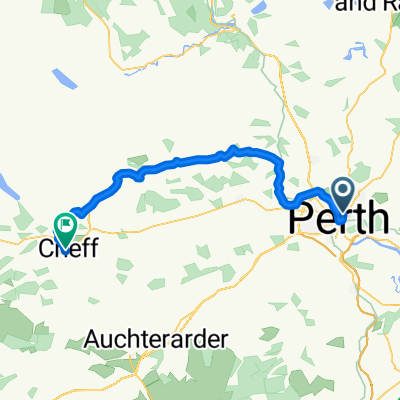 Perth - Crieff High Route
- Distanz
- 41,2 km
- Aufstieg
- 353 m
- Abstieg
- 326 m
- Standort
- Perth, Schottland, Vereinigtes Königreich
 almost mailer hill
- Distanz
- 5,1 km
- Aufstieg
- 142 m
- Abstieg
- 147 m
- Standort
- Perth, Schottland, Vereinigtes Königreich
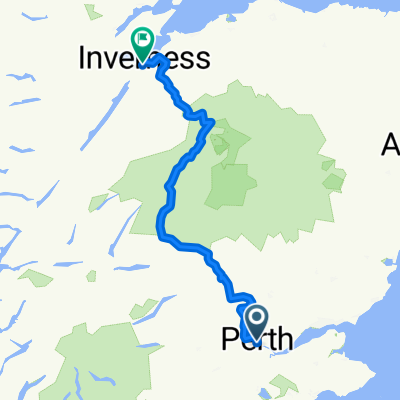 Pitlochry - Inverness
- Distanz
- 214,6 km
- Aufstieg
- 2.207 m
- Abstieg
- 2.209 m
- Standort
- Perth, Schottland, Vereinigtes Königreich
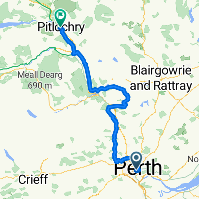 Perth - Pitlochry
- Distanz
- 62,5 km
- Aufstieg
- 721 m
- Abstieg
- 633 m
- Standort
- Perth, Schottland, Vereinigtes Königreich
 Perth Eastern circuit 1
- Distanz
- 46,3 km
- Aufstieg
- 529 m
- Abstieg
- 530 m
- Standort
- Perth, Schottland, Vereinigtes Königreich
 St Columba's Way- Perth to St Andrews
- Distanz
- 73,2 km
- Aufstieg
- 266 m
- Abstieg
- 249 m
- Standort
- Perth, Schottland, Vereinigtes Königreich
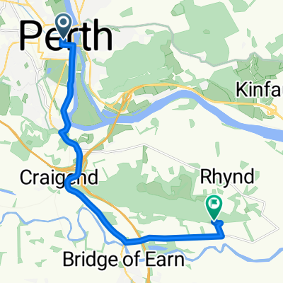 Perth to Moncrieffe Hill via Bridge of Earn
- Distanz
- 9 km
- Aufstieg
- 95 m
- Abstieg
- 66 m
- Standort
- Perth, Schottland, Vereinigtes Königreich
In der App öffnen