Armidale, Uralla, Gostwyck loop
Eine Fahrradroute, die in Armidale, New South Wales, Australien beginnt.
Übersicht
Über diese Route
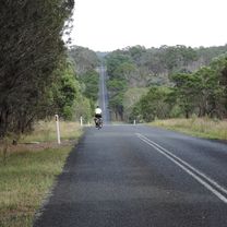
A lovely half-day coffee ride on quiet, scenic and mostly sealed roads. Head out of town on Bundarra road, turning at about 15 km towards Invergowrie. At Invergowrie there is a small shop selling coffee, but its too early to stop yet. Bundarra Rd has some fast traffic and lacks a shoulder so we avoid it at the busiest times (~9 am or 5 pm). There is a quieter/hillier alternative route via Booroolong Rd/Dumaresq Rd. Once off Bundarra rd there is generally very little traffic and the route is very scenic. Thunderbolts way has a great swooping downhill, which if taken at maximum speed can get you most of the way up the other side. Uralla has a great choice of cafes, so a stop is compulsory. It is possible to head back to Armidale via Barley fields Rd and join up with the outward route on Rocky River/Hawthorne drive corner. However, the route mapped here is more interesting (and about 10 km longer). Heading out of Uralla along Gostwyck rd involves a little climbing before you are on a ridge with fabulous views. There is then a long descent down to Gostwyck station and the picturesque Gostwyck chapel, DRG woolshed. There is a ~8 km section of dirt along Gostwyck Rd/Mihi Rd. This can get a bit bumpy when not recently graded. However, we regularly do this ride on road bikes. The seal is reached again at Enmore Rd for a very pleasant if a bit hilly ride back to Armidale. All roads on the return trip are very quiet.
- -:--
- Dauer
- 80,3 km
- Distanz
- 516 m
- Aufstieg
- 515 m
- Abstieg
- ---
- Ø-Tempo
- ---
- Max. Höhe
Routenqualität
Wegtypen und Untergründe entlang der Route
Wegtypen
Straße
43,4 km
(54 %)
Ruhige Straße
24,1 km
(30 %)
Untergründe
Befestigt
71,5 km
(89 %)
Unbefestigt
7,2 km
(9 %)
Asphalt
71,5 km
(89 %)
Unbefestigt (undefiniert)
6,4 km
(8 %)
Weiter mit Bikemap
Diese Radroute verwenden, bearbeiten oder herunterladen
Du möchtest Armidale, Uralla, Gostwyck loop fahren oder sie für deine eigene Reise anpassen? Folgendes kannst du mit dieser Bikemap-Route machen:
Gratis Funktionen
- Speichere diese Route als Favorit oder in einer Sammlung
- Kopiere & plane deine eigene Version dieser Route
- Teile sie in Etappen ein, um eine mehrtägige Tour zu erstellen
- Synchronisiere deine Route mit Garmin oder Wahoo
Premium-Funktionen
Kostenlose Testversion für 3 Tage oder einmalige Zahlung. Mehr über Bikemap Premium.
- Navigiere diese Route auf iOS & Android
- Exportiere eine GPX / KML-Datei dieser Route
- Erstelle deinen individuellen Ausdruck (Jetzt kostenlos ausprobieren)
- Lade diese Route für die Offline-Navigation herunter
Entdecke weitere Premium-Funktionen.
Bikemap Premium aktivierenVon unserer Community
Armidale: Andere beliebte Routen, die hier beginnen
 Apple tree drive loop for kids
- Distanz
- 7,8 km
- Aufstieg
- 92 m
- Abstieg
- 93 m
- Standort
- Armidale, New South Wales, Australien
 Armidale Tourist Information Centre to Dangars Gorge return
- Distanz
- 47 km
- Aufstieg
- 355 m
- Abstieg
- 353 m
- Standort
- Armidale, New South Wales, Australien
 Armidale to Gara river crossing along Herbert Park Rd
- Distanz
- 48,3 km
- Aufstieg
- 516 m
- Abstieg
- 515 m
- Standort
- Armidale, New South Wales, Australien
 Armidale to Point Lookout loop
- Distanz
- 226,3 km
- Aufstieg
- 4.225 m
- Abstieg
- 4.225 m
- Standort
- Armidale, New South Wales, Australien
 Avoiding the Waterfall Way from Armidale
- Distanz
- 92,5 km
- Aufstieg
- 708 m
- Abstieg
- 708 m
- Standort
- Armidale, New South Wales, Australien
 Armidale, Toms Gully, Puddledock loop
- Distanz
- 71,6 km
- Aufstieg
- 607 m
- Abstieg
- 607 m
- Standort
- Armidale, New South Wales, Australien
 Kelly's plains circuit
- Distanz
- 19,5 km
- Aufstieg
- 179 m
- Abstieg
- 179 m
- Standort
- Armidale, New South Wales, Australien
 Flat White
- Distanz
- 19,5 km
- Aufstieg
- 203 m
- Abstieg
- 201 m
- Standort
- Armidale, New South Wales, Australien
In der App öffnen


