

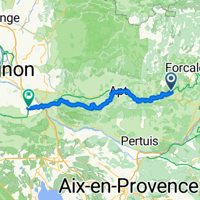
Trasa C – kaňonem Oppedette do Manosque
Eine Fahrradroute, die in Reillanne, Provence-Alpes-Côte d’Azur, Frankreich beginnt.
Übersicht
Über diese Route
Wir fahren von der Rotunde im charmanten Dorf Simiane-la-Rotonde ab und machen einen Halt bei der Abtei. Anschließend radeln wir um eine der steilsten Schluchten in der Provence – die Schlucht d'Oppedette. Wir besichtigen das Dorf Viens, das auf einem felsigen Felsvorsprung erbaut wurde, und dann den alten Priorat Prieuré de Carluc. Von dem Dorf Cereste brechen wir gemächlich entlang des Ausläufers des großen Luberon nach Montfuron auf, wo sich eine gut erhaltene Windmühle erhebt; in der Nähe befindet sich die Kapelle StElzeard. Danach fahren wir nach Manosque, der Stadt des uns bereits bekannten Naturkosmetikunternehmens L'Occitanne. Hier besichtigen wir neben dem historischen Stadtteil auch die Stadt von oben vom Turm des Mont d'Or auf einem der Hügel in der Nähe des Zentrums.
- -:--
- Dauer
- 53,4 km
- Distanz
- 886 m
- Aufstieg
- 1.226 m
- Abstieg
- ---
- Ø-Tempo
- ---
- Max. Höhe

Routenqualität
Wegtypen und Untergründe entlang der Route
Wegtypen
Ruhige Straße
22,4 km
(42 %)
Straße
14,4 km
(27 %)
Untergründe
Befestigt
24 km
(45 %)
Unbefestigt
4,3 km
(8 %)
Asphalt
24 km
(45 %)
Schotter
3,2 km
(6 %)
Weiter mit Bikemap
Diese Radroute verwenden, bearbeiten oder herunterladen
Du möchtest Trasa C – kaňonem Oppedette do Manosque fahren oder sie für deine eigene Reise anpassen? Folgendes kannst du mit dieser Bikemap-Route machen:
Gratis Funktionen
- Speichere diese Route als Favorit oder in einer Sammlung
- Kopiere & plane deine eigene Version dieser Route
- Synchronisiere deine Route mit Garmin oder Wahoo
Premium-Funktionen
Kostenlose Testversion für 3 Tage oder einmalige Zahlung. Mehr über Bikemap Premium.
- Navigiere diese Route auf iOS & Android
- Exportiere eine GPX / KML-Datei dieser Route
- Erstelle deinen individuellen Ausdruck (Jetzt kostenlos ausprobieren)
- Lade diese Route für die Offline-Navigation herunter
Entdecke weitere Premium-Funktionen.
Bikemap Premium aktivierenVon unserer Community
Reillanne: Andere beliebte Routen, die hier beginnen
 Descente sur toulon
- Distanz
- 170,7 km
- Aufstieg
- 1.173 m
- Abstieg
- 1.779 m
- Standort
- Reillanne, Provence-Alpes-Côte d’Azur, Frankreich
 De La Place 63, Vachères à Place Pierre Puget 79, La Londe-les-Maures
- Distanz
- 140,4 km
- Aufstieg
- 967 m
- Abstieg
- 1.836 m
- Standort
- Reillanne, Provence-Alpes-Côte d’Azur, Frankreich
 Reillanne - Volx Veloroute
- Distanz
- 45,8 km
- Aufstieg
- 774 m
- Abstieg
- 803 m
- Standort
- Reillanne, Provence-Alpes-Côte d’Azur, Frankreich
 Dia 4 - Gite de Chaloux a Domain Saint Victor
- Distanz
- 52,8 km
- Aufstieg
- 701 m
- Abstieg
- 997 m
- Standort
- Reillanne, Provence-Alpes-Côte d’Azur, Frankreich
 Reillanne - Mollégès
- Distanz
- 85,1 km
- Aufstieg
- 1.187 m
- Abstieg
- 1.685 m
- Standort
- Reillanne, Provence-Alpes-Côte d’Azur, Frankreich
 24-16b Reillanne - Mirabeau
- Distanz
- 74 km
- Aufstieg
- 699 m
- Abstieg
- 879 m
- Standort
- Reillanne, Provence-Alpes-Côte d’Azur, Frankreich
 Reillanne - Apt
- Distanz
- 31,5 km
- Aufstieg
- 277 m
- Abstieg
- 590 m
- Standort
- Reillanne, Provence-Alpes-Côte d’Azur, Frankreich
 24-16a Reillanne - Mirabeau
- Distanz
- 40,4 km
- Aufstieg
- 694 m
- Abstieg
- 871 m
- Standort
- Reillanne, Provence-Alpes-Côte d’Azur, Frankreich
In der App öffnen