

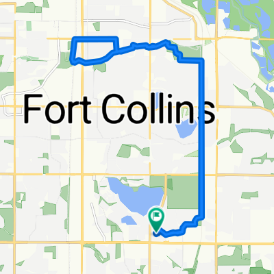
Rist Loop from Edora- 48 miles
Eine Fahrradroute, die in Fort Collins, Colorado, United States of America beginnt.
Übersicht
Über diese Route
Loop up Rist Canyon and down Buckhorn Canyon. Load up with water/food at Vern's in LaPort. There isn't anything until you get to the Masonville store and it may or may not be open.
14 mile climb. Steep part at the top. There are a couple of cattle guards and short uphill sections on the descent. Watch for sand in the corners in the spring. . (cloned from route 729545)- -:--
- Dauer
- 78,2 km
- Distanz
- 1.046 m
- Aufstieg
- 1.045 m
- Abstieg
- ---
- Ø-Tempo
- ---
- Ø-Tempo
Routenqualität
Wegtypen und Untergründe entlang der Route
Wegtypen
Vielbefahrene Straße
52,8 km
(68 %)
Straße
14,8 km
(19 %)
Untergründe
Befestigt
73,7 km
(94 %)
Unbefestigt
0,8 km
(1 %)
Asphalt
44,5 km
(57 %)
Befestigt (undefiniert)
27 km
(34 %)
Weiter mit Bikemap
Diese Radroute verwenden, bearbeiten oder herunterladen
Du möchtest Rist Loop from Edora- 48 miles fahren oder sie für deine eigene Reise anpassen? Folgendes kannst du mit dieser Bikemap-Route machen:
Gratis Funktionen
- Speichere diese Route als Favorit oder in einer Sammlung
- Kopiere & plane deine eigene Version dieser Route
- Synchronisiere deine Route mit Garmin oder Wahoo
Premium-Funktionen
Kostenlose Testversion für 3 Tage oder einmalige Zahlung. Mehr über Bikemap Premium.
- Navigiere diese Route auf iOS & Android
- Exportiere eine GPX / KML-Datei dieser Route
- Erstelle deinen individuellen Ausdruck (Jetzt kostenlos ausprobieren)
- Lade diese Route für die Offline-Navigation herunter
Entdecke weitere Premium-Funktionen.
Bikemap Premium aktivierenVon unserer Community
Fort Collins: Andere beliebte Routen, die hier beginnen
 Foco stroll
- Distanz
- 30,9 km
- Aufstieg
- 91 m
- Abstieg
- 90 m
- Standort
- Fort Collins, Colorado, USA
 Buckhorn Mountain Loop
- Distanz
- 75,4 km
- Aufstieg
- 1.107 m
- Abstieg
- 1.107 m
- Standort
- Fort Collins, Colorado, USA
 brother ride
- Distanz
- 18,7 km
- Aufstieg
- 40 m
- Abstieg
- 40 m
- Standort
- Fort Collins, Colorado, USA
 3/13/19
- Distanz
- 25,9 km
- Aufstieg
- 87 m
- Abstieg
- 87 m
- Standort
- Fort Collins, Colorado, USA
 WFM-Spring Canyon-Mason
- Distanz
- 21,5 km
- Aufstieg
- 96 m
- Abstieg
- 96 m
- Standort
- Fort Collins, Colorado, USA
 Fort Collins Poudre & Spring Creek Trail #2
- Distanz
- 24,1 km
- Aufstieg
- 56 m
- Abstieg
- 55 m
- Standort
- Fort Collins, Colorado, USA
 EPIC Circumnavigation
- Distanz
- 31,1 km
- Aufstieg
- 115 m
- Abstieg
- 114 m
- Standort
- Fort Collins, Colorado, USA
 Lory Park
- Distanz
- 36,3 km
- Aufstieg
- 443 m
- Abstieg
- 440 m
- Standort
- Fort Collins, Colorado, USA
In der App öffnen