

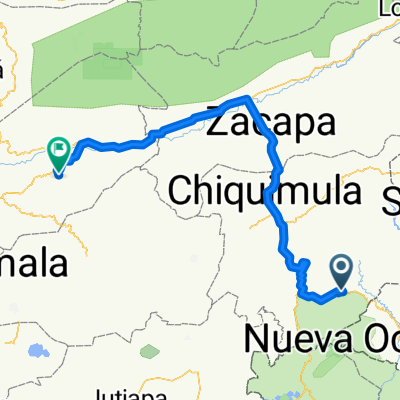
Vuelta a Guatemala Fantasy: Etapa 6 ** Esquipulas- Cerro de la Santa Cruz 202,08 kms
Eine Fahrradroute, die in Esquipulas, Departamento Chiquimula, Guatemala beginnt.
Übersicht
Über diese Route
Eine harte, aber Übergangs-Etappe zwischen den Bergen des Ostens und des Westens.
- -:--
- Dauer
- 202,1 km
- Distanz
- 1.863 m
- Aufstieg
- 1.842 m
- Abstieg
- ---
- Ø-Tempo
- ---
- Max. Höhe

Weiter mit Bikemap
Diese Radroute verwenden, bearbeiten oder herunterladen
Du möchtest Vuelta a Guatemala Fantasy: Etapa 6 ** Esquipulas- Cerro de la Santa Cruz 202,08 kms fahren oder sie für deine eigene Reise anpassen? Folgendes kannst du mit dieser Bikemap-Route machen:
Gratis Funktionen
- Speichere diese Route als Favorit oder in einer Sammlung
- Kopiere & plane deine eigene Version dieser Route
- Teile sie in Etappen ein, um eine mehrtägige Tour zu erstellen
- Synchronisiere deine Route mit Garmin oder Wahoo
Premium-Funktionen
Kostenlose Testversion für 3 Tage oder einmalige Zahlung. Mehr über Bikemap Premium.
- Navigiere diese Route auf iOS & Android
- Exportiere eine GPX / KML-Datei dieser Route
- Erstelle deinen individuellen Ausdruck (Jetzt kostenlos ausprobieren)
- Lade diese Route für die Offline-Navigation herunter
Entdecke weitere Premium-Funktionen.
Bikemap Premium aktivierenVon unserer Community
Esquipulas: Andere beliebte Routen, die hier beginnen
 Esquipulas- Monjas
- Distanz
- 139,7 km
- Aufstieg
- 2.452 m
- Abstieg
- 2.415 m
- Standort
- Esquipulas, Departamento Chiquimula, Guatemala
 Esquipulas Chiquimula
- Distanz
- 56,5 km
- Aufstieg
- 510 m
- Abstieg
- 1.034 m
- Standort
- Esquipulas, Departamento Chiquimula, Guatemala
 Esquipulas a Ocotepeque via Cascajal
- Distanz
- 41,8 km
- Aufstieg
- 1.086 m
- Abstieg
- 1.228 m
- Standort
- Esquipulas, Departamento Chiquimula, Guatemala
 Vuelta a Guatemala inventada 3 etapa Esquipulas- Chiquimula- Zacapa- Guastatoya
- Distanz
- 155,7 km
- Aufstieg
- 1.043 m
- Abstieg
- 1.471 m
- Standort
- Esquipulas, Departamento Chiquimula, Guatemala
 Esquipulas- Monjas
- Distanz
- 128,9 km
- Aufstieg
- 2.356 m
- Abstieg
- 2.343 m
- Standort
- Esquipulas, Departamento Chiquimula, Guatemala
 Vuelta a Guatemala Fantasy: Etapa 6 ** Esquipulas- Cerro de la Santa Cruz 202,08 kms
- Distanz
- 202,1 km
- Aufstieg
- 1.863 m
- Abstieg
- 1.842 m
- Standort
- Esquipulas, Departamento Chiquimula, Guatemala
 Etapa 3 Esquipulas- Guastatoya
- Distanz
- 154,8 km
- Aufstieg
- 1.087 m
- Abstieg
- 1.515 m
- Standort
- Esquipulas, Departamento Chiquimula, Guatemala
 Vuelta a Guatemala 2014 Etapa 1 Esquipulas- Teculutan
- Distanz
- 149,2 km
- Aufstieg
- 1.368 m
- Abstieg
- 2.064 m
- Standort
- Esquipulas, Departamento Chiquimula, Guatemala
In der App öffnen