

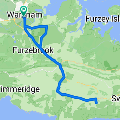
Dorset Coast (Wareham -- Axminster) 200Km
Eine Fahrradroute, die in Wareham, England, United Kingdom beginnt.
Übersicht
Über diese Route
This is the infamous Dorset Coast 200Km ride that sets out from Wareham to Axminster every April, with Audax UK.
It was my first century Audax – in fact it was my first ever Audax and first century ride that I attemted and completed quite a few years back. Afterwards I was told: "you've had a baptism of fire" – though wearing British Army issue desert boots helped reinforce this commentator's incredulity. The direction is clockwise and all starts pretty nicely having a jolly over the Sandbanks chain ferry and then riding over the Purbecks onto Weymouth. There’s a few climbs in the Purbecks but they’re just a warm up... as things are going to turn pretty nasty after - Abbotsbury Hill. This brute tops out at 20%, but that's not the problem – it just seems to go on and on; there's riders zig-zagging all over the road this decimated what “pack” there was. Many ended up pushing. Next set, repeat, “set” of killers is the three 16%s after Chideock these taking you onto Axminster. Ordnance Survey really don’t do these triplets justice on their 1:25 and 1:50,000 maps. You’re now at Axminster. Hey! Time for a nice spot of lunch at the school (scheduled stop), better fuel up real good. Feeling full? Excellent! But don’t then yak it up all over your handlebars, as immediately, (within 400 metres), after lunch it's straight back into those climbs - Sector and Stammery Hill – if you do yak it will be a pity as you’re going to need those kilocalories for later. Fret not though, at the moment you’ve a respite from all of that climbing, enjoy the scenery all the way to Uploders where, alas, things will again get seriously heavy on the hideous 1.7 miles of climbing of Spyway Hill that awaits you. After that it’s a piece of cake. Get further K-rations at Top-of-Town café Dorchester and a flat ride back to Wareham. Have a nice day. (cloned from route 274173)- -:--
- Dauer
- 20,6 km
- Distanz
- 66 m
- Aufstieg
- 75 m
- Abstieg
- ---
- Ø-Tempo
- ---
- Ø-Tempo

Routenqualität
Wegtypen und Untergründe entlang der Route
Wegtypen
Vielbefahrene Straße
14 km
(68 %)
Radweg
4,9 km
(24 %)
Untergründe
Befestigt
16,8 km
(82 %)
Unbefestigt
0 km
(<1 %)
Asphalt
16,5 km
(80 %)
Holz
0,2 km
(<1 %)
Weiter mit Bikemap
Diese Radroute verwenden, bearbeiten oder herunterladen
Du möchtest Dorset Coast (Wareham -- Axminster) 200Km fahren oder sie für deine eigene Reise anpassen? Folgendes kannst du mit dieser Bikemap-Route machen:
Gratis Funktionen
- Speichere diese Route als Favorit oder in einer Sammlung
- Kopiere & plane deine eigene Version dieser Route
- Synchronisiere deine Route mit Garmin oder Wahoo
Premium-Funktionen
Kostenlose Testversion für 3 Tage oder einmalige Zahlung. Mehr über Bikemap Premium.
- Navigiere diese Route auf iOS & Android
- Exportiere eine GPX / KML-Datei dieser Route
- Erstelle deinen individuellen Ausdruck (Jetzt kostenlos ausprobieren)
- Lade diese Route für die Offline-Navigation herunter
Entdecke weitere Premium-Funktionen.
Bikemap Premium aktivierenVon unserer Community
Wareham: Andere beliebte Routen, die hier beginnen
 Swanage 2016 Saturday ride
- Distanz
- 47,6 km
- Aufstieg
- 530 m
- Abstieg
- 533 m
- Standort
- Wareham, England, Vereinigtes Königreich
 Kimmeridge roure
- Distanz
- 24,6 km
- Aufstieg
- 300 m
- Abstieg
- 304 m
- Standort
- Wareham, England, Vereinigtes Königreich
 Filieul Toad
- Distanz
- 13,3 km
- Aufstieg
- 75 m
- Abstieg
- 74 m
- Standort
- Wareham, England, Vereinigtes Königreich
 jurassic
- Distanz
- 23,4 km
- Aufstieg
- 363 m
- Abstieg
- 342 m
- Standort
- Wareham, England, Vereinigtes Königreich
 Unnamed Road to Turbary Park Avenue 176K
- Distanz
- 31,4 km
- Aufstieg
- 271 m
- Abstieg
- 253 m
- Standort
- Wareham, England, Vereinigtes Königreich
 ride through Wareham
- Distanz
- 15,6 km
- Aufstieg
- 120 m
- Abstieg
- 118 m
- Standort
- Wareham, England, Vereinigtes Königreich
 Lengthy bike tour through Wareham
- Distanz
- 31,3 km
- Aufstieg
- 258 m
- Abstieg
- 258 m
- Standort
- Wareham, England, Vereinigtes Königreich
 RempstoneRide
- Distanz
- 27,1 km
- Aufstieg
- 338 m
- Abstieg
- 337 m
- Standort
- Wareham, England, Vereinigtes Königreich
In der App öffnen