- 96,6 km
- 659 m
- 658 m
- Remuș, Kreis Giurgiu, Rumänien
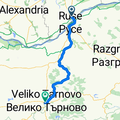
Giurgiu - Ruse - Shtarklevo - Rusenski Lom canyon - Ivanovo - Krasen - Lom canyon - Ruse - Giurgiu
Eine Fahrradroute, die in Remuș, Kreis Giurgiu, Rumänien beginnt.
Übersicht
Über diese Route
Eine Kombination aus gepflasterter Straße für schnellen Zugang zum MTB-Gebiet. Der Zugang zum Rusenski Lom Canyon ist von der Hauptstraße nach Shtraklevo ausgeschildert. Der Canyonweg ist an einigen Stellen ziemlich vage und kann schlammig sein, wenn es in den Tagen zuvor geregnet hat. Es gibt keine Wasserquellen vor dem ersten Flussübergang bei den in Stein gehauenen Kirchen von Ivanovo. Um den Flussübergang nicht zu verpassen, beobachten Sie die in die Steine gehauenen Fenster auf der linken Seite des Weges und einige Handläufe, die oben am Abhang hängen. Nach dem Flussübergang gibt es eine Wasserpumpe. Der Griff war kaputt, aber wir konnten etwas Wasser entnehmen. Von dort bis Krasen ist es eine Asphaltstraße. Von Krasen nach Ruse gibt es nur Schluchten und kleine Straßen, sehr leichte Anstiege, schöne Landschaften. In der Nähe von Basarbovo versuchen Sie, eine Höhle zu finden, die sehr frische Luft ausstößt. Es gibt kein Schild auf dem Weg, aber Sie können die kalte Luft spüren, die beim Radfahren aus dem Wald strömt. Viel Spaß.
- -:--
- Dauer
- 90,6 km
- Distanz
- 472 m
- Aufstieg
- 472 m
- Abstieg
- ---
- Ø-Tempo
- ---
- Max. Höhe
Erstellt vor 12 Jahren
Weiter mit Bikemap
Diese Radroute verwenden, bearbeiten oder herunterladen
Du möchtest Giurgiu - Ruse - Shtarklevo - Rusenski Lom canyon - Ivanovo - Krasen - Lom canyon - Ruse - Giurgiu fahren oder sie für deine eigene Reise anpassen? Folgendes kannst du mit dieser Bikemap-Route machen:
Gratis Funktionen
- Speichere diese Route als Favorit oder in einer Sammlung
- Kopiere & plane deine eigene Version dieser Route
- Teile sie in Etappen ein, um eine mehrtägige Tour zu erstellen
- Synchronisiere deine Route mit Garmin oder Wahoo
Premium-Funktionen
Kostenlose Testversion für 3 Tage oder einmalige Zahlung. Mehr über Bikemap Premium.
- Navigiere diese Route auf iOS & Android
- Exportiere eine GPX / KML-Datei dieser Route
- Erstelle deinen individuellen Ausdruck (Jetzt kostenlos ausprobieren)
- Lade diese Route für die Offline-Navigation herunter
Entdecke weitere Premium-Funktionen.
Bikemap Premium aktivierenVon unserer Community
Remuș: Andere beliebte Routen, die hier beginnen
- Bulgaristan II
- Giurgiu-Gostinu-Braniste-Oinacu
- 30,8 km
- 27 m
- 27 m
- Remuș, Kreis Giurgiu, Rumänien
- Bulgaria 2
- 103 km
- 631 m
- 627 m
- Remuș, Kreis Giurgiu, Rumänien
- Giurgiu (Kaufland) - Bucuresti (Izvor)
- 63 km
- 130 m
- 78 m
- Remuș, Kreis Giurgiu, Rumänien
- Bulgaristan I
- 102,8 km
- 860 m
- 857 m
- Remuș, Kreis Giurgiu, Rumänien
- 5. diena Girgiu to Suhaia 90km
- 81,9 km
- 175 m
- 111 m
- Remuș, Kreis Giurgiu, Rumänien
- marten - nikolovo - ruse - giurgiu
- 47,4 km
- 208 m
- 210 m
- Remuș, Kreis Giurgiu, Rumänien
- Giurgiu - Veliko Tarnovo
- 137 km
- 995 m
- 814 m
- Remuș, Kreis Giurgiu, Rumänien
In der App öffnen


