

3.Route des Grandes Alpes - Day Three
Eine Fahrradroute, die in Tignes, Auvergne-Rhône-Alpes, Frankreich beginnt.
Übersicht
Über diese Route
<span style="margin: 0px; padding: 0px; border: 0px; outline: 0px; font-size: medium; vertical-align: baseline; background-color: transparent; color: rgb(0, 0, 0); font-family: Tahoma, Geneva, Kalimati, sans-serif; background-position: initial initial; background-repeat: initial initial;">105km 1950m gain, 2 cat. 1 cols</span>
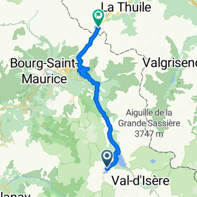
<span style="margin: 0px; padding: 0px; border: 0px; outline: 0px; font-size: small; vertical-align: baseline; background-color: transparent; color: rgb(0, 0, 0); font-family: Tahoma, Geneva, Kalimati, sans-serif; background-position: initial initial; background-repeat: initial initial;">From Val d’Isere it is straight up to the Iseran, an exposed and tough start to the morning but well worth it for the view from the top. The descent seems endless at 73km but well deserved and very beautiful, it brings us down to St Michel-de-Maurienne where with rested legs we tackle the Col du Telegraphe which at 830m height gain is a tough but good end to the day as it winds up through the trees which offer good shade on a hot day. A short descent takes us to Valloire and the hotel.</span> <span style="margin: 0px; padding: 0px; border: 0px; outline: 0px; font-size: small; vertical-align: baseline; background-color: transparent; color: rgb(0, 0, 0); font-family: Tahoma, Geneva, Kalimati, sans-serif; background-position: initial initial; background-repeat: initial initial;">Accommodation: </span><span style="color: rgb(34, 34, 34); font-family: Arial, Verdana, sans-serif;">Hôtel Patchwork, </span><span style="color: rgb(34, 34, 34); font-family: Arial, Verdana, sans-serif;">Route des Grandes Alpes, </span><span style="color: rgb(34, 34, 34); font-family: Arial, Verdana, sans-serif;">73450 Valloire, </span><span style="color: rgb(34, 34, 34); font-family: Arial, Verdana, sans-serif;">04.79.59.00.99</span>- -:--
- Dauer
- 109,8 km
- Distanz
- 1.851 m
- Aufstieg
- 2.250 m
- Abstieg
- ---
- Ø-Tempo
- ---
- Max. Höhe

Weiter mit Bikemap
Diese Radroute verwenden, bearbeiten oder herunterladen
Du möchtest 3.Route des Grandes Alpes - Day Three fahren oder sie für deine eigene Reise anpassen? Folgendes kannst du mit dieser Bikemap-Route machen:
Gratis Funktionen
- Speichere diese Route als Favorit oder in einer Sammlung
- Kopiere & plane deine eigene Version dieser Route
- Teile sie in Etappen ein, um eine mehrtägige Tour zu erstellen
- Synchronisiere deine Route mit Garmin oder Wahoo
Premium-Funktionen
Kostenlose Testversion für 3 Tage oder einmalige Zahlung. Mehr über Bikemap Premium.
- Navigiere diese Route auf iOS & Android
- Exportiere eine GPX / KML-Datei dieser Route
- Erstelle deinen individuellen Ausdruck (Jetzt kostenlos ausprobieren)
- Lade diese Route für die Offline-Navigation herunter
Entdecke weitere Premium-Funktionen.
Bikemap Premium aktivierenVon unserer Community
Tignes: Andere beliebte Routen, die hier beginnen
 Col de l'Iseran and Mont Cenis
- Distanz
- 72 km
- Aufstieg
- 1.711 m
- Abstieg
- 1.739 m
- Standort
- Tignes, Auvergne-Rhône-Alpes, Frankreich
 Guillestre - Tignes
- Distanz
- 231,2 km
- Aufstieg
- 4.232 m
- Abstieg
- 5.325 m
- Standort
- Tignes, Auvergne-Rhône-Alpes, Frankreich
 Tignes - Col de Petit st. Bernard
- Distanz
- 39,8 km
- Aufstieg
- 1.121 m
- Abstieg
- 1.057 m
- Standort
- Tignes, Auvergne-Rhône-Alpes, Frankreich
 3.Route des Grandes Alpes - Day Three
- Distanz
- 109,8 km
- Aufstieg
- 1.851 m
- Abstieg
- 2.250 m
- Standort
- Tignes, Auvergne-Rhône-Alpes, Frankreich
 Tignes-Val Thorens-Cormet d´Acheres-Col du Pre-Cormet de Roseland-Tignes
- Distanz
- 231,2 km
- Aufstieg
- 5.026 m
- Abstieg
- 5.059 m
- Standort
- Tignes, Auvergne-Rhône-Alpes, Frankreich
 Tignes Cormet De Roselend Val Thorens 151km
- Distanz
- 151,4 km
- Aufstieg
- 3.147 m
- Abstieg
- 2.928 m
- Standort
- Tignes, Auvergne-Rhône-Alpes, Frankreich
 Tour de France 2019 3. Etappe
- Distanz
- 216,3 km
- Aufstieg
- 1.040 m
- Abstieg
- 2.435 m
- Standort
- Tignes, Auvergne-Rhône-Alpes, Frankreich
 Tignes to D902, Val-d'Isère
- Distanz
- 29,4 km
- Aufstieg
- 1.007 m
- Abstieg
- 330 m
- Standort
- Tignes, Auvergne-Rhône-Alpes, Frankreich
In der App öffnen