
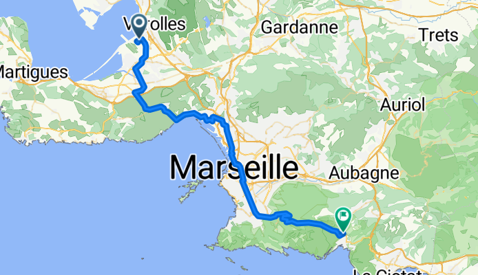
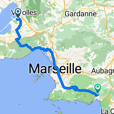
Flughafen Marseille - Cassis
Eine Fahrradroute, die in Vitrolles, Provence-Alpes-Côte d’Azur, Frankreich beginnt.
Übersicht
Über diese Route
- Etappe meiner Frankreich-Reise '08 <table style="border-collapse: collapse; width: 98pt;" border="0" cellspacing="0" cellpadding="0" width="131"> <tbody> <tr style="height: 12.75pt;" height="17"> <td class="xl22" style="height: 12.75pt; width: 98pt;" width="131" height="17">
Flughafen
</td> </tr> </tbody> </table> <table style="border-collapse: collapse; width: 98pt;" border="0" cellspacing="0" cellpadding="0" width="131"> <tbody> <tr style="height: 12.75pt;" height="17"> <td class="xl22" style="height: 12.75pt;" height="17">
St. Victoret
</td> </tr> </tbody> </table> <table style="border-collapse: collapse; width: 98pt;" border="0" cellspacing="0" cellpadding="0" width="131"> <tbody> <tr style="height: 12.75pt;" height="17"> <td class="xl22" style="height: 12.75pt;" height="17">
Lauret
</td> </tr> </tbody> </table>
<table style="border-collapse: collapse; width: 98pt;" border="0" cellspacing="0" cellpadding="0" width="131"> <tbody> <tr style="height: 12.75pt;" height="17"> <td class="xl22" style="height: 12.75pt;" height="17">
Le Rove
</td> </tr> </tbody> </table>
<table style="border-collapse: collapse; width: 98pt;" border="0" cellspacing="0" cellpadding="0" width="131"> <tbody> <tr style="height: 12.75pt;" height="17"> <td class="xl22" style="height: 12.75pt;" height="17">
L'Estaque
</td> </tr> </tbody> </table>
<table style="border-collapse: collapse; width: 98pt;" border="0" cellspacing="0" cellpadding="0" width="131"> <tbody> <tr style="height: 12.75pt;" height="17"> <td class="xl22" style="height: 12.75pt;" height="17">
Marseille
</td> </tr> </tbody> </table> <table style="border-collapse: collapse; width: 98pt;" border="0" cellspacing="0" cellpadding="0" width="131"> <tbody> <tr style="height: 12.75pt;" height="17"> <td class="xl22" style="height: 12.75pt;" height="17">
Valmante
</td> </tr> </tbody> </table>
<table style="border-collapse: collapse; width: 98pt;" border="0" cellspacing="0" cellpadding="0" width="131"> <tbody> <tr style="height: 12.75pt;" height="17"> <td class="xl23" style="height: 12.75pt;" height="17">
Col de la Gineste
</td> </tr> </tbody> </table>
<table style="border-collapse: collapse; width: 98pt;" border="0" cellspacing="0" cellpadding="0" width="131"> <tbody> <tr style="height: 12.75pt;" height="17"> <td class="xl22" style="height: 12.75pt;" height="17">
Cassis
</td> </tr> </tbody> </table>
<table style="border-collapse: collapse; width: 98pt;" border="0" cellspacing="0" cellpadding="0" width="131"> <tbody> </tbody> </table>
- -:--
- Dauer
- 53 km
- Distanz
- 616 m
- Aufstieg
- 522 m
- Abstieg
- ---
- Ø-Tempo
- ---
- Max. Höhe

Weiter mit Bikemap
Diese Radroute verwenden, bearbeiten oder herunterladen
Du möchtest Flughafen Marseille - Cassis fahren oder sie für deine eigene Reise anpassen? Folgendes kannst du mit dieser Bikemap-Route machen:
Gratis Funktionen
- Speichere diese Route als Favorit oder in einer Sammlung
- Kopiere & plane deine eigene Version dieser Route
- Synchronisiere deine Route mit Garmin oder Wahoo
Premium-Funktionen
Kostenlose Testversion für 3 Tage oder einmalige Zahlung. Mehr über Bikemap Premium.
- Navigiere diese Route auf iOS & Android
- Exportiere eine GPX / KML-Datei dieser Route
- Erstelle deinen individuellen Ausdruck (Jetzt kostenlos ausprobieren)
- Lade diese Route für die Offline-Navigation herunter
Entdecke weitere Premium-Funktionen.
Bikemap Premium aktivierenVon unserer Community
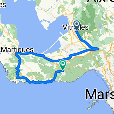
Vitrolles: Andere beliebte Routen, die hier beginnen
 Marseille to Romain
- Distanz
- 138,3 km
- Aufstieg
- 1.481 m
- Abstieg
- 1.267 m
- Standort
- Vitrolles, Provence-Alpes-Côte d’Azur, Frankreich
 aeroport Marseille
- Distanz
- 3 km
- Aufstieg
- 8 m
- Abstieg
- 80 m
- Standort
- Vitrolles, Provence-Alpes-Côte d’Azur, Frankreich
 Easter 2018 Eurovelo 8
- Distanz
- 278,7 km
- Aufstieg
- 1.224 m
- Abstieg
- 1.220 m
- Standort
- Vitrolles, Provence-Alpes-Côte d’Azur, Frankreich
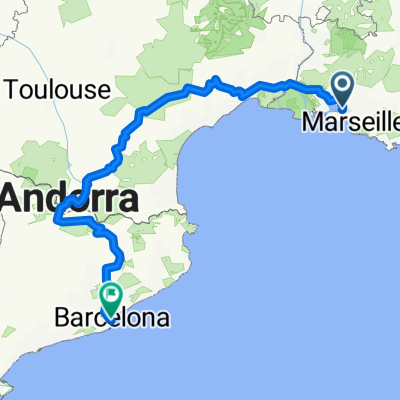 Marseille-Barcelona
- Distanz
- 809,4 km
- Aufstieg
- 5.469 m
- Abstieg
- 5.437 m
- Standort
- Vitrolles, Provence-Alpes-Côte d’Azur, Frankreich
 Flughafen Marseille - Cassis
- Distanz
- 53 km
- Aufstieg
- 616 m
- Abstieg
- 522 m
- Standort
- Vitrolles, Provence-Alpes-Côte d’Azur, Frankreich
 210329_Vitroles_Redonne
- Distanz
- 58,6 km
- Aufstieg
- 379 m
- Abstieg
- 383 m
- Standort
- Vitrolles, Provence-Alpes-Côte d’Azur, Frankreich
 Mariagne-Niolon
- Distanz
- 57 km
- Aufstieg
- 502 m
- Abstieg
- 488 m
- Standort
- Vitrolles, Provence-Alpes-Côte d’Azur, Frankreich
 eyguiéres/lamanon
- Distanz
- 140,6 km
- Aufstieg
- 661 m
- Abstieg
- 648 m
- Standort
- Vitrolles, Provence-Alpes-Côte d’Azur, Frankreich
In der App öffnen