NL Rhine Cycle Route
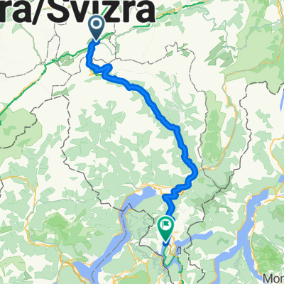
Eine Fahrradroute, die in Andermatt, Kanton Uri, Schweiz beginnt.
Übersicht
Über diese Route
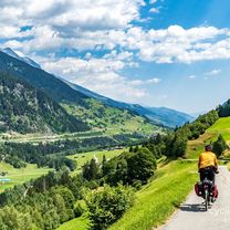
Die Rheintalradroute ist etwa 1.360 Kilometer lang und führt durch fünf Länder. Die Strecke beginnt in den Schweizer Alpen – dem Quellgebiet des Rheins. Dann führt sie durch Österreich, Frankreich und Deutschland. Die Route endet in Rotterdam in den Niederlanden, wo der Rhein in die Nordsee mündet.
- -:--
- Dauer
- 1.365,4 km
- Distanz
- 12 m
- Aufstieg
- 1.447 m
- Abstieg
- ---
- Ø-Tempo
- ---
- Max. Höhe
Routenqualität
Wegtypen und Untergründe entlang der Route
Wegtypen
Forst- / Feldweg
368,7 km
(27 %)
Ruhige Straße
286,7 km
(21 %)
Untergründe
Befestigt
887,5 km
(65 %)
Unbefestigt
286,7 km
(21 %)
Asphalt
860,2 km
(63 %)
Schotter
177,5 km
(13 %)
Highlights der Route
POIs entlang der Route

Interessanter Ort nach 299,4 km
The Rhine Falls (Rheinfall in German) is the largest plain waterfall in Europe. They are 150 m wide and 23 m high.

Interessanter Ort nach 675,2 km
Speyer is one of the oldest cities in Germany and is therefore historically and culturally important. Most famous is the Imperial Cathedral of Speyer.

Interessanter Ort nach 839,2 km
The Lorelei is a rock on the eastern bank of the Rhine which soars some 120 metres above the waterline. It marks the narrowest part of the river between Switzerland and the North Sea, and is the most famous feature of the Rhine Gorge, a 65 km section of the river between Koblenz and Bingen that was added to the UNESCO World Heritage Sites in June 2002. A very strong current and rocks below the waterline have caused many boat accidents there. Lorelei is also the name of a feminine water spirit, similar to mermaids or Rhine maidens, associated with this rock in popular folklore and in works of music, art and literature.

Interessanter Ort nach 903,5 km
One of Andernach's natural attractions is the world's highest (max. 64 m) cold-water geyser, driven by carbon dioxide with force generated in a fashion similar to that in a shaken bottle of table water.
Weiter mit Bikemap
Diese Radroute verwenden, bearbeiten oder herunterladen
Du möchtest NL Rhine Cycle Route fahren oder sie für deine eigene Reise anpassen? Folgendes kannst du mit dieser Bikemap-Route machen:
Gratis Funktionen
- Speichere diese Route als Favorit oder in einer Sammlung
- Kopiere & plane deine eigene Version dieser Route
- Teile sie in Etappen ein, um eine mehrtägige Tour zu erstellen
- Synchronisiere deine Route mit Garmin oder Wahoo
Premium-Funktionen
Kostenlose Testversion für 3 Tage oder einmalige Zahlung. Mehr über Bikemap Premium.
- Navigiere diese Route auf iOS & Android
- Exportiere eine GPX / KML-Datei dieser Route
- Erstelle deinen individuellen Ausdruck (Jetzt kostenlos ausprobieren)
- Lade diese Route für die Offline-Navigation herunter
Entdecke weitere Premium-Funktionen.
Bikemap Premium aktivierenVon unserer Community
Andermatt: Andere beliebte Routen, die hier beginnen
 Furka-Nufenen-Gotthard-Oberalp
- Distanz
- 135,9 km
- Aufstieg
- 4.637 m
- Abstieg
- 4.527 m
- Standort
- Andermatt, Kanton Uri, Schweiz
 VR01 Furkapass Belvedere-Brig.kml - VR01 Furkapass Belvedere-Brig.kml_VR01 Furkapass Belvedere-Brig
- Distanz
- 60,1 km
- Aufstieg
- 852 m
- Abstieg
- 2.409 m
- Standort
- Andermatt, Kanton Uri, Schweiz
 Andermatt 3
- Distanz
- 158,9 km
- Aufstieg
- 3.905 m
- Abstieg
- 3.702 m
- Standort
- Andermatt, Kanton Uri, Schweiz
 Rhine Cycle Route, EuroVelo 15 - Andermatt to Basel
- Distanz
- 492,2 km
- Aufstieg
- 6.424 m
- Abstieg
- 7.590 m
- Standort
- Andermatt, Kanton Uri, Schweiz
![[DAY 19] Göschenen - Ilanz](https://media.bikemap.net/routes/8561780/gallery/thumbs/af10c4bc-a85d-4013-8c11-c6c25ccc528a.jpeg.208x208_q80_crop.jpg) [DAY 19] Göschenen - Ilanz
[DAY 19] Göschenen - Ilanz- Distanz
- 68,1 km
- Aufstieg
- 984 m
- Abstieg
- 1.380 m
- Standort
- Andermatt, Kanton Uri, Schweiz
 20.09.2010 Furka, Nufenen, Gotthard
- Distanz
- 98,5 km
- Aufstieg
- 2.959 m
- Abstieg
- 2.959 m
- Standort
- Andermatt, Kanton Uri, Schweiz
 Transalpine (7) Andermatt - Visp
- Distanz
- 89,5 km
- Aufstieg
- 1.685 m
- Abstieg
- 2.290 m
- Standort
- Andermatt, Kanton Uri, Schweiz
 Bellinzona - Vizzola Ticino
- Distanz
- 130,7 km
- Aufstieg
- 2.639 m
- Abstieg
- 3.799 m
- Standort
- Andermatt, Kanton Uri, Schweiz
In der App öffnen


