Bangkok to Hua Hin
Eine Fahrradroute, die in Bang Na, Bangkok, Thailand beginnt.
Ãbersicht
Ãber diese Route
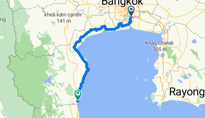
This is a very varied road bike route which takes you from Bearing BTS station, the most southern station on the BTS in Bangkok to the Sheraton Hotel in Hua Hin, which is a very good place to recover once you've ridden 206 km. The route avoids highways and major roads as much as possible and takes you down some fairly remote klongs and rough tracks. I rode it on a Specialised Roubaix road bike which ate the rough stuff (as it is designed to do) but a good quality road bike will have no problems. Scenery is also a plus with the very rural paddy fields in the northern sector and the salt farms on the coast east of Phetchaburi. The route also uses one ferry to cross the Chao Phraya and the pier can be accessed through a covered market but you have to look for it. The ferry avoids the need to cross the huge expressway bridge to the north.
- -:--
- Dauer
- 204,6 km
- Distanz
- 22 m
- Aufstieg
- 20 m
- Abstieg
- ---
- Ã-Tempo
- ---
- Ã-Tempo
RoutenqualitÃĪt
Wegtypen und UntergrÞnde entlang der Route
Wegtypen
Undefiniert
204,6 km
(100 %)
UntergrÞnde
Undefiniert
204,6 km
(100 %)
Weiter mit Bikemap
Diese Radroute verwenden, bearbeiten oder herunterladen
Du mÃķchtest Bangkok to Hua Hin fahren oder sie fÞr deine eigene Reise anpassen? Folgendes kannst du mit dieser Bikemap-Route machen:
Gratis Funktionen
- Speichere diese Route als Favorit oder in einer Sammlung
- Kopiere & plane deine eigene Version dieser Route
- Synchronisiere deine Route mit Garmin oder Wahoo
Premium-Funktionen
Kostenlose Testversion fÞr 3 Tage oder einmalige Zahlung. Mehr Þber Bikemap Premium.
- Navigiere diese Route auf iOS & Android
- Exportiere eine GPX / KML-Datei dieser Route
- Erstelle deinen individuellen Ausdruck (Jetzt kostenlos ausprobieren)
- Lade diese Route fÞr die Offline-Navigation herunter
Entdecke weitere Premium-Funktionen.
Bikemap Premium aktivierenVon unserer Community
Bang Na: Andere beliebte Routen, die hier beginnen
- Tambon Bang Kaeo to Kanchanaphisek Road, Tambon Bang Kaeo
- Distanz
- 20,9 km
- Aufstieg
- 126 m
- Abstieg
- 125 m
- Standort
- Bang Na, Bangkok, Thailand
- āļāļāļ āđāļāļāļēāļĢāļąāļāļĐāđ 888, āļāļģāļāļĨāđāļāļāļēāļĢāļąāļāļĐāđ to āļāļāļ āđāļāļāļēāļĢāļąāļāļĐāđ 888, āļāļģāļāļĨāđāļāļāļēāļĢāļąāļāļĐāđ
- Distanz
- 107,6 km
- Aufstieg
- 223 m
- Abstieg
- 229 m
- Standort
- Bang Na, Bangkok, Thailand
- 418/99 Soi Muban Casa Ville Bangna Suwannaphum, Bangkok to Sammakon 1 Soi C 4, Bangkok
- Distanz
- 17,5 km
- Aufstieg
- 24 m
- Abstieg
- 22 m
- Standort
- Bang Na, Bangkok, Thailand
- One lap at Sky lane with commute
- Distanz
- 63,4 km
- Aufstieg
- 10 m
- Abstieg
- 9 m
- Standort
- Bang Na, Bangkok, Thailand
- Suang Luang Group Rides
- Distanz
- 0,7 km
- Aufstieg
- 6 m
- Abstieg
- 4 m
- Standort
- Bang Na, Bangkok, Thailand
- 24 km loop
- Distanz
- 24 km
- Aufstieg
- 10 m
- Abstieg
- 12 m
- Standort
- Bang Na, Bangkok, Thailand
- ride through Nong Bon
- Distanz
- 12 km
- Aufstieg
- 25 m
- Abstieg
- 23 m
- Standort
- Bang Na, Bangkok, Thailand
- Bueatrium Run
- Distanz
- 5 km
- Aufstieg
- 11 m
- Abstieg
- 20 m
- Standort
- Bang Na, Bangkok, Thailand