

River Ping Southern Route
Eine Fahrradroute, die in Chiang Mai, Chiang Mai Province, Thailand beginnt.
Übersicht
Über diese Route
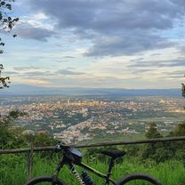
This trip begins in the southern city district of Chang Khlan and runs along the banks of river Ping to the border of Lamphun and back. First follow the road on the western bank leading south (downstream). The tarmac road is not very wide, but in good condition. From Saraphi on, there is considerably less traffic. If you go all the way down to the Lamphun border, the scenery becomes quite rural and you will pass through Longan orchards, fields, and villages. Turn around at Lamphun and follow the eastern bank north (upstream) back to Chiang Mai.<br /> <br /> There are several interesting spots for sight-seeing that potentially turn this into a full-day trip: 1. an optional detour to the city of Lamphun at the southernmost point (+1-2 hours), 2. an optional detour to the beautiful park of the century-old McKean rehabilitation centre (+0.5 hours), and 3. exploration of the ancient ruins and tempels of Wiang Kum Kam between the two outer ring roads (+1 hour).
(cloned from route 2325497)- -:--
- Dauer
- 44,7 km
- Distanz
- 24 m
- Aufstieg
- 25 m
- Abstieg
- ---
- Ø-Tempo
- ---
- Ø-Tempo
Routenqualität
Wegtypen und Untergründe entlang der Route
Wegtypen
Straße
33,9 km
(76 %)
Ruhige Straße
9,7 km
(22 %)
Untergründe
Befestigt
44,3 km
(99 %)
Asphalt
32,4 km
(73 %)
Beton
6,9 km
(15 %)
Highlights der Route
POIs entlang der Route
Interessanter Ort nach 19,6 km
Lamphun city
Interessanter Ort nach 34,8 km
McKean Rehabilitation Centre
Weiter mit Bikemap
Diese Radroute verwenden, bearbeiten oder herunterladen
Du möchtest River Ping Southern Route fahren oder sie für deine eigene Reise anpassen? Folgendes kannst du mit dieser Bikemap-Route machen:
Gratis Funktionen
- Speichere diese Route als Favorit oder in einer Sammlung
- Kopiere & plane deine eigene Version dieser Route
- Synchronisiere deine Route mit Garmin oder Wahoo
Premium-Funktionen
Kostenlose Testversion für 3 Tage oder einmalige Zahlung. Mehr über Bikemap Premium.
- Navigiere diese Route auf iOS & Android
- Exportiere eine GPX / KML-Datei dieser Route
- Erstelle deinen individuellen Ausdruck (Jetzt kostenlos ausprobieren)
- Lade diese Route für die Offline-Navigation herunter
Entdecke weitere Premium-Funktionen.
Bikemap Premium aktivierenVon unserer Community
Chiang Mai: Andere beliebte Routen, die hier beginnen
 Chiangmai U to Doi Su Thep view point
- Distanz
- 18,1 km
- Aufstieg
- 404 m
- Abstieg
- 403 m
- Standort
- Chiang Mai, Chiang Mai Province, Thailand
 Phuping Palace
- Distanz
- 52,2 km
- Aufstieg
- 1.083 m
- Abstieg
- 1.098 m
- Standort
- Chiang Mai, Chiang Mai Province, Thailand
 Chiang Mai
- Distanz
- 669,4 km
- Aufstieg
- 1.461 m
- Abstieg
- 1.461 m
- Standort
- Chiang Mai, Chiang Mai Province, Thailand
 CPB small circle
- Distanz
- 13,7 km
- Aufstieg
- 73 m
- Abstieg
- 71 m
- Standort
- Chiang Mai, Chiang Mai Province, Thailand
 Moderate Route in Chiang Mai
- Distanz
- 7,4 km
- Aufstieg
- 21 m
- Abstieg
- 18 m
- Standort
- Chiang Mai, Chiang Mai Province, Thailand
 Chiang Mai - Rim Ping
- Distanz
- 65 km
- Aufstieg
- 30 m
- Abstieg
- 29 m
- Standort
- Chiang Mai, Chiang Mai Province, Thailand
 DoiSuthep
- Distanz
- 49,9 km
- Aufstieg
- 1.107 m
- Abstieg
- 1.109 m
- Standort
- Chiang Mai, Chiang Mai Province, Thailand
 Reverse Samoeng Loop back via Bhubbing Palace
- Distanz
- 116,8 km
- Aufstieg
- 2.847 m
- Abstieg
- 2.847 m
- Standort
- Chiang Mai, Chiang Mai Province, Thailand
In der App öffnen