

Roanoke/Peaks of Otter
Eine Fahrradroute, die in Roanoke, Virginia, Vereinigte Staaten beginnt.
Übersicht
Über diese Route
Teilweise hügelig, flach von Roanoke nach Buchanan. Steiler 4-Meilen-Anstieg von Buchanan zum Blue Ridge Parkway. Einmal auf dem Parkway geht es etwa 1 Meile bergab, nach derer weitere Anstiege folgen. Es wird gegen Ende flach und ist ein sehr schöner Abschluss dieser Fahrt. Stelle die verlorenen Kohlenhydrate im Lodge wieder her. Gutes Essen und kalte Getränke.
- -:--
- Dauer
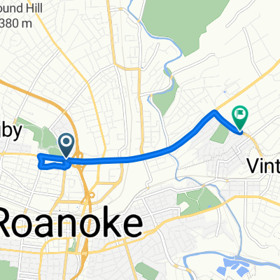
- 62,5 km
- Distanz
- 838 m
- Aufstieg
- 387 m
- Abstieg
- ---
- Ø-Tempo
- ---
- Max. Höhe
Routenqualität
Wegtypen und Untergründe entlang der Route
Wegtypen
Straße
8,1 km
(13 %)
Ruhige Straße
6,2 km
(10 %)
Untergründe
Befestigt
10 km
(16 %)
Asphalt
10 km
(16 %)
Undefiniert
52,5 km
(84 %)
Weiter mit Bikemap
Diese Radroute verwenden, bearbeiten oder herunterladen
Du möchtest Roanoke/Peaks of Otter fahren oder sie für deine eigene Reise anpassen? Folgendes kannst du mit dieser Bikemap-Route machen:
Gratis Funktionen
- Speichere diese Route als Favorit oder in einer Sammlung
- Kopiere & plane deine eigene Version dieser Route
- Synchronisiere deine Route mit Garmin oder Wahoo
Premium-Funktionen
Kostenlose Testversion für 3 Tage oder einmalige Zahlung. Mehr über Bikemap Premium.
- Navigiere diese Route auf iOS & Android
- Exportiere eine GPX / KML-Datei dieser Route
- Erstelle deinen individuellen Ausdruck (Jetzt kostenlos ausprobieren)
- Lade diese Route für die Offline-Navigation herunter
Entdecke weitere Premium-Funktionen.
Bikemap Premium aktivierenVon unserer Community
Roanoke: Andere beliebte Routen, die hier beginnen
 Roanoke/Peaks of Otter
- Distanz
- 62,5 km
- Aufstieg
- 838 m
- Abstieg
- 387 m
- Standort
- Roanoke, Virginia, Vereinigte Staaten
 Roanoke to Lake House
- Distanz
- 50,8 km
- Aufstieg
- 689 m
- Abstieg
- 691 m
- Standort
- Roanoke, Virginia, Vereinigte Staaten
 Kirk Avenue Southwest 18b, Roanoke to Peppers Ferry Road 150, Wytheville
- Distanz
- 140,6 km
- Aufstieg
- 2.155 m
- Abstieg
- 1.729 m
- Standort
- Roanoke, Virginia, Vereinigte Staaten
 Roanoke - Blue Ridge Parkway - Galax 166 km
- Distanz
- 165,9 km
- Aufstieg
- 1.413 m
- Abstieg
- 976 m
- Standort
- Roanoke, Virginia, Vereinigte Staaten
 USA Etape 4 Roanoke-Fayetteville
- Distanz
- 218,1 km
- Aufstieg
- 2.149 m
- Abstieg
- 1.912 m
- Standort
- Roanoke, Virginia, Vereinigte Staaten
 Bikeshare by RIDE Solutions
- Distanz
- 34,6 km
- Aufstieg
- 112 m
- Abstieg
- 123 m
- Standort
- Roanoke, Virginia, Vereinigte Staaten
 592 Bridge St SW, Roanoke to 592 Bridge St SW, Roanoke
- Distanz
- 21,5 km
- Aufstieg
- 338 m
- Abstieg
- 336 m
- Standort
- Roanoke, Virginia, Vereinigte Staaten
 Recovered Route
- Distanz
- 5,3 km
- Aufstieg
- 51 m
- Abstieg
- 39 m
- Standort
- Roanoke, Virginia, Vereinigte Staaten
In der App öffnen