

Going North. Ripollet - Vic - Olot - Ripoll
Eine Fahrradroute, die in Ripollet, Katalonien, Spanien beginnt.
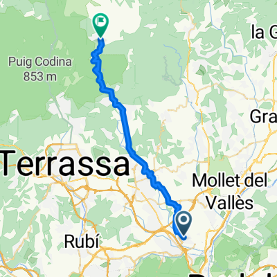
Übersicht
Über diese Route
Lange und ziemlich anspruchsvolle Strecke, aber sehr lohnend mit schönen Aussichten und Landschaften. Von Ripollet (man kann Ripollet von Barcelona mit der Renfe Linie R4 erreichen) führt die Straße leicht bergauf nach Sentmenat, von wo aus die schöne Straße durch zwei kleine Hügel und flache Täler nach Calders de Montbui führt. Von hier gibt es einen Anstieg, nicht zu hart, aber immer noch über 400 m, bis wir die Hauptstraße C59 verlassen, um auf der sehr ruhigen und malerischen Straße C1413a weiterzufahren. Nach ein paar weiteren Kilometern bergauf folgt eine angenehme Abfahrt nach Centelles. Dann verläuft die Straße parallel zur Autobahn C13 und danach in einem etwas hügeligen Gebiet nach Vic. Es lohnt sich, Notizen zu machen und durch das Zentrum von Taradell, Vic und Manlleu zu fahren, da man dadurch in jeder Stadt einige hundert Meter sparen kann. Die Straßen in der Nähe von Vic sind ziemlich belebt, aber nach Manlleu werden sie leerer, und am Anstieg zum Coll de Bracons (1130 m) fühlt man sich fast allein (ich war an einem herrlichen Samstag im April unterwegs und traf zwischen Sant Pere de Torello und Joanetes etwa 30 Radfahrer, 5 Motorräder und vielleicht 4 Autos). Der Anstieg ist sehr steil, ebenso die Abfahrt auf der anderen Seite. Nach Olot führt eine flache und schöne Straße, danach eine leere Straße und ein nicht zu harter Anstieg bis Ripoll. Von Ripoll fahren Züge fast jede Stunde nach Barcelona ab.
Es ist eine gute Idee, die Route früh am Morgen zu starten, um übermäßigen Verkehr im Großraum Barcelona zu vermeiden.
(kopiert von Route 2545330 von wotjek_620)
- -:--
- Dauer
- 151,8 km
- Distanz
- 2.300 m
- Aufstieg
- 1.679 m
- Abstieg
- ---
- Ø-Tempo
- ---
- Max. Höhe
Routenqualität
Wegtypen und Untergründe entlang der Route
Wegtypen
Straße
80,5 km
(53 %)
Ruhige Straße
10,6 km
(7 %)
Untergründe
Befestigt
63,8 km
(42 %)
Unbefestigt
1,5 km
(1 %)
Asphalt
62,3 km
(41 %)
Befestigt (undefiniert)
1,5 km
(1 %)
Weiter mit Bikemap
Diese Radroute verwenden, bearbeiten oder herunterladen
Du möchtest Going North. Ripollet - Vic - Olot - Ripoll fahren oder sie für deine eigene Reise anpassen? Folgendes kannst du mit dieser Bikemap-Route machen:
Gratis Funktionen
- Speichere diese Route als Favorit oder in einer Sammlung
- Kopiere & plane deine eigene Version dieser Route
- Teile sie in Etappen ein, um eine mehrtägige Tour zu erstellen
- Synchronisiere deine Route mit Garmin oder Wahoo
Premium-Funktionen
Kostenlose Testversion für 3 Tage oder einmalige Zahlung. Mehr über Bikemap Premium.
- Navigiere diese Route auf iOS & Android
- Exportiere eine GPX / KML-Datei dieser Route
- Erstelle deinen individuellen Ausdruck (Jetzt kostenlos ausprobieren)
- Lade diese Route für die Offline-Navigation herunter
Entdecke weitere Premium-Funktionen.
Bikemap Premium aktivierenVon unserer Community
Ripollet: Andere beliebte Routen, die hier beginnen
 "Brevet'24 RIPOLLET"
- Distanz
- 329,1 km
- Aufstieg
- 6.871 m
- Abstieg
- 6.871 m
- Standort
- Ripollet, Katalonien, Spanien
 Olot to Ripollet -
- Distanz
- 120,4 km
- Aufstieg
- 1.653 m
- Abstieg
- 1.268 m
- Standort
- Ripollet, Katalonien, Spanien
 De Avenida del Río Ripoll, 5120, Ripollet a Calle de Maragall, 37–49, Ripollet
- Distanz
- 19,5 km
- Aufstieg
- 255 m
- Abstieg
- 257 m
- Standort
- Ripollet, Katalonien, Spanien
 Ripollet - Sant Llorenç Savall
- Distanz
- 30,5 km
- Aufstieg
- 597 m
- Abstieg
- 206 m
- Standort
- Ripollet, Katalonien, Spanien
 De Calle de San Enrique, 47, Ripollet a Calle de Balmes, Ripollet
- Distanz
- 26,1 km
- Aufstieg
- 606 m
- Abstieg
- 615 m
- Standort
- Ripollet, Katalonien, Spanien
 Ripollet-Moià Bottecchia 69
- Distanz
- 114,9 km
- Aufstieg
- 1.929 m
- Abstieg
- 1.869 m
- Standort
- Ripollet, Katalonien, Spanien
 Ripollet-Estenalles (Per V)
- Distanz
- 88,3 km
- Aufstieg
- 1.093 m
- Abstieg
- 1.093 m
- Standort
- Ripollet, Katalonien, Spanien
 II BREVET'23 RIPOLLET. 300km.
- Distanz
- 344,1 km
- Aufstieg
- 5.663 m
- Abstieg
- 5.657 m
- Standort
- Ripollet, Katalonien, Spanien
In der App öffnen