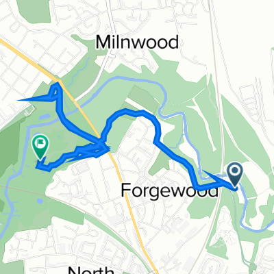
The Ladywell Way - Motherwell to Hillend Reservoir
Eine Fahrradroute, die in Motherwell, Schottland, Vereinigtes Königreich beginnt.
Übersicht
Über diese Route
Abgesehen von dem belebten Stadtbereich zu Beginn nach Newhouse führt dieser Weg in die großen Wildnislandschaften mit Moorpfaden und isolierten Seen.
Detaillierte Beschreibung unten
Dieser Niedriglandwildnisbereich beginnt an der Kathedrale von Motherwell. Es wird empfohlen, einen kurzen Umweg zum Ladywell-Stein in der Ladywell-Straße und zu den Ursprüngen des Namens Motherwell zu machen. Dann geht es auf einem belebten Weg mit Gehweg durch städtische Gebiete. Nach 3 km erreichen Sie die berühmte Carfin-Grotte. Fahren Sie dann weitere 4 km auf der Straße mit Gehweg durch Newarthill nach Newhouse. (Dies ist ein alternativer Startpunkt, wenn Sie den städtischen Abschnitt von Motherwell vermeiden möchten.) Fahren Sie weiter auf dem Gehweg und der Straße für anderthalb Kilometer und biegen Sie links in eine ruhige Umzäunte Straße ein, laufen Sie ein Kilometer und gehen Sie unter der Autobahn hindurch, dann weiter für ein Kilometer und biegen Sie links ab bei Blackridge Farm und rauf zum Wald bei Easter Dunsyston. Biegen Sie rechts auf den Weg zum Steinbruch und dann rechts auf den Weg entlang der Nordseite des Roughrigg-Stausees, in Richtung der Radiomasten auf dem Black Hill, bis Sie auf eine ruhige Straße, Duntilland Road, in Mountcow treffen.
Fahren Sie nordwestlich auf der Straße für 1½ Kilometer und nehmen Sie dann den Weg, der zum Lilly Loch 1 Meile ausgeschildert ist. Am Lilly Loch nehmen Sie den Weg, der die Ostseite des Lochs umfährt, der Sie zum Ziel am Hillend-Stausee bringt.
Hotel usw. in Newhouse, aber dann keine Einrichtungen bis zum Hillend-Stausee und dem nahegelegenen Dorf Caldercruix.
Dies ist der 1. Abschnitt des großen Pilgerwegs, der Ladywell Way, von Motherwell in Lanarkshire zur Forth Road Bridge und dann weiter nach St Andrews.
Für andere großartige Pilgerroute besuchen Sie die Website: http://www.thewayofstandrews.com/
- -:--
- Dauer
- 17,3 km
- Distanz
- 268 m
- Aufstieg
- 147 m
- Abstieg
- ---
- Ø-Tempo
- 267 m
- Max. Höhe
Routenqualität
Wegtypen und Untergründe entlang der Route
Wegtypen
Ruhige Straße
4,7 km
(27 %)
Forst- / Feldweg
2,9 km
(17 %)
Untergründe
Befestigt
1,9 km
(11 %)
Unbefestigt
2,1 km
(12 %)
Natürlicher Untergrund
1,4 km
(8 %)
Befestigt (undefiniert)
1,2 km
(7 %)
Highlights der Route
POIs entlang der Route
Interessanter Ort nach 3,3 km
Carfin Grotto 100 Newarthill Road, Motherwell, United Kingdom 01698 263308

Interessanter Ort nach 11,3 km
Former Quarry
Interessanter Ort nach 14 km
Joins quiet tarmac road

Interessanter Ort nach 16,4 km
Lilly Loch
Weiter mit Bikemap
Diese Radroute verwenden, bearbeiten oder herunterladen
Du möchtest The Ladywell Way - Motherwell to Hillend Reservoir fahren oder sie für deine eigene Reise anpassen? Folgendes kannst du mit dieser Bikemap-Route machen:
Gratis Funktionen
- Speichere diese Route als Favorit oder in einer Sammlung
- Kopiere & plane deine eigene Version dieser Route
- Synchronisiere deine Route mit Garmin oder Wahoo
Premium-Funktionen
Kostenlose Testversion für 3 Tage oder einmalige Zahlung. Mehr über Bikemap Premium.
- Navigiere diese Route auf iOS & Android
- Exportiere eine GPX / KML-Datei dieser Route
- Erstelle deinen individuellen Ausdruck (Jetzt kostenlos ausprobieren)
- Lade diese Route für die Offline-Navigation herunter
Entdecke weitere Premium-Funktionen.
Bikemap Premium aktivierenVon unserer Community
Motherwell: Andere beliebte Routen, die hier beginnen
 Woodlands Road 31 to M74
- Distanz
- 9,7 km
- Aufstieg
- 92 m
- Abstieg
- 144 m
- Standort
- Motherwell, Schottland, Vereinigtes Königreich
 Prospect Hill Road 6 to Merry Street 545
- Distanz
- 3,4 km
- Aufstieg
- 36 m
- Abstieg
- 32 m
- Standort
- Motherwell, Schottland, Vereinigtes Königreich
 The Ladywell Way - Motherwell to Hillend Reservoir
- Distanz
- 17,3 km
- Aufstieg
- 268 m
- Abstieg
- 147 m
- Standort
- Motherwell, Schottland, Vereinigtes Königreich
 North Lodge Avenue 5 to Clyde Valley Avenue 1
- Distanz
- 0,1 km
- Aufstieg
- 0 m
- Abstieg
- 0 m
- Standort
- Motherwell, Schottland, Vereinigtes Königreich
 Solo JOGLE Day 5
- Distanz
- 123,1 km
- Aufstieg
- 550 m
- Abstieg
- 525 m
- Standort
- Motherwell, Schottland, Vereinigtes Königreich
 North-Holytown-The Craig- Strathy-Home
- Distanz
- 21,2 km
- Aufstieg
- 151 m
- Abstieg
- 151 m
- Standort
- Motherwell, Schottland, Vereinigtes Königreich
 Dalriada Crescent 156 to Forbes Drive 9
- Distanz
- 4 km
- Aufstieg
- 214 m
- Abstieg
- 209 m
- Standort
- Motherwell, Schottland, Vereinigtes Königreich
 Watling Street
- Distanz
- 13,1 km
- Aufstieg
- 104 m
- Abstieg
- 104 m
- Standort
- Motherwell, Schottland, Vereinigtes Königreich
In der App öffnen


