

round mini mound
- 6,6 km
- 103 m
- 100 m
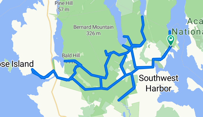
- Tremont, Maine, Vereinigte Staaten
Eine Fahrradroute, die in Tremont, Maine, Vereinigte Staaten beginnt.
Übersicht
Diese Route verläuft auf etwa 65 % Schotterstraßen (mit einer kurzen Sektion nicht-technischen Trailfahrens) und 35 % Asphalt, und es gibt einen kurzen Abschnitt nicht-technischen Trails. Eine Reihe dieser Schotterstraßen sind einspurige Wege und verlaufen durch dichte Wälder, mit grünem Moos als Bodenbelag. Es ist wirklich schön an einem sonnigen Tag.
An der Cape Road gibt es ein paar Picknicktische in der Nähe eines kleinen Hafens und Bootsanlegers. Hier hat man eine großartige Aussicht, während man einen Clif Bar knabbert.
Ungefähr zwei Drittel des Weges gibt es einen Feuerweg, der dich zum südlichsten Punkt bringt. Er endet an einem kleinen Gewässer, das schließlich zum Bass Harbor wird. Es ist mitten im Nirgendwo.
Die Parkplätze befinden sich am Trailhead für den Flying Mtn.
Erstellt vor 11 Jahren
Routenqualität
Ruhige Straße
26,8 km
(60 %)
Straße
7,6 km
(17 %)
Befestigt
5,4 km
(12 %)
Unbefestigt
17,4 km
(39 %)
Unbefestigt (undefiniert)
17,4 km
(39 %)
Asphalt
5,4 km
(12 %)
Undefiniert
21,9 km
(49 %)
Highlights der Route
Picnic table with a great view while chewing on the Clif Bar.
Weiter mit Bikemap
Du möchtest Western side of Acadia fahren oder sie für deine eigene Reise anpassen? Folgendes kannst du mit dieser Bikemap-Route machen:
Kostenlose Testversion für 3 Tage oder einmalige Zahlung. Mehr über Bikemap Premium.
Entdecke weitere Premium-Funktionen.
Bikemap Premium aktivierenVon unserer Community
In der App öffnen


